 IMAS Metadata Catalogue
Conservation and Biodiversity
Type of resources
Topics
Keywords
Contact for the resource
Provided by
Years
-
The aim of this study is to use artificial boulders in the form of sandstone blocks to investigate the benthic cryptofaunal communities of subtidal rocky reefs; specifically to quantify temporal and spatial patterns, the influence of the sub-block reef profile, and protection from fishing on these animals at locations inside and external to the Maria Island marine reserve in eastern Tasmania.
-
NESP Marine Biodiversity Hub Project C2 involved integration and analysis of three existing monitoring datasets: the Reef Life Survey (RLS), IMAS Long-term MPA (LTMPA), and AIMS Long-term (AIMS LTM) monitoring programs. These analyses involved generating new derived data on indicator values for survey sites in each of the datasets, which have been reported in the 2016 State of the Environment (SoE) report. Indicators included the biomass of large fishes, the community temperature index, the proportion of invasive species, crown-of-thorns seastar density and the proportion of threatened species. Details of calculation of these indicators and summary of trends in values across sites and times are provided in detail in a manuscript currently in the review process for an international journal [RSS to provide publication details once available], as well as in metadata supplied for the State of the Environment report. This metadata record provides links to each of the three datasets used in the synthesis, and links to access the derived biological indicator data reported in the 2016 SoE report. See "On-Line Resources" section.
-
This record provides an overview of the scope and research output of the NESP Marine Biodiversity Hub project "Exploring the status of Western Australia’s sea snakes". For specific data outputs from this project, please see child records associated with this metadata. -------------------- All sea snakes are listed marine species under the EPBC Act and three Australian endemic species are listed as Critically Endangered or Endangered, and as such are a national conservation priority. This project examines existing data from the northwest marine region to define sea snake relative abundance and distribution patterns, including within CMRs, to refine species status. Synthesis of existing data will be useful to DOE, DPaW, Parks Australia and others. This analysis will help establish baseline data, guide future research, define abundance in and use of CMRs and refine EPBC listings and recovery plans. Planned Outputs • A report outlining the presence and relative abundance of sea snakes in northwestern Australia with a focus on reef and shoal habitats including identification of BIAs or key habitats where possible. Research and management priorities will be highlighted. • Presentation of results to key stakeholders and end users • Presentation of recommendations at scientific conferences • Communication of findings to the broader community via social media
-
This record provides an overview of the scope of the NESP Marine Biodiversity Hub project "Conservation status of tropical inshore dolphins". No data outputs were generated by this project. -------------------- This project reviewed current knowledge on Australia’s tropical inshore dolphins to inform future assessment of their conservation status. It focused on the Australian humpback dolphin (Sousa sahulensis), snubfin dolphin (Orcaella heinsohni), Indo-Pacific bottlenose dolphin (Tursiops aduncus) and the spinner dolphin (Stenella longirostris) complex. The project was undertaken as a desktop review of peer-reviewed literature, research projects and reports, including environmental impact assessments associated with major port developments from 2013 to 2019. It synthesised available information on species distribution, abundance, trends, habitat use, population structure and anthropogenic threats. The review found that knowledge had improved for several tropical inshore dolphin species, but was uneven across regions and species. Available data were largely concentrated in discrete study areas, limiting national-scale assessment. Identified threats included habitat loss and degradation associated with coastal development, bycatch in fishing gear and shark nets, and climate change impacts such as ocean warming, acidification and extreme weather events. Key recommendations included the use of scenario modelling and sensitivity analysis to support assessment of national population size and conservation status under uncertainty.
-
This record provides an overview of the scope and research output of the NESP Marine Biodiversity Hub project "Grey Nurse Shark CK-MR Population Estimate – East Coast". For specific data outputs from this project, please see child records associated with this metadata. -------------------- A review of the 2002 National Recovery Plan for Grey Nurse Shark (DEWHA 2009) concluded it was not possible to determine if the east coast population had shown any signs of recovery (DoE 2014); recommending a new recovery plan be developed for this species. A primary objective of the new recovery plan (DoE 2014) is to improve knowledge of GNS population status. This will require a robust estimate of population size and trend – something that has not been provided to date. This project will use genetic SNP data to inform close kin-mark recapture analysis to estimate population size and trend, and provide guidance on future monitoring strategies for the east coast population of grey nurse shark. Planned Outputs • Tools to refine and integrate CK-MR and species demographic data for population assessments of a key threatened species at a national scale (combining knowledge developed under this project combined with similar techniques being applied under NESP to euryhaline sharks and white sharks). • A national estimate of (census) population size and trend for the eastern Australian population of grey nurse shark will be developed to fulfil the highest priority actions of the National Recovery Plan. • Identify national strategies to guide future monitoring of grey nurse shark populations. • The project will provide peer-reviewed additions to the scientific literature that will add to the science-support for the development and implementation of policies to support the ecologically sustainable management of Australia’s marine environment.
-
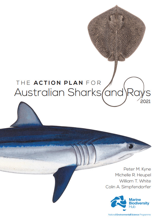
Australia is home to a quarter of the world’s cartilaginous fishes (Class Chondrichthyes) with 328 species consisting of 182 sharks, 132 rays, and 14 chimaeras. Australia’s first Shark Action Plan aims to provide a comprehensive and consistent review of the extinction risk of all cartilaginous fishes (hereafter ‘sharks’) occurring in Australian waters, to provide a benchmark from which changes in population and risk can be measured, and to help guide management for their conservation. This Action Plan also serves to raise the profile of their diversity and conservation needs. This volume includes a taxa profile for each of the 328 species occurring in Australian marine and inland waters, including external territories. Each species’ extinction risk was assessed by applying the IUCN Red List Categories and Criteria at the national level. Assessments of extinction risk consider all available information on a species’ taxonomy, distribution, population status, habitat and ecology, major threats, use and trade, and conservation measures. The IUCN Red List Categories and Criteria utilise a series of thresholds to evaluate extinction risk based on population size reduction, geographic range, population size, or the probability of extinction. Species were assessed against the five Red List criteria; to qualify for one of the three threatened categories (Critically Endangered, Endangered, or Vulnerable), a species had to meet a quantitative threshold for that category in any of the five criteria. The overall status of sharks in Australia is characterised by a relatively low level of extinction risk and a high level of secure species. Of the 328 species, 12% are threatened (39 species: 22 sharks, 17 rays; no chimaeras are threatened); 10% are Near Threatened (32 species: 18 sharks, 13 rays, 1 chimaera); 70% are Least Concern (231 species: 123 sharks, 95 rays, 13 chimaeras); and, 8% are Data Deficient (26 species: 19 sharks, 7 rays, no chimaeras are Data Deficient). No species are Extinct or Extinct in the Wild. Each taxa profile specifies two sets of actions for a species: actions to address knowledge gaps, and actions to maintain, secure, and if necessary, recover the population. To improve the ability to accurately assess the status of species, and ultimately, better conserve and manage them, all species treated in this Action Plan require some knowledge gaps be filled. Knowledge gaps are divided into five themes, each of which improves the information base from which to assess status: taxonomy, distribution, population trend, life history, and connectivity. Conservation actions are provided for each species, regardless of the status assigned them in this Action Plan. While threatened species require immediate action to conserve, manage, and recover their populations, Least Concern species also require action to maintain their secure status. Data Deficient species require action to understand various aspects of their population, but since an assessment as Data Deficient acknowledges the possibility that future research may show that a threatened classification is appropriate, action is also needed to minimise or mitigate threats until such time as more information is available to show that the species is not threatened. Finally, an overarching recommendation is provided for each threatened species. This includes the recommendation that five species be considered for listing on the Environment Protection and Biodiversity Conservation Act (EPBC Act), three species be considered for up-listing, and two species be considered for down-listing. An additional 12 threatened species have been identified as priorities for data collection where further data are required to strengthen the evidence-base underlying their status determinations. These species are priorities for research and monitoring to provide data to support inferred or suspected population reductions or continuing declines identified in the Action Plan. The implementation of the recommendations and actions in this Action Plan will require an ongoing and enhanced investment in science and management which will help secure the future of Australia’s sharks, rays, and chimaeras.
-
This study aims to undertake a comprehensive survey of the benthic fauna of Port Davey – Bathurst Harbour and adjoining Payne Bay, James Kelly Basin and Hannant Inlet. This will provide important information on the composition and structure of benthic faunal communities and the distribution of any introduced species amongst the benthos. In February/ April 2007 invertebrate faunal communities were sampled at 70 locations throughout the system – with the greatest intensity of sites located within Port Davey, Bathurst Channel and Bathurst Harbour.
-
This record provides an overview of the scope and research output of the NESP Marine Biodiversity Hub project "National data collation, synthesis and visualisation to support sustainable use, management and monitoring of marine assets". For specific data outputs from this project, please see child records associated with this metadata. -------------------- Effective management of marine assets requires an understanding of ecosystems and the processes that influence patterns of biodiversity. Focusing on the North and North-west regions, this project will leverage previous research to improve ecosystem understanding through a synthesis of existing information and by making testable predictions about the character and extent of conservation values, including for key ecological features (KEFs) and Commonwealth Marine Reserves. End-users and stakeholders will benefit from improved regional descriptions of marine ecosystems and uncertainty statements. In turn, this will inform prioritisation of future investments in monitoring marine ecosystems and State of the Environment reporting. Planned Outputs • A report on the synthesis (based on collations completed in 2015) of datasets and models for the North and NW identifying areas of greatest information coverage, gaps and themed to CMRs and KEFs in those regions. This report will also describe key spatial patterns in biodiversity (benthic and pelagic) and associations between benthic environments, fish and megafauna and large scale processes (e.g. oceanography). • Predictions and related products (maps) of the spatial distribution of biodiversity across the Oceanic Shoals CMR that encompasses benthic habitat, pelagic and demersal fish and megafauna communities. This will provide an example/test case at the National Prioritisation Workshop of how confidently predictive modelling can be used to describe assets and values in data poor areas to inform management and monitoring. • An updated conceptual model of ecosystem processes (benthic and pelagic) within the Oceanic Shoals CMR based on extension of modelling into pelagics. • A review of existing knowledge of the Ancient Coastline KEF. • A qualitative model of Glomar Shoal KEF (to be confirmed in consultation with DOE). • Communication products that capture activities and general interest stories of scientific results disseminated through NW Atlas social media links. • Upload of new relevant spatial data layers in NW Atlas for management and planning, and engagement with end users to maximize uptake of the NW Atlas products.
-
This record provides an overview of the scope and research output of the NESP Marine Biodiversity Hub project "Implementing monitoring of AMPs and the status of marine biodiversity assets on the continental shelf". For specific data outputs from this project, please see child records associated with this metadata. -------------------- There is a significant need to support Parks Australia in the establishment of an inventory and monitoring program for Australian Marine Park (AMP) networks, and ensure it is integrated within broader national monitoring frameworks. The first part of this project provided a national collation all known mapping data from government and industry (including data acquired during CERF and NERP Hubs) to improve understanding of the distribution and extent of this key habitat around Australia, and to identify critical gaps in this knowledge to be filled by targeted surveys. This significantly improved understanding of KEF boundaries and conservation values or assets within Commonwealth Marine Reserves on Australia’s continental shelf. A classification system was developed for these reefs, and matched with refinement of inventory and monitoring approaches to track reef health through time, including standard approaches to SOE understanding and reporting consistent with measures developed for coastal systems within NESP (i.e. see project C2). This also involved collation of all mapping data on non-reef hard substrate, and all non-reef soft substrate, with this information also being available as a significant output. The second part of this project initiates a series of surveys, utilising standard operating procedures (SOPs), to demonstrate a sustainable path for a national survey program. By facilitating national approaches, including a standards-based approach to collecting new marine data, project outcomes will include key steps to assist Parks Australia to implement and initiate an AMP monitoring program, new knowledge to inform AMP management, a national integrated framework for State of Environment (SOE) reporting, and collaboration between State-based and Commonwealth-based programs. Planned Outputs • National-scale map of the distribution and extent of reef/non-reef habitat on the Aus continental shelf • Collation of all available mapping data for the Aus continental shelf • Detailed reports specific to each AMP survey, including a plain English summary • Survey data stored in national databases and portals • New multibeam mapping data from AMP survey areas and adjacent waters • New data on benthic invertebrate cover obtained from AUV imagery surveys • New data on benthic fish abundance obtained by BRUV surveys
-
This record provides an overview of the scope and research output of the NESP Marine Biodiversity Hub project "Expanding our spatial knowledge of marine biodiversity to support future best-practice reviews". For specific data outputs from this project, please see child records associated with this metadata. -------------------- This project will fill data gaps and evaluate methods relevant to the ongoing spatial management of seafloor biota across the Australian marine domain. The objective is to prepare Australian, State and Territory governments for future best-practice reviews of Australia’s marine bioregionalisation that can be used to improve marine spatial planning and management initiatives (e.g. marine bioregional plan and marine protected area reviews, environmental impact and natural heritage assessments). The project will incorporate results from field trips to unexplored offshore areas of Australia’s marine domain and communicate biodiversity values of the AMP network to the Australian public. Planned Outputs • Report evaluating the usefulness of phylodiversity (genetic diversity) to spatial marine planning • Report outlining extensions of known statistical approaches to be able to utilise available mixed-resolution biological data (including museum and historical data) for the production of best-evidence bioregional maps • Report evaluating the usefulness of connectivity (current) models to spatial marine planning • Report including description and images of deep-sea biological communities of the east coast, including the CMR network, on a scheduled November 2016 expedition of the NMF ‘Investigator’ (mid 2016-7). This survey will result in significant media opportunities to promote the values of the CMR network. • Report including description and images of banks, seamounts and pelagic aggregations within the Cocos Keeling/Christmas Island territories. This would require a successful application for ship-time on the NMF ‘Investigator’ • Report investigating the possibility of downscaling biogeographic maps to the typical scale of areas of conservation concern (1-100 km) by utilising emerging fine-scale bathymetry (provided by the shelf mapping project), acoustic and water movement data