 IMAS Metadata Catalogue
2007
Type of resources
Topics
Keywords
Contact for the resource
Provided by
Years
-
Describes the database used for storing Southern Rock Lobster (Jasus edwardsii) biological data collected by observers on commercial boats and dedicated research trips incorporating information on sex, length, weight, damage, reproduction, bycatch, protected species interaction, location, depth, tagging and equipment type.
-
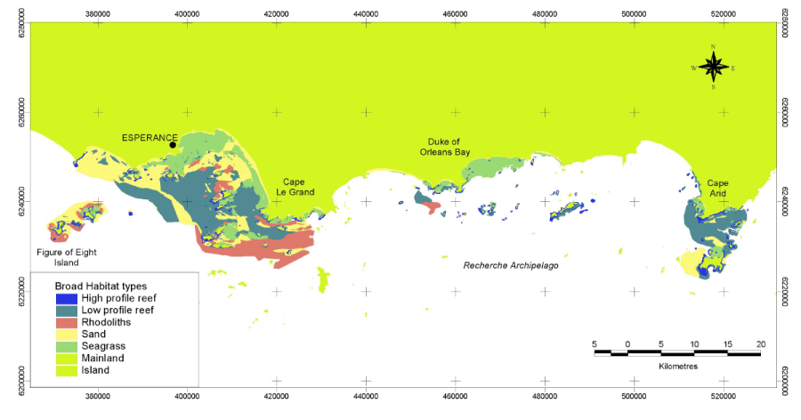
The Fisheries Research and Development Corporation Project (FRDC) No. 2001/060 characterised and identified the distribution of the different benthic habitats of the Recherche Archipelago and identified the distribution of assemblages of fish, mobile invertebrates, filter feeding communities and seagrasses and the patterns and processes which structure them. Benthic habitat were determined from the interpretation of Landsat imagery, sidescan sonar imagery and video validation data collected within the Recherche region from May 2002 to November 2003.
-
Lipofuscin density in Giant Crab (Pseudocarcinus gigas) brain tissue was estimated through fluorescent microscopy. The intent was to relate lipofuscin to crab age. Some known age specimens were included in the sample, these were reared from larvae.
-
The movement and behaviour of the Southern Rock Lobster (Jasus edwardsii) was monitored using a radio acoustic telemetry systems at two sites in eastern Tasmania.
-
Mesozooplankton community composition and structure were examined throughout the D’Entrecasteaux Channel, Huon Estuary and North West Bay, Tasmania, from November 2004 to October 2005, the data represented by this record was collected on the 07/12/2004 The composition of the mesozooplankton community was typical of inshore, temperate marine habitats, with seasonally higher abundance in summer and autumn and lower numbers in winter and spring. Copepods were the largest contributors to total abundance across all seasons and stations, while cladocerans and appendicularians were proportionally abundant in spring and summer. The faecal pellets of these three main groups, along with those of krill and amphipods, also contributed significantly to material recovered from sediment traps. Meroplanktonic larvae of benthic animals showed short-term peaks in abundance and were often absent from the water column for long periods. Spatially, North West Bay and the Channel had a higher representation of typically marine species, including Calanus australis and Labidocera cervi, while truly estuarine species, such as the copepod Gladioferens pectinatus, were more important in the Huon Estuary.
-
The data is quantitative abundance of fish and megafaunal invertebrates and algal % cover derived from transect based counts at a wide range of locations across Temperate Australia. The methods are described in detail in Edgar and Barrett (1997). Primarily the data are derived from transects at 5 m depth and/or 10 m depth at each site surveyed. Methods were initially developed for research on temporal changes following protection in Tasmanian MPAs (Maria Is, Tinderbox, Ninepin Point, Governor Island). The data represented by this record was collected in MPA studies and surveys interstate, and was collected from Esperence to Albany (WA). In many cases the dataset involved temporal replication (year scale).
-
Conducted under the Coast and Clean Seas program of the Natural Heritage Trust fund, this study provides a summary and assessment of water quality parameters, as indicators of estuarine health, in 22 selected Tasmanian estuaries. The estuaries are: Duck Bay, East Inlet, Black River, Don River, Mersey River, Port Sorell, Boobyalla Inlet, Little Musselroe River, Ansons Bay, Grants Lagoon, Douglas River, Great Swanport, Meredith River, Little Swanport, Earlham Lagoon, Browns River, Cloudy Bay Lagoon, Catamaran River, Cockle Creek, Pieman River, Nelson Bay River and Arthur River (for location, see Fig. 1 in the attached report). Information is summarised on both a State wide and individual estuary basis.
-
Raw acoustic data files for Tasmanian coastal waters from the LWM (Low water mark) to 40 metres in depth or 1.5 kms from shore.
-
The spatial extent of C. rodgersii "barrens" was estimated by surveying rocky reef habitat with a towed underwater video system. Sampling took place at 13 regions along the east coast of Tasmania, each comprising 3 subsites, this dataset refers to the Schouten Island, and its 3 subsites: Baudin, Sarah and Sonerat.
-
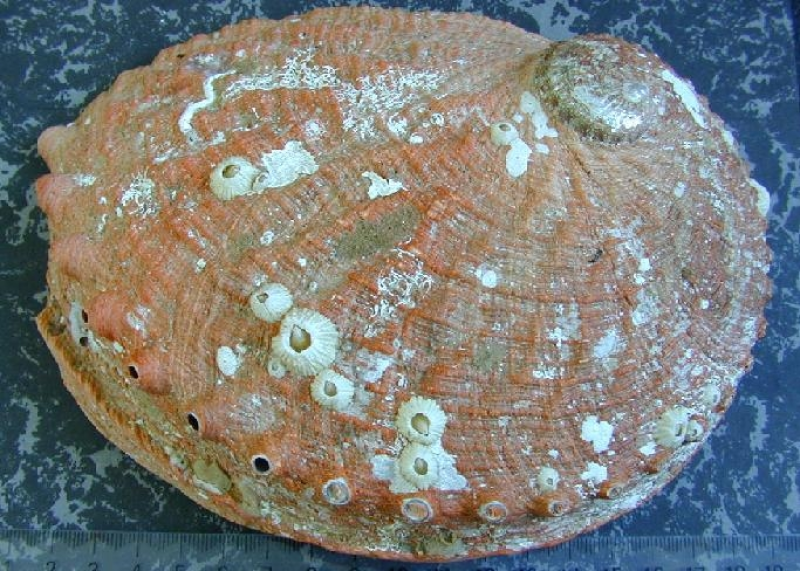
This project uses positional information from GPS loggers on abalone divers' boats and depth information from depth loggers attached to the divers for fine-scale spatial reporting of abalone fishing.