 IMAS Metadata Catalogue
EARTH SCIENCE | BIOSPHERE | ECOSYSTEMS | MARINE ECOSYSTEMS | REEF
Type of resources
Topics
Keywords
Contact for the resource
Provided by
Years
-
The data is the quantitative abundance of fish derived from underwater visual census methods involving transect counts at rocky reef sites around Tasmania. This data forms part of a larger dataset that also surveyed megafaunal invertebrate abundance and algal cover for the area. The aggregated dataset allows examination of changes in Tasmanian shallow reef floral and faunal communities over a decadal scale - initial surveys were conducted in 1992-1995, and again at the same sites in 2006-2007. There are plans for ongoing surveys. An additional component was added in the latter study - a boat ramp study looking at the proximity of boat ramps and their effects of fishing. We analysed underwater visual census data on fishes and macroinvertebrates (abalone and rock lobsters) at 133 shallow rocky reef sites around Tasmania that ranged from 0.6 - 131 km from the nearest boat ramp. These sites were not all the same as those used for the comparison of 1994 and 2006 reef communities. The subset of 133 sites examined in this component consisted of only those sites that were characterized by the two major algal (kelp) types (laminarian or fucoid dominated). Sites with atypical algal assemblages were omitted from the 196 sites surveyed in 2006. This study aimed to examine reef community data for changes at the community level, changes in species richness and introduced species populations, and changes that may have resulted from ocean warming and fishing. The methods are described in detail in Edgar and Barrett (1997). Primarily the data are derived from transects at 5 m depth and/or 10 m depth at each site surveyed. The underwater visual census (UVC) methodology used to survey rocky reef communities was designed to maximise detection of (i) changes in population numbers and size-structure (ii) cascading ecosystem effects associated with disturbances such as fishing, (iii) long term change and variability in reef assemblages.
-
Sea urchins have the capacity to destructively overgraze kelp beds and cause a wholesale shift to an alternative and stable ‘urchin barren’ state. However, their destructive grazing behaviour can be highly labile and contingent on behavioural shifts at the individual and local population level. Changes in supply of allochthonous food sources, i.e. availability of drift-kelp, is often suggested as a proximate trigger of change in sea urchin grazing behaviour, yet field tests of this hypothesis are rare. Here we conduct a suite of in situ behavioural surveys and manipulative experiments within kelp beds and on urchin barrens to examine foraging movements and evidence for a behavioural switch to an overgrazing mode by the Australian sea urchin Heliocidaris erythrogramma (Echinometridae). Tracking of urchins using time-lapse photography revealed urchin foraging to broadly conform to a random-walk-model within both kelp beds and on barren grounds, while at the individual level there was a tendency towards local ‘homing’ to proximate crevices. However, consistent with locally observed ‘mobile feeding fronts’ that can develop at the barrens-kelp interface, urchins were experimentally inducible to show directional movement toward newly available kelp. Furthermore, field assays revealed urchin grazing rates to be high on both simulated drift-kelp and attached kelp thalli on barren grounds, however drift-kelp but not attached kelp was consumed at high rates within kelp beds. Time-lapse tracking of urchin foraging before/ after the controlled addition of drift-kelp on barrens revealed a reduction in foraging movement across the reef surface when drift-kelp was captured. Collectively results indicate that the availability of drift-kelp is a pivotal trigger in determining urchin feeding modes, which is demonstrably passive and cryptic in the presence of a ready supply of drift-kelp. Recovery of kelp beds therefore appears possible if a sustained influx of drift-kelp was to inundate urchin barrens, particularly on reefs where local urchin densities and where grazing pressure is close to the threshold enabling kelp bed recovery.
-
Baited remote underwater stereo-video (stereo-BRUV) were used to sample the fish assemblages of the Hunter Marine Park and adjacent Port Stephens - Great Lakes Marine Park at equivalent depths. Stereo-BRUV were deployed in both autumn and spring from spring 2016 to autumn 2018 and at depth of 32-105m. The videos were analyse to all fish species to the lowest taxonmic level and estimate relative abundance (MaxN) and lengths of all species. This information was used to form a baseline of the benthic fish assemblages of the Hunter Marine Park. This study was done as part of the NESP Marine Biodiversity Hub D3 project (https://www.nespmarine.edu.au/project/project-d3-implementing-monitoring-amps-and-status-marine-biodiversity-assets-continental).
-
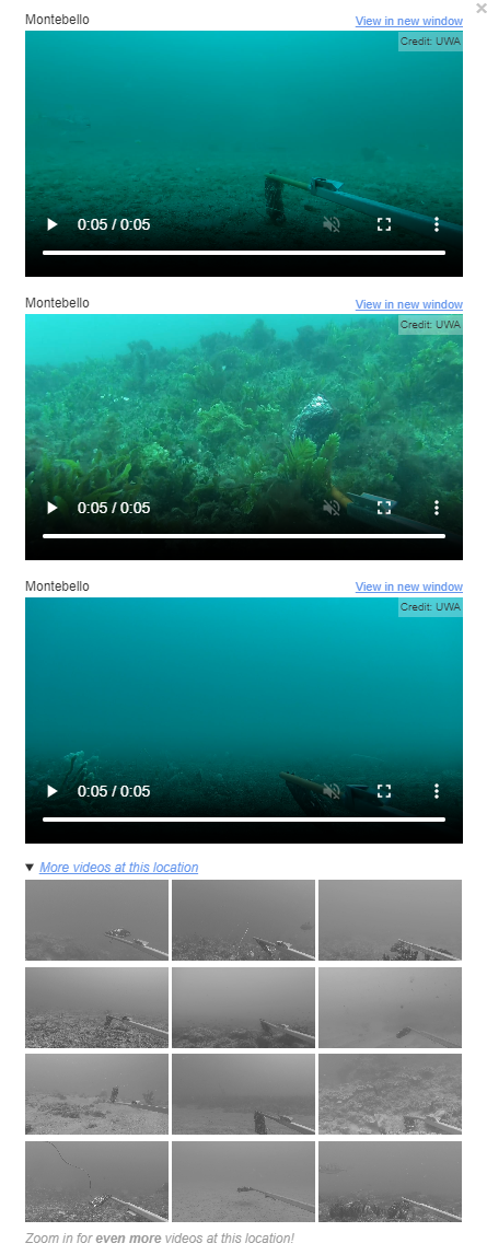
This data is a national compilation of video clips predominantly derived from underwater video sampling techniques (e.g. BRUV, Stereo-BOSS) for quantitative sampling of abundance, body size, and diversity of demersal fishes. The curated collection also includes regional 'compilation' videos highlighting a particular marine protected area or region of interest. Current contributors to this data compilation are IMAS, UWA, Geoscience Australia and the NESP Marine Biodiversity & Marine and Coastal Hubs, with the intention that this collection will grow to encompass collections from other research organisations around Australia. As of August 2024, this dataset includes video in and around Abrolhos, Arafura, Apollo, Beagle, Bremer, Christmas Island, Cod Grounds, Coral Sea, Dampier, Eastern Recherche, Flinders, Franklin, Freycinet, Gascoyne, Geographe, Huon, Lord Howe, Montebello, Murat, Murray, Ningaloo, Oceanic Shoals, Perth Canyon, South Tasman Rise, South-west Corner, Tasman Fracture, Two Rocks, and Zeehan Australian Marine Parks (AMPs), and of Bathurst Channel in the Port Davey Marine Reserve. The dataset allows examination of changes in fish communities over time as part of ongoing monitoring of these regions. This record represents a 'parent' record of multiple collections. See individual 'child' records for more information on specific regional collections.
-
Coral community transect data collected concurrent with coral disease surveys in in the vicinity of Hoga Island in the Wakatobi Marine National Park, Sulawesi, Indonesia. Three replicate 20 m transects were collected by divers in each of reef flat, crest and slope habitats in 2005 (four sites, point intersect transect data), 2007, 2010 and 2011 (all six sites, line intersect transect data). For further detail see: Haapkylä, J., A. S. Seymour, J. Trebilco, and D. Smith. 2007. Coral disease prevalence and coral health in the Wakatobi Marine Park, south-east Sulawesi, Indonesia. Journal of the Marine Biological Association of the UK 87:403. Haapkylä, J., R. Unsworth, A. Seymour, J. Melbourne-Thomas, M. Flavell, B. Willis, and D. Smith. 2009. Spatio-temporal coral disease dynamics in the Wakatobi Marine National Park, South-East Sulawesi, Indonesia. Diseases of Aquatic Organisms 87:105–115. Haapkylä, J., J. Melbourne-Thomas, and M. Flavell. 2015. The association between coral communities and disease assemblages in the Wakatobi Marine National Park, south-eastern Sulawesi, Indonesia. Marine and Freshwater Research.
-
The Seamap Australia spatial data layer is a nationally synthesised data product of seafloor marine habitat data. Australian continental shelf benthic habitat layers in GIS format were collected from various stakeholders around the country. Through compiling all of these data sets, we established a controlled vocabulary, reviewed by ANDS and external independent assessors, to produce a national classification of marine habitats. This national marine habitat classification scheme complements work undertaken by the National Environmental Science Program (NESP) Marine Biodiversity Hub (Theme D). The Seamap Australia product is of national importance and highlights the diversity of benthic habitats around our marine estate. This is the first edition of a seafloor marine habitat data layer that seamlessly brings together data from each of Australia’s state and territory marine habitat databases. Seamap Australia is a constantly evolving product as we continuously improve our skills in standardising, collating and sharing marine spatial data. This record describes a static version of the Seamap Australia national data layer as of 28/11/2018. The most current version of the data is available from the Seamap Australia website [http://seamapaustralia.org/map]. We envisage that the 'live' product will be constantly developed and updated as future surveys continue to improve our knowledge of our vast marine estate.
-
NESP Marine Biodiversity Hub Project E7. Results from the outplanting of lab-selected and cultivated warm-adapted genotypes of giant kelp (Macrocystis pyrifera), at two trial restoration sites. A third restoration trial site had no surviving kelp, so those data were not included here. Data and details from lab-selection experiments can be found in the associated dataset - "NESP Marine Hub Project E7 - Macrocystis pyrifera thermal tolerance testing" https://metadata.imas.utas.edu.au/geonetwork/srv/eng/catalog.search#/metadata/0b91d7fd-7d29-452f-954a-78cf75151035
-
Data accompanying Layton et al. 2019, Resilience and stability of kelp forests: the importance of patch dynamics and environment-engineer feedbacks. PLOS ONE. To explore how resilience and stability of kelp habitats is influenced by this habitat degradation, we created an array of patch reefs of various sizes and supporting adult Ecklonia radiata kelp transplanted at different densities. This enabled testing of how sub-canopy abiotic conditions change with reductions in patch size and adult kelp density, and how this influenced demographic processes of microscopic and macroscopic juvenile kelp.
-
This data set consists of a scored time-series of Autonomous Underwater Vehicle (AUV) images from the Bicheno region on the east coast of Tasmania. Surveys were conducted between 2011 and 2016 within the Governor Island Marine Reserve and nearby sites outside the reserve. Governor Island was surveyed in 2011, 2013, 2014 and 2016. The outside sites of Trap Reef, Cape Lodi and Butlers Point were surveyed in 2011, 2013 and 2016. Imagery across all surveys was scored for the presence of Centrostephanus rodgersii urchin barrens across rocky reef at each site. Prior to analysis the data was subsetted to every fifth image to avoid overlapping images. The data set also contains depth information for each image and a measure of rugosity (Vector Rugosity Measure) computed in ArcGIS software from a one metre resolution bathymetric map covering the survey sites. Analysis was conducted to examine the trend in the presence of barrens through time and to compare the occurrence of barrens inside the Governor Island Marine Reserve with sites outside the reserve. A spatio-temporal model incorporating both spatial and temporal correlation in the time-series of data was used. This data set contains the scored data used in the analysis. Further details of the methods used and results are contained in the following article. Please cite any use of the data or code by citing this article: Perkins NR, Hosack GR, Foster SD, Monk J, Barrett NS (2020) Monitoring the resilience of a no-take marine reserve to a range extending species using benthic imagery. PLOS ONE 15(8): e0237257. https://doi.org/10.1371/journal.pone.0237257