 IMAS Metadata Catalogue
Environmental Science and Management not elsewhere classified
Type of resources
Topics
Keywords
Contact for the resource
Provided by
Years
-
This GIS layer is the product of interpreted multibeam acoustic data charaterising the distribution pattern of seafloor habitats at forty sampling sites within the Flinders Commonwealth Marine Reserve. The three classes that were mapped include hard, mixed and soft substrate. Mappin the Flinders CMR is a prerequisite to understanding the relationships between inshore (shelf) and offshore (slope) habitats and therefore representing a key element in developing effective management for the depth strata across the entire CMR. Habitat characterisation provides the underlying spatial framework for developing models of habitat dynamics, trophic interactions and spatial distribution of marine biodiversity.
-
Raw acoustic data files for Tasmanian coastal waters from the LWM (Low water mark) to 40 metres in depth or 1.5 kms from shore.
-
Bathymetric contours (5 m interval) for Tasmanian coastal waters from the LWM (Low water mark) to 40 metres in depth or 1.5 kms from shore (whichever boundary is first identified). Detailed bathymetric contours were developed to be used to fulfill coastal management objectives according to The Living Marine Resources Act 1995.
-
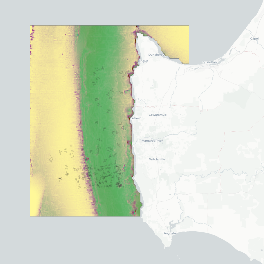
This dataset presents the results of a seafloor habitat modeling exercise for the 'Capes region' of the South-west Corner Marine Park, southern WA. The model classifies five broad habitat types (hereafter 'ecosystem components'): seagrass, macroalgae, sessile invertebrates, bare consolidated substrata, and bare unconsolidated substrata. Modeling was conducted at two spatial scales to assess the effectiveness of using broad-scale (~250 m) spatial covariates derived from bathymetry in mapping habitat classes and to compare the modelling outcomes with those obtained using finer-resolution input data. The fine-scale mapping focused on an IUCN II zone near Margaret River, using a seamless 5 m resolution multibeam bathymetry composite. The broad-scale mapping covered multiple IUCN zones, including the southwestern Geographe Australian Marine Park (AMP), the northwestern tip of the South-west Corner AMP, and the Ngari Capes WA State Marine Park. This component used the 250 m resolution 2023 AusBathyTopo grid from Geoscience Australia. Habitat maps were constructed using (1) the bathymetry data sources described above; (2) ground-truthing observations from stereo-BRUV and BOSS camera systems; and (3) Physical covariates, all smoothed to 5 m or 250 m resolution, for the fine- and broad-scale mapping, respectively. Source datasets are available from: • Geoscience Australia's eCat: https://dx.doi.org/10.26186/145281 (5 m multibeam bathymetry) and https://doi.org/10.26186/148758 (250 m DEM bathymetry) • Squidle+: http://squidle.org/geodata/explore (benthic imagery annotations - see also outputs from NESP MaC Project 2.4: https://doi.org/10.25959/6G5A-3G03) • AODN Portal: https://portal.aodn.org.au/search (IMOS oceanographic datasets). This analysis uses the modelling methodology developed in NESP Project 2.1, which extended the ecosystem component modelling to include all temperate Australian shelf waters at a resolution of 250 m (https://doi.org/10.25959/BVJ7-D984). Analysing the scale effects effects of spatial covarariate inputs was undertaken by NESP Project 2.3, along with exploration of visualisation options regarding prediction certainty in consultation with Parks Australia (management end-users). Further details on sampling design for ground-truthing observations and the modelling techniques are available in the NESP MaC Project 2.1 Final Report: https://www.nespmarinecoastal.edu.au/publication/improving-seabed-habitat-predictions-for-southern-australia. A description on this specific South-west Corner case study and the spatial scale analysis is described in the NESP MaC Project 2.3 Final Report: https://www.nespmarinecoastal.edu.au/publication/improving-knowledge-transfer-to-support-australian-marine-park-decision-making-and-management-effectiveness-evaluation. A selection of mapping (WMS) services are listed in the 'Downloads & Links' section of this record. See the 'Lineage' section for a full description of the data packages available for download, and for more visualisation options.
-
The Tasman Fracture CMR AUV survey was a pilot study undertaken in 2014/15 as part of the National Marine Biodiversity Hub's National monitoring, evaluation and reporting theme. The aim of this theme is to develop a bluepint for the sustained monitoring of the South-east Commonwealth Marine Reserve Network. The particular aim of the survey was to contribute to an inventory of the distribution and abundance of demersal fishes in the reserve and adjacent reference sites using BRUVs. Data contained here represents footage collected using these drops and the associated scored data (abundance and lengths).
-
The Tasman Fracture CMR AUV survey was a pilot study undertaken in 2014/15 as part of the National Marine Biodiversity Hub's National monitoring, evaluation and reporting theme. The aim of this theme is to develop a blueprint for the sustained monitoring of the South-east Commonwealth Marine Reserve Network. The particular aim of the survey was to contribute to an inventory of the distribution and abundance of southern rock lobster (Jasus edwardsi). Data contained here represents the data collected from lobster potting component of the study. This includes lobster abundance, gender and length. Bycatch is also recorded.
-
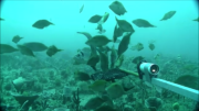
The Flinders CMR survey was a pilot study undertaken in August 2012 as part of the National Marine Biodiversity Hub's National monitoring, evaluation and reporting theme. The aim of this theme is to develop a bluepint for the sustained monitoring of the South-east Commonwealth Marine Reserve Network. The particular aims of the survey were twofold; 1) to contribute to an inventory of demersal and epibenthic conservation values in the reserve and 2) to test methodologies and deployment strategies in order to inform future survey design efforts. Several gear types were deployed; including multibeam sonar, shallow-water (less than 150m) Baited Remote Underwater Video (BRUVs), deep- water BRUVs, towed video and digital stereo stills. This resource contains the shallow-water BRUV footage captured on the FLinders CMR shelf (less than 150 m). Stereo BRUV's were deployed using a probabalistic and spatially-balanced survey design called Generalized Random Tessellation Stratified (GRTS). Habitats were identified in a previous multibeam survey and consisted of 'mixed reef' (containing patchy reef) and sand. Mixed reef habitat was targeted in this survey (9 GRTS mixed reef sites versus 3 sand sites). A total of 60 stereo BRUVs were deployed. Data contained here represents footage collected using these drops and the associated scored data (abundance (MaxN) and lengths).
-

This record describes the outputs of two different modelling exercises that were used to characterise the seafloor habitats for temperate Australian waters. The modelled area includes all shelf waters (<250m depth) in southern Australia south of the Tropic of Capricorn. Bioregional benthic habitat maps were constructed using (1) the Geoscience Australia 250m 2023 grid (Beaman 2023); (2) ground-truthing observations derived from horizontally facing imagery from stereo-BRUV and BOSS camera systems; and (3) several physical datasets as covariates in model development (all oceanographic variables smoothed to 250m resolution). Source data is available from Geoscience Australia's eCat: https://doi.org/10.26186/148758 (bathymetry), Squidle+: (benthic imagery annotations), and (3) AODN Portal: https://portal.aodn.org.au/search (IMOS oceanographic datasets). The specific subset of benthic observations used in this modelling exercise is available from https://github.com/UWA-Marine-Ecology-Group-projects/nesp-2.1/blob/main/data/tidy/NESP-2.1_broad-habitat.csv. See the NESP Mac Project 2.1 final report for a description of the sampling design for ground-truthing observations and annotation technique. -----Functional Reef model (binomial)----- This model discriminates ‘functional reef’ from sediment (non-reef) ecosystem types. Functional reef is defined by this project as “any seabed area functioning as a reef, which may include dense beds of sessile invertebrates or molluscs”. This term was chosen because much of the continental shelf is dominated by sediment yet is stable enough to support emergent sessile biota that provide structure and resources for “reef-affiliated” species. The modelling approach uses a Bayesian representation of a Binomial generalised linear model. For ground-truthing benthic annotations, the following benthic categories were collapsed into the ‘functional reef’ classification: sessile invertebrates, bare rocky reef (consolidated), macroalgae, Amphibolis spp. and Thalassodendron spp. All other benthic classifications were assigned to the ‘non-reef’ category. -----Ecosystem Component model (multinomial)----- This model discriminates between five broad habitat types (hereafter ‘ecosystem components’): seagrass, macroalgae, sessile invertebrates, bare consolidated substrata, bare unconsolidated substrata. The modelling approach uses a Bayesian implementation of a Multinomial generalised linear model. For ground-truthing benthic annotations, benthic annotations for mobile species (e.g. echinodermata) were discarded. All remaining annotations were collapsed into the five broad ecosystem components. A selection of mapping (WMS) services are listed in the 'Downloads & Links' section of this record. See the 'Lineage' section for a full description of the data packages available for download, and for more visualisation options.
-
The Flinders CMR AUV survey was a pilot study undertaken in June 2013 as part of the National Marine Biodiversity Hub's National monitoring, evaluation and reporting theme. The aim of this theme is to develop a blueprint for the sustained monitoring of the South-east Commonwealth Marine Reserve Network. The particular aim of the survey was to contribute to an inventory of the distribution and cover of epibenthic biota in the reserve using IMOS AUV 'Sirius'. Data contained here represents a scored subset of the ~ 36,700 images collected at the Flinders CMR. Images were scored for proportion cover of visible macrobiota using 25 random points superimposed on each image. Taxon were biologically classified using CATAMI (http://catami.org/).
-
The Tasman Fracture CMR AUV survey was a pilot study undertaken in 2014/15 as part of the National Marine Biodiversity Hub's National monitoring, evaluation and reporting theme. The aim of this theme is to develop a bluepint for the sustained monitoring of the South-east Commonwealth Marine Reserve Network. The particular aim of the survey was to contribute to an inventory of the distribution and cover of epibenthic biota in the reserve using IMOS AUV 'Sirius'. Data contained here represents a scored subset of the ~ 18,400 images collected at the Tasman Fracture CMR. Images were scored for proportion cover of visible macrobiota using 25 random points superimposed on each image. Taxon were biologically classified using UTAS morphospecies classification scheme, which can be mapped back to CATAMI (http://catami.org/).