 IMAS Metadata Catalogue
BALEEN WHALES
Type of resources
Topics
Keywords
Contact for the resource
Provided by
Years
-
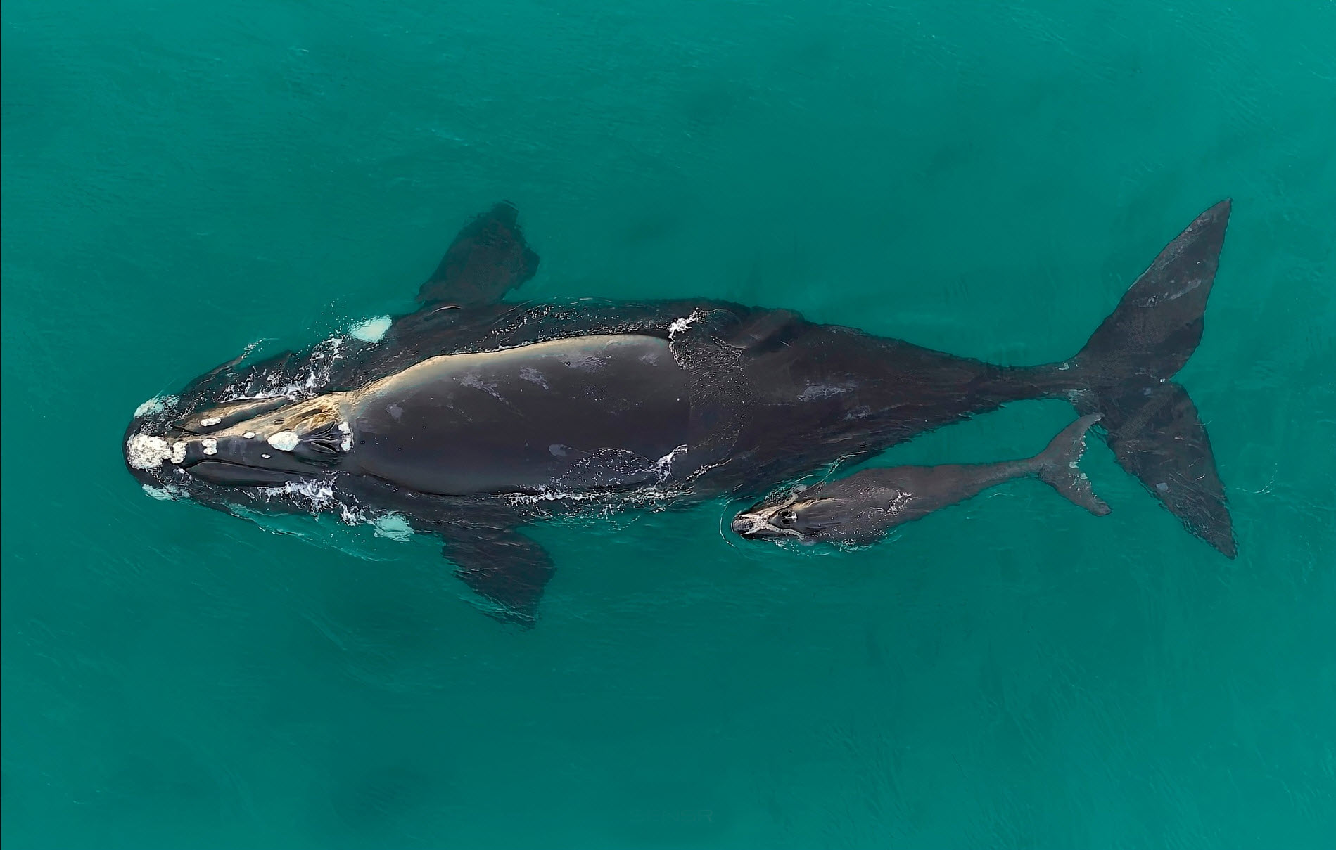
Aerial surveys of southern right whales (Eubalaena australis) were undertaken off the southern Australian coast to monitor the recovery of this endangered species following extreme 19th and 20th Century commercial whaling. The aerial survey was undertaken in the coastal waters from Perth (Western Australia) to Ceduna (South Australia) between the 12th and 19th August 2022, to maintain the annual series of surveys and inform the long-term population trend. The survey resulted in a total 526 whales sighted, consisting of 247 cow-calf pairs, 31 unaccompanied adults and 1 yearling. The ‘western’ population of southern right whales in Australian waters is increasing in size (~5.3% per year based on female/calf pairs and a population estimate of 2675 whales) based on the long-term population trend data from the annual aerial surveys. This represents the majority of the Australian population given the very low numbers in the ‘eastern’ population. The 2022 surveys recorded the lowest number of unaccompanied animals (i.e. males and females without a calf) ever throughout the time-series of the annual aerial surveys since 1993 when survey coverage between Cape Leeuwin and Ceduna first began. Across this time series, there is a particularly notable decline in sightings of unaccompanied animals over the past five years. It is currently unclear what factors account for the decline in these sightings or may influence the variation in numbers of unaccompanied animals on the southern Australian coast. Lower than expected counts in the long-term data may provide evidence of a slowing population growth rate, which can only be assessed by continued annual population surveys to assess population trend data.
-
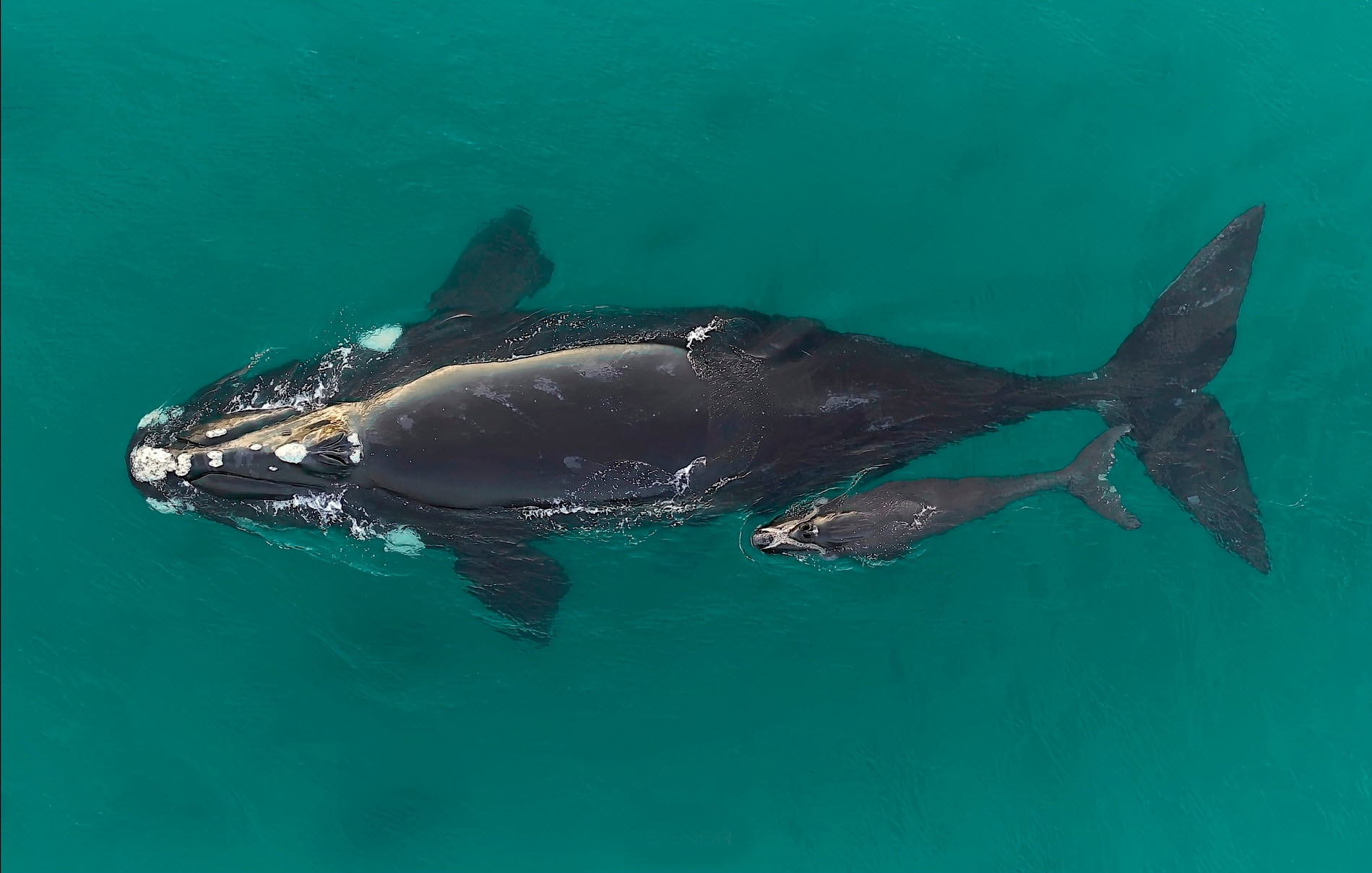
Aerial surveys of southern right whales (Eubalaena australis) were undertaken off the southern Australian coast to monitor the recovery of this endangered species following extreme 19th and 20th Century commercial whaling. The aerial survey was undertaken in the coastal waters from Perth (Western Australia) to Ceduna (South Australia) between the 12th and 17th August 2021, to maintain the annual series of surveys and inform the long-term population trend. The maximum whale counts for each leg of the survey flights between Cape Leeuwin and Ceduna, and consisted of a total 643 southern right whales sighted across the survey area (270 cow-calf pairs and 103 unaccompanied whales). The subsequent population estimate for the Australian ‘south-western’ population is 2,549 whales, which represents the majority of the Australian population given the very low numbers in the ‘south-eastern’ subpopulation. The population long-term trend data is indicating recent years (from 2007) are showing greater inter-annual variation in whale counts. To evaluate the recovery of the southern right whale population, it will be critical to collect long-term data on the annual variability in whale numbers related to the non-annual female breeding cycle and identify possible impacts on this by short-term climate dynamics, longer-term climate change and/or anthropogenic threats.
-
This record provides an overview of the NESP Marine and Coastal Hub project "Aerial survey of the Southern Right Whale 'western' sub-population off southern Australia". For specific data outputs from this project, please see child records associated with this metadata. -------------------- Southern right whales are listed as Endangered under the EPBC Act and are a species of national conservation significance. Monitoring of their recovery is guided by the Southern Right Whale Conservation Management Plan, which aims to improve the population’s conservation status through regular assessment of population size, calving intervals, and spatial trends. This project continued the long-term aerial survey program of southern right whales along the southern Australian coast, spanning from Perth (WA) to Ceduna (SA). Annual surveys have been conducted since 1993, providing a continuous long-term dataset for the 'western' population and supporting national assessments of connectivity with the smaller ‘eastern’ population. The surveys contribute essential data on population trends, calving rates, and movements of individuals. The August 2022 aerial survey ensured an uninterrupted time series in the long-term population trend data. This is particularly important given the species' non-annual breeding cycle (typically every three years). Annual surveys are essential to maintain an acceptable level of precision in estimating population trends and key life history parameters. A total of 526 whales were recorded, including 247 cow–calf pairs, 31 unaccompanied adults and one yearling. Based on long-term models, this equated to a population estimate of approximately 2,675 individuals, with an average annual growth rate of ~5.3%. While this represents a continued population growth, results suggest a possible slowing in the rate of growth over the past 13 years (from 7.5% in 2009). The 2022 survey also recorded the lowest number of unaccompanied animals in the entire time series, extending a five-year trend of low sightings in this group. Continued monitoring of the population is needed to assess whether these changes represent longer-term shifts in population dynamics and calving intervals, and to inform adaptive management for this long-lived, slow-recovering species. Outputs • Estimate of relative abundance and population trend compared to long-term aerial survey sightings [dataset] • Individual whale photo-identification data - 2021-22 season [imagery - published to ARWPIC] • Final technical report detailing overall numbers of southern right whales observed within the survey region, their gender (and life stage where possible) and spatial distribution of individuals [written]
-
This record provides an overview of the NESP Marine and Coastal Hub bridging study - "A photo-identification study of southern right whales to update aggregation area classification in the southwest of Australia". For specific data outputs from this project, please see child records associated with this metadata. -------------------- The southern right whale (Eubalaena australis) is listed as Endangered under the Environmental Protection and Biodiversity Conservation Act 1999 (EPBC Act) and is subject to conservation listings in five Australian states due to severe population declines caused by historical whaling. The Southern Right Whale Conservation Management Plan 2011–2021 outlines the current status of, and threats to, the southern right whale in Australian waters and prioritises recovery actions during this period. The long-term vision for the recovery of this species in Australian waters is to increase the population size to a level that the conservation status improves, and the species no longer qualifies for listing as threatened under any of the EPBC Act listing criteria. The plan must be periodically updated to reflect new knowledge and prioritise the research needed to monitor population recovery and predict the impacts of threats such as climate change. Aerial surveys of southern right whales have been conducted across the southern Australian coast from Perth (W.A.) to Ceduna (S.A.) since 1993, as part of a long-term program to monitor the recovery, and inform the Conservation Management Plan (2011-2021), for this Endangered species. In Australia’s south-east, there has been little sign of recovery in southern right whale numbers following intense commercial whaling. A working hypothesis assumes separation between the ‘western’ and ‘eastern’ populations, largely due to loss of ‘cultural memory’ of whales migrating to the eastern range breeding areas. Given the relative paucity of animals that visit the southern Australian coast in areas other than south-west Australia, the western population is considered to represent the majority of the ‘Australian’ southern right whale population. The count data from these aerial surveys provide data on population trend and estimates of population size for the ‘western’ population, and hence the majority of the Australian southern right whales. Associated photo-identification data provide life history information (such as calving intervals) and connectivity between the ‘western’ and ‘eastern’ populations and contribute to the national southern right whale photo-id database: the Australasian Right Whale Photo-Identification Catalogue (ARWPIC). The 2020 aerial survey program recorded substantially lower numbers of whales than in the previous 13 years, and the lowest number of non-calving whales since the program started. This project conducted new aerial surveying in August 2021 to provide a relative estimate of annual population size for determining longer term population trends and contribute to determining if 2020 was an anomalous year or an indicator of some longer-term change to recent recovery rates and the female breeding cycle. Outputs • Aerial whale survey data (counts by size class, number, and location) - 2021-22 season [dataset] • Individual whale photo-identification data - 2021-22 season [imagery - published to ARWPIC] • Final Project Report including a short summary of recommendations for policy makers of key findings [written]
-
This record provides an overview of the NESP Marine and Coastal Hub small-scale study - "A photo-identification study of southern right whales to update aggregation area classification in the southwest of Australia". For specific data outputs from this project, please see child records associated with this metadata. -------------------- The population of Southern Right Whales (SRW) in the Southern Hemisphere has been recovering slowly from near extinction due to its decimation from whaling before its ban in the mid-1970’s. The population that visits the Australian coast each year to breed is estimated to have increased by about 4–5% per year in the past two decades, bringing the total population to approximately 3,500 whales. As the population increases, the whales extend their breeding areas into previously occupied suitable habitat. As the species recovers, there is increasing evidence of expansion of aggregation areas. Consequently, there is a need to update known established aggregation areas and Biologically Important Areas (BIAs) and update relevant Marine Parks management plans based on new evidence. Flinders Bay and Geographe Bay off south-western Western Australia were likely to have been important calving areas before commercial whaling began. Much of this habitat is popular for recreational boating and other marine activities. This project collated and completed photo-ID matching of southern right whale images collected between 2010 to 2020 in the southwest of Australia, and uploaded these to the Australasian Right Whale Photo-Identification Catalogue (ARWPIC). The photo-ID matching outcomes provide evidence that Flinders Bay and Geographe Bay now fit the criteria to be recognised nationally as Biologically Important Areas (BIAs) for Southern Right Whales. Outputs • Photo-identifications of individual whales in southwestern Australia for 1991-2021 (photo-matches contributed to ARWPIC) • Final Project Report, including evidence and recommendations for updating aggregation area classification in the southwest of Australia according to the Commonwealth criteria [written]
-
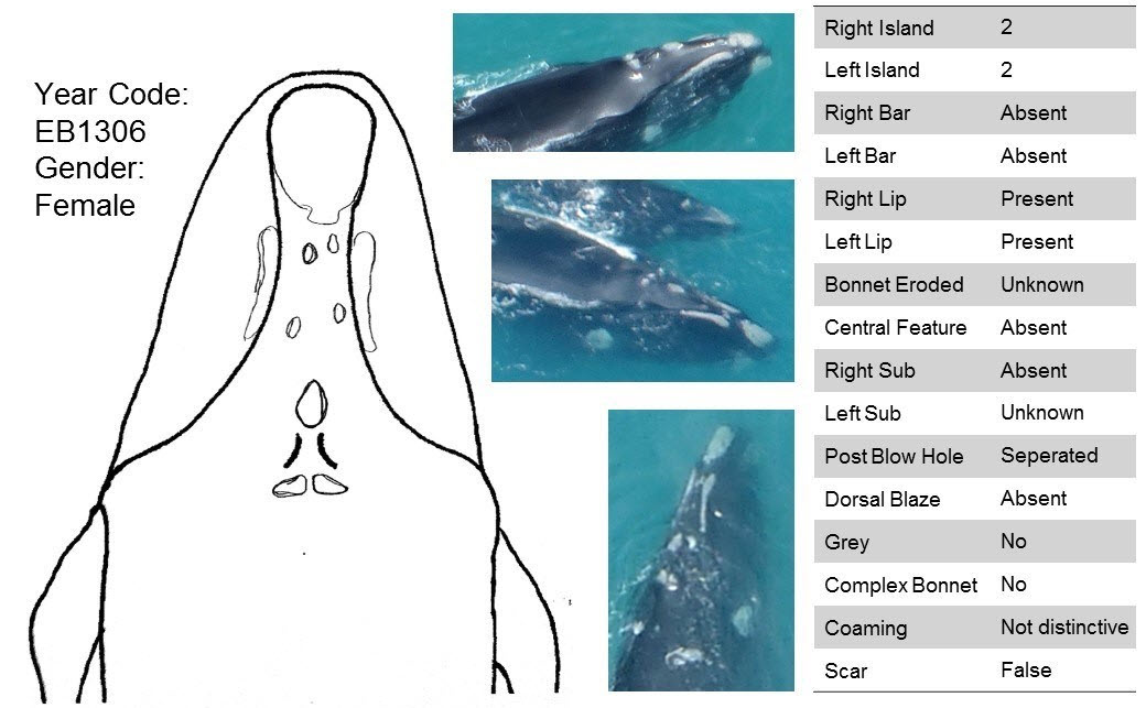
The population of southern right whales in the Southern Hemisphere has been recovering slowly from near extinction due to its decimation from whaling before its ban in 1935 and cessation in the mid-1970’s. As the species recovers, there is increasing evidence of expansion of aggregation areas, including breeding grounds off the coast of Australia. Consequently, there is a need to update known southern right whale established aggregation areas recognised nationally as Biologically Important Areas (BIAs), as well as the national Southern Right Whale Conservation Management and Recovery Plan, which are both used in decision-making using new evidence. This project collated over 2,000 images collected entirely opportunistically by researchers, volunteer citizen scientists, and whale watch operators, and completed matching of individually identifiable whales in photos (i.e., Photo-ID) between 1991 to 2021 in the southwest corner of Australia to evaluate abundance, residency, site fidelity and connectivity in this historically data limited region. The results are reported in the NESP report for Project 1.22 ("A photo-identification study of southern right whales to update aggregation area classification in the southwest of Australia"). A goal of this project was also to upload unique individual southern right whale Photo-IDs into the Australasian Right Whale Photo-Identification Catalogue (ARWPIC; AMMC 2021). The process for these Photo-IDs are briefly described here.
-
This record provides an overview of the NESP Marine and Coastal Hub Research Plan 2023 project "Monitoring, aggregation areas and approaches to improve data effectiveness for southern right whale conservation". For specific data outputs from this project, please see child records associated with this metadata. -------------------- Southern right whales are listed as Endangered under the EPBC Act and are recovering slowly from historical whaling. In Australia, recovery differs between the growing western population and the more poorly understood eastern population, where available data are largely opportunistic. Improved abundance estimates, photo-identification workflows, aggregation-area assessment, and understanding of connectivity are needed to support conservation management. This project delivered priority information for southern right whale conservation through four linked components: (1) long-term aerial surveys of the western population; (2) expansion and integration of photo-identification datasets within the Australian Right Whale Photo-Identification Catalogue (ARWPIC); (3) development of statistical approaches to combine opportunistic and systematic observations; and (4) collection of movement and genomic data to assess connectivity between eastern and western subpopulations. The project continued annual aerial surveys from Perth to Ceduna to update abundance trends and reproductive parameters for the western population. Photo-identification images and metadata were collated from archived, targeted, and opportunistic sources across eastern and western aggregation areas, supporting matching of individual whales, assessment of reproductive areas, and estimation of population parameters. The project also developed methods to expand the use of opportunistic sightings data alongside systematically collected observations, improving capacity to estimate population size, trends, recovery rates, residency, site fidelity, and connectivity. Movement, photo-identification, and genomic data collected near the boundary of the eastern and western subpopulations, particularly around Encounter Bay and adjacent waters, supported assessment of population structure, whale movements, habitat use, and potential exposure to human activities. The outputs of this project support updates to the national Southern Right Whale Conservation Management Plan, Biologically Important Area (BIA) mapping, marine park management, and risk assessments for marine industries and tourism. Consultation and engagement with Indigenous groups in South Australia and Western Australia enabled communication of research goals and findings, supported knowledge sharing, and identified opportunities for collaboration and capacity building linked to southern right whale conservation. Outputs • Individual whale photo-identifications in aggregation areas [ARWPIC image catalogue] • Aerial survey data for 2023, 2024, 2026 [dataset] • Exposure to single and cumulative threats [dataset] • Whale tracking tracking, behaviour, and dive data [dataset] • Final project report [written]
-
Whale muscle samples were collected from stranded and dead blue (Baleoptera musculus) and fin (Baleoptera physalus) whales in South-western Australia. Blue, fin, sperm (Physeter macrocephalus), humpback (Megaptera novaeangliae) and pygmy blue (Baleoptera musculus brevicauda) whale faecal samples were collected from coastal waters off Southern Australia by trawling 0.5 mm mesh nets over the surface waters following defecation. Four species of krill (Nyctiphanes australia, Euphausia pacifica, Meganyctiphanes norvegica), including Antarctic krill (Euphausia superba) were collected from various locations worldwide. We analysed the concentration of iron, cadmium, manganese, cobalt, copper, zinc, phosphorus and carbon in baleen whale faeces and muscle, and krill tissue using inductively coupled plasma mass spectrometry.