 IMAS Metadata Catalogue
2021 Aerial survey data of southern right whales (Eubalaena australis) off southern Australia (NESP MaC 1.26)
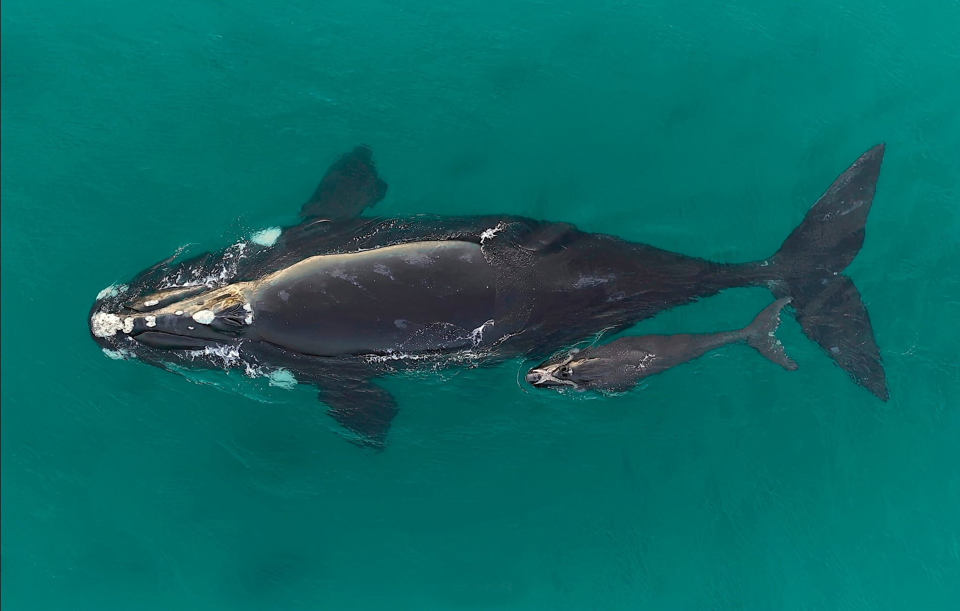
Aerial surveys of southern right whales (Eubalaena australis) were undertaken off the southern Australian coast to monitor the recovery of this endangered species following extreme 19th and 20th Century commercial whaling. The aerial survey was undertaken in the coastal waters from Perth (Western Australia) to Ceduna (South Australia) between the 12th and 17th August 2021, to maintain the annual series of surveys and inform the long-term population trend. The maximum whale counts for each leg of the survey flights between Cape Leeuwin and Ceduna, and consisted of a total 643 southern right whales sighted across the survey area (270 cow-calf pairs and 103 unaccompanied whales). The subsequent population estimate for the Australian ‘south-western’ population is 2,549 whales, which represents the majority of the Australian population given the very low numbers in the ‘south-eastern’ subpopulation. The population long-term trend data is indicating recent years (from 2007) are showing greater inter-annual variation in whale counts. To evaluate the recovery of the southern right whale population, it will be critical to collect long-term data on the annual variability in whale numbers related to the non-annual female breeding cycle and identify possible impacts on this by short-term climate dynamics, longer-term climate change and/or anthropogenic threats.
Simple
Identification info
- Date (Publication)
- 2022-10-28
Identifier
- Title
- Information and documentation - Digital object identifier system
- Citation identifier
- ISO 26324:2012
- Code
- 10.25959/WBGG-6J38
- Codespace
- doi.org
- Description
- Digital Object Identifier (DOI)
Principal investigator
Principal investigator
- Purpose
- Assessing the status and trend of Australia's southern right whale populations.
- Credit
- The data collections described in this record are funded by the Australian Government Department of Climate Change, Energy, the Environment and Water (DCCEEW) through the NESP Marine and Coastal Hub. In addition to NESP (DCCEEW) funding, this project is matched by an equivalent amount of in-kind support and co-investment from project partners and collaborators.
- Status
- Completed
Point of contact
- Topic category
-
- Biota
Extent

Extent
- Description
- Temporal Coverage
Temporal extent
- Time period
- 2021-08-12 2021-08-17
- Maintenance and update frequency
- Not planned
- Keywords (Project)
-
- National Environmental Science Program (NESP) Marine and Coastal Hub
- Keywords (Theme)
-
- Southern right whale
- Areal survey
- Keywords (Taxon)
-
- Eubalaena australis
- Global Change Master Directory Earth Science Keywords, Version 8.5
Resource constraints
- Classification
- Unclassified
Resource constraints
- Linkage
-
http://i.creativecommons.org/l/by/4.0/88x31.png
License Graphic
- Title
- Creative Commons Attribution 4.0 International License
- Website
-
http://creativecommons.org/licenses/by/4.0/
License Text
- Other constraints
- Cite data as: Smith, J., & Double, M. (2022). 2021 Aerial survey data of southern right whales (Eubalaena australis) off southern Australia [Data set]. Institute for Marine and Antarctic Studies. https://doi.org/10.25959/WBGG-6J38
Resource constraints
- Other constraints
- This dataset is hosted by the University of Tasmania, on behalf of the Australian Antarctic Data Centre and NESP Marine and Coastal Hub Project 1.27.
Associated resource
- Title
- NESP MaC Project 1.26 - Relative abundance of the ‘western’ population of southern right whales from an aerial survey off southern Australia, 2021-2022 (Murdoch Uni)
Identifier
- Association Type
- Dependency
- Initiative Type
- Project
- Language
- English
- Character encoding
- UTF8
Distribution Information
- OnLine resource
- 2021 field survey data [direct download]
Resource lineage
- Statement
- Photo quality will be variable and requires assessment prior to assimilation into photo-identification catalogue http://data.marinemammals.gov.au/arwpic
- Hierarchy level
- Dataset
Metadata
- Metadata identifier
- urn:uuid/c5f8ecf3-7ff8-4fb3-b965-eb6ca29335d4
- Language
- English
- Character encoding
- UTF8
Type of resource
- Resource scope
- Dataset
- Metadata linkage
-
https://metadata.imas.utas.edu.au/geonetwork/srv/eng/catalog.search#/metadata/c5f8ecf3-7ff8-4fb3-b965-eb6ca29335d4c
Point of truth URL of this metadata record
- Date info (Creation)
- 2022-10-28T00:00:00
- Date info (Revision)
- 2026-10-10T11:26:23
Metadata standard
- Title
- ISO 19115-3:2018
Overviews
Spatial extent

Provided by