 IMAS Metadata Catalogue
2022 Aerial survey data of southern right whales (Eubalaena australis) off southern Australia (NESP MaC 2.7)
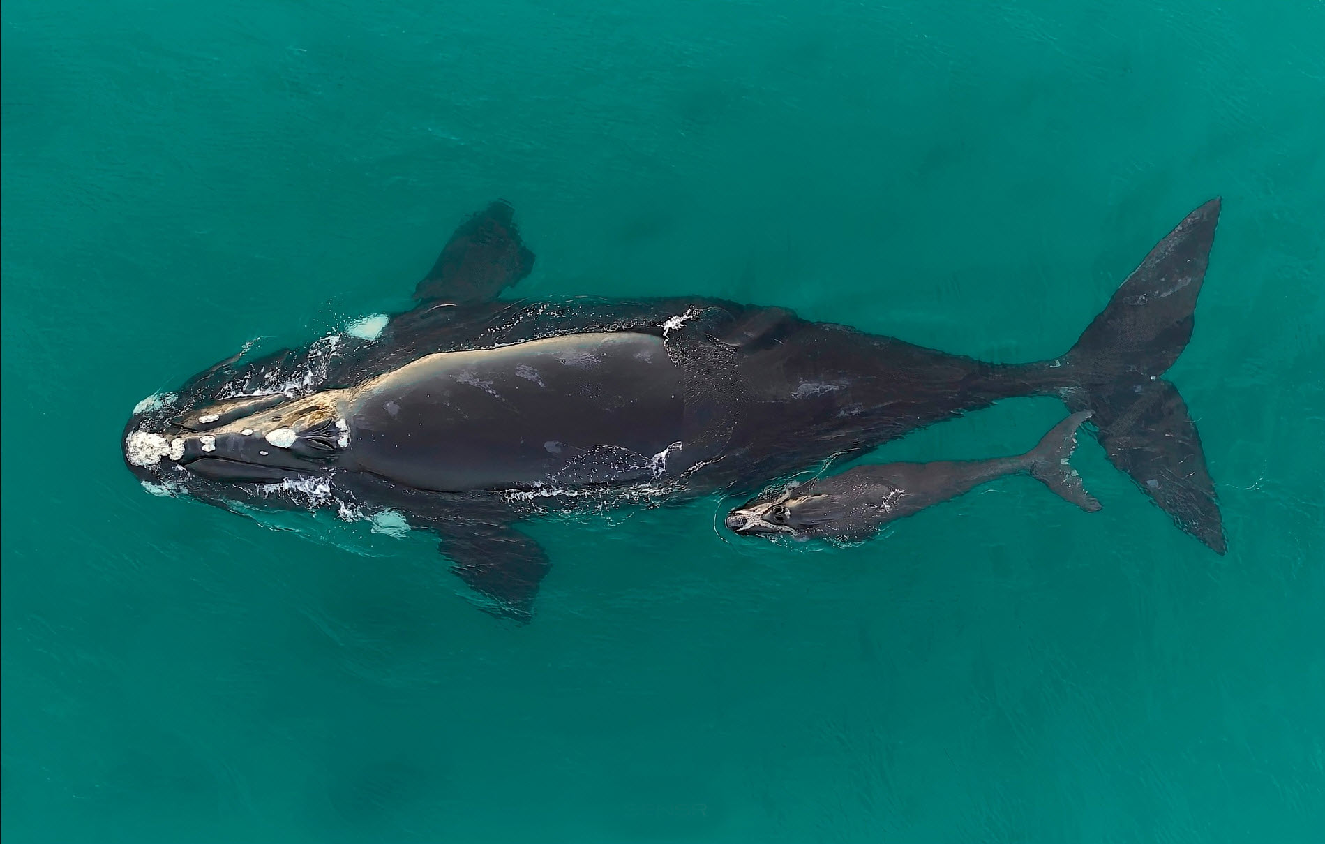
Aerial surveys of southern right whales (Eubalaena australis) were undertaken off the southern Australian coast to monitor the recovery of this endangered species following extreme 19th and 20th Century commercial whaling. The aerial survey was undertaken in the coastal waters from Perth (Western Australia) to Ceduna (South Australia) between the 12th and 19th August 2022, to maintain the annual series of surveys and inform the long-term population trend. The survey resulted in a total 526 whales sighted, consisting of 247 cow-calf pairs, 31 unaccompanied adults and 1 yearling. The ‘western’ population of southern right whales in Australian waters is increasing in size (~5.3% per year based on female/calf pairs and a population estimate of 2675 whales) based on the long-term population trend data from the annual aerial surveys. This represents the majority of the Australian population given the very low numbers in the ‘eastern’ population. The 2022 surveys recorded the lowest number of unaccompanied animals (i.e. males and females without a calf) ever throughout the time-series of the annual aerial surveys since 1993 when survey coverage between Cape Leeuwin and Ceduna first began. Across this time series, there is a particularly notable decline in sightings of unaccompanied animals over the past five years. It is currently unclear what factors account for the decline in these sightings or may influence the variation in numbers of unaccompanied animals on the southern Australian coast. Lower than expected counts in the long-term data may provide evidence of a slowing population growth rate, which can only be assessed by continued annual population surveys to assess population trend data.
Simple
Identification info
- Date (Publication)
- 2023-06-28
Identifier
- Title
- Information and documentation - Digital object identifier system
- Citation identifier
- ISO 26324:2012
- Code
- 10.25959/27GD-VY37
- Codespace
- doi.org
- Description
- Digital Object Identifier (DOI)
Principal investigator
Principal investigator
- Purpose
- Assessing the status and trend of Australia's southern right whale populations
- Credit
- The data collections described in this record are funded by the Australian Government Department of Climate Change, Energy, the Environment and Water (DCCEEW) through the NESP Marine and Coastal Hub. In addition to NESP (DCCEEW) funding, this project is matched by an equivalent amount of in-kind support and co-investment from project partners and collaborators.
- Status
- Completed
Point of contact
- Topic category
-
- Biota
Extent

Extent
- Description
- Temporal Coverage
Temporal extent
- Time period
- 2022-08-12 2022-08-19
- Maintenance and update frequency
- Not planned
- Keywords (Project)
-
- National Environmental Science Program (NESP) Marine and Coastal Hub
- Keywords (Theme)
-
- Southern right whale
- Areal survey
- Keywords (Taxon)
-
- Eubalaena australis
- Global Change Master Directory Earth Science Keywords, Version 8.5
Resource constraints
- Classification
- Unclassified
Resource constraints
- Linkage
-
http://i.creativecommons.org/l/by/4.0/88x31.png
License Graphic
- Title
- Creative Commons Attribution 4.0 International License
- Website
-
http://creativecommons.org/licenses/by/4.0/
License Text
- Other constraints
- Cite data as: Smith, J., & Double, M. (2023). 2022 Aerial survey data of southern right whales (Eubalaena australis) off southern Australia [Data set]. Institute for Marine and Antarctic Studies. https://doi.org/10.25959/27GD-VY37
Resource constraints
- Other constraints
- This dataset is hosted by the University of Tasmania, on behalf of the Australian Antarctic Data Centre and NESP Marine and Coastal Hub Project 2.7.
Associated resource
- Association Type
- Dependency
- Initiative Type
- Project
- Title
- NESP MaC Project 2.7 - Aerial survey of the Southern Right Whale 'western' sub-population off southern Australia, 2022-2023 (Murdoch Uni)
Identifier
- Language
- English
- Character encoding
- UTF8
Distribution Information
- OnLine resource
- 2022 field survey data [direct download]
Resource lineage
- Statement
- Photo quality will be variable and requires assessment prior to assimilation into photo-identification catalogue.
- Hierarchy level
- Dataset
Metadata
- Metadata identifier
- urn:uuid/0e431de4-43c6-4101-8930-c7705f1522fc
- Language
- English
- Character encoding
- UTF8
- Parent metadata
Type of resource
- Resource scope
- Dataset
- Metadata linkage
-
https://metadata.imas.utas.edu.au/geonetwork/srv/eng/catalog.search#/metadata/0e431de4-43c6-4101-8930-c7705f1522fc
Point of truth URL of this metadata record
- Date info (Creation)
- 2023-06-26T00:00:00
- Date info (Revision)
- 2026-10-10T11:34:16
Metadata standard
- Title
- ISO 19115-3:2018
Overviews
Spatial extent

Provided by