 IMAS Metadata Catalogue
EARTH SCIENCE | OCEANS | MARINE ENVIRONMENT MONITORING
Type of resources
Topics
Keywords
Contact for the resource
Provided by
Years
-
This dataset depicts the location of the Broadscale Environmental Monitoring Program (BEMP) sites. It was compiled from data provided by EPA Tasmania, IMAS and published reports. BEMP was initiated in 2009 by the State Government to provide knowledge and information on ecosystem function in the D’Entrecasteaux Channel and Huon Estuary. BEMPs have been developed for all marine farming regions. The objective of each program is to document (on an ongoing basis) broadscale spatial and temporal trends for key environmental parameters, allowing assessment of the environmental effects of finfish aquaculture in Tasmania. Marine farming licence conditions include participation in respective BEMPs. The BEMP program initially covered assessment of water column and sediment health at a broadscale level but has been expanded to include inshore reef, deep-reef and seagrass distribution and health. Seagrass monitoring occurs over transects. In this dataset, only the start location is displayed. Sediment sampling includes benthic infauna, stable isotopes, particle size, visual assessment, redox analysis, and sulphide measurements. Visual assessment, redox and sulphide analysis is carried out each year, while analysis of benthic infauna, stable isotopes and particle size is undertaken every four years. In the intervening years these samples are collected, preserved and retained. Water quality analytes include physico-chemical parameters (temperature, dissolved oxygen and salinity), nutrients (dissolved nutrients: ammonia, nitrate, phosphate, and silicate, nutrients: total nitrogen, total phosphorous), chlorophyll a and phytoplankton species counts. Water quality sampling is undertaken monthly from May to January and fortnightly from February to April.
-

Locations of the Oysters Tasmania's Sensor Network. The sensor network provides real-time data on salinity, water temperature, and depth in shellfish growing areas in Tasmania. Oyster growers can access the sensor data via the ‘ShellPOINT’ portal (https://www.oysterstasmania.org/shellpoint.html).
-
This dataset relates to statistical models of killer whale (Orcinus orca) occurrence in the Bremer Sub-Basin developed from vessel-based and aerial survey data collected between 2015 and 2017. Further information can be found in: Salgado-Kent C, Parnum I, Wellard R, Erbe C, Fouda L. 2017. Habitat preferences and distribution of killer whales (Orcinus orca) in the Bremer Sub-Basin, Australia. Report to the National Environmental Science Programme Marine Biodiversity Hub (CMST 2017-15), 37 p.
-

An aerial survey of giant kelp (Macrocystis pyrifera), was carried out on the east coast of Tasmania from Musselroe Bay to Southeast Cape. This survey represents part of a series of similar surveys, with historic aerial surveys having been conducted in 1986, 1999 and 2009. This survey was conducted via light aircraft in Nov-Dec 2019, and recorded areas of visible surface canopy cover of giant kelp. Canopy areas were scribed in-flight onto 1:50,000 topographic maps (TASMAP 2017), and complimentary photo and video footage was collected. Canopy areas were digitised with reference to photo, video and map data within QGIS 3.4, and boundaries were checked against Seamap Australia seafloor habitats (Lucieer et al. 2017) and bathymetric data (Smith 2016). Each bed was attributed a broad and fine scale location, density and reliability estimate (see attached report for details). This survey was completed with funding from Pennicott Wilderness Journeys, Tassal and IMAS, and equal in-kind support by Marine Solutions and Seacare Inc.
-

This record describes an aggregated data product compiled from a number of different surveys of Macrocystis surface cover in Tasmanian waters, spanning 1950 to 2019. Some surveys represent a statewide census of Macrocystis cover, while others are targeted surveys of smaller regions. Methodology and data quality may also vary between surveys. Please see linked metadata records for specific methodologies and quality statements applying to individual surveys.
-
The Tasman Fracture CMR AUV survey was a pilot study undertaken in 2014/15 as part of the National Marine Biodiversity Hub's National monitoring, evaluation and reporting theme. The aim of this theme is to develop a blueprint for the sustained monitoring of the South-east Commonwealth Marine Reserve Network. The particular aim of the survey was to contribute to an inventory of the distribution and abundance of southern rock lobster (Jasus edwardsi). Data contained here represents the data collected from lobster potting component of the study. This includes lobster abundance, gender and length. Bycatch is also recorded.
-
IMAS/CSIRO undertook a multibeam mapping campaign in eastern and Southern Tasmania to map shelf waters of the Freycinet, Huon and Tasman Fracture Marine Parks and several reference areas for the Tasman Fracture Park, including waters around Pedra Brancha and South-west Cape. The dataset includes a post-processed transit along the mid-shelf i=of Western Tasmania. The dataset includes raw mutibeam outputs and post-processed data, including Caris Files, xyz data and geotiffs. A data report for this has been produced by CSIRO. The study was intended to increase knowledge of the distribution of habitats within the SE Australian Australian Marine Park network, and at nearby reference areas with similar habitat. This information is required to underpin subsequent biological monitoring of key habitats within the AMP network, and to contrast the observations within parks with nearby fished locations to determine the extent that changes in biological communities are driven by natural vs anthropogenic pressures.
-
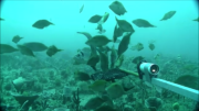
The Flinders CMR survey was a pilot study undertaken in August 2012 as part of the National Marine Biodiversity Hub's National monitoring, evaluation and reporting theme. The aim of this theme is to develop a bluepint for the sustained monitoring of the South-east Commonwealth Marine Reserve Network. The particular aims of the survey were twofold; 1) to contribute to an inventory of demersal and epibenthic conservation values in the reserve and 2) to test methodologies and deployment strategies in order to inform future survey design efforts. Several gear types were deployed; including multibeam sonar, shallow-water (less than 150m) Baited Remote Underwater Video (BRUVs), deep- water BRUVs, towed video and digital stereo stills. This resource contains the shallow-water BRUV footage captured on the FLinders CMR shelf (less than 150 m). Stereo BRUV's were deployed using a probabalistic and spatially-balanced survey design called Generalized Random Tessellation Stratified (GRTS). Habitats were identified in a previous multibeam survey and consisted of 'mixed reef' (containing patchy reef) and sand. Mixed reef habitat was targeted in this survey (9 GRTS mixed reef sites versus 3 sand sites). A total of 60 stereo BRUVs were deployed. Data contained here represents footage collected using these drops and the associated scored data (abundance (MaxN) and lengths).
-
This dataset derives from deployments of pelagic baited camera systems (stereo-BRUVS) conducted within the Oceanic Shoals Commonwealth Marine Reserve (CMR) in the Timor Sea during September and October 2012 onboard the RV Solander. This resource comprises species lists and relative abundance data (measured as MaxN, the maximum number of individuals of a given species captured in any one frame) for 116 sampling sites surveyed across three focal areas. The Oceanic Shoals Commonwealth Marine Reserve survey was undertaken as an activity within the Australian Government's National Environmental Research Program Marine Biodiversity Hub and was the key component of Research Theme 4 - Regional Biodiversity Discovery to Support Marine Bioregional Plans. Hub partners involved in the survey included the Australian Institute of Marine Science, Geoscience Australia, the University of Western Australia, Museum Victoria and the Museum and Art Gallery of the Northern Territory. Data acquired during the survey included: multibeam sonar bathymetry and acoustic backscatter; sub-bottom acoustic profiles; physical samples of seabed sediments, infauna and epibenthic biota; towed underwater video and still camera observations of seabed habitats; baited video observations of demersal and pelagic fish, and; oceanographic measurements of the water column from CTD (conductivity, temperature, depth) casts and from deployment of sea surface drifters. Further information on the survey is available in the post-survey report published as Geoscience Australia Record 2013/38: Nichol, S.L., Howard, F.J.F., Kool, J., Stowar, M., Bouchet, P., Radke, L.,Siwabessy, J., Przeslawski, R., Picard, K., Alvarez de Glasby, B., Colquhoun, J., Letessier, T. & Heyward, A. 2013. Oceanic Shoals Commonwealth Marine Reserve (Timor Sea) Biodiversity Survey: GA0339/SOL5650 - Post Survey Report. Record 2013/38. Geoscience Australia: Canberra. (GEOCAT #76658).
-
Opportunistic visual surveys were conducted in transit to, and within, the Oceanic Shoals Commonwealth Marine Reserve (CMR) in the Timor Sea during September and October 2012 onboard the RV Solander. This resource comprises species lists and estimated counts of marine mammals, sea snakes, seabirds, sea turtles and other large wildlife encountered during the voyage. The Oceanic Shoals Commonwealth Marine Reserve survey was undertaken as an activity within the Australian Government's National Environmental Research Program Marine Biodiversity Hub and was the key component of Research Theme 4 - Regional Biodiversity Discovery to Support Marine Bioregional Plans. Hub partners involved in the survey included the Australian Institute of Marine Science, Geoscience Australia, the University of Western Australia, Museum Victoria and the Museum and Art Gallery of the Northern Territory. Data acquired during the survey included: multibeam sonar bathymetry and acoustic backscatter; sub-bottom acoustic profiles; physical samples of seabed sediments, infauna and epibenthic biota; towed underwater video and still camera observations of seabed habitats; baited video observations of demersal and pelagic fish, and; oceanographic measurements of the water column from CTD (conductivity, temperature, depth) casts and from deployment of sea surface drifters. Further information on the survey is available in the post-survey report published as Geoscience Australia Record 2013/38: Nichol, S.L., Howard, F.J.F., Kool, J., Stowar, M., Bouchet, P., Radke, L.,Siwabessy, J., Przeslawski, R., Picard, K., Alvarez de Glasby, B., Colquhoun, J., Letessier, T. & Heyward, A. 2013. Oceanic Shoals Commonwealth Marine Reserve (Timor Sea) Biodiversity Survey: GA0339/SOL5650 - Post Survey Report. Record 2013/38. Geoscience Australia: Canberra. (GEOCAT #76658).