2008
Type of resources
Topics
Keywords
Contact for the resource
Provided by
Years
-

Reef Life Survey is a program that trains and assists a network of skilled and committed recreational divers to cost-effectively assess the state of the inshore marine environment at the continental scale. The program uses standardised underwater visual census methods employed by SCUBA divers to survey fish and invertebrate species and to record macroalgal and coral cover using photo quadrats - this record refers to the website for this program. By standardising techniques and establishing a monitoring system on a nation-wide scale, the program addresses many of the current problems associated with managing the marine environment, including the paucity, patchiness and variable quality of data on the distribution of and trends to marine biodiversity. A central database is managed for the storage, analysis and dissemination of data collected nationally, with a publicly-accessible web-based portal. The website allows information collected on Australia's marine environment to be accessed in a meaningful form by policy-makers and the general public, including recreational groups, scientists and industry. It also has information and resources for particpating divers and those wishing to become involved. The dataset generated by recreational divers will provide a national framework for monitoring the state of the inshore environment and the identification of those threats and locations of greatest conservation concern. This record points to the online resource for Reef Life Survey: http://www.reeflifesurvey.com/
-
Interactions between native and introduced species can help to elucidate the impact of exotic species on the broader community. This work examines utilisation of an introduced gastropod, the New Zealand screwshell (Maoricolpus roseus) by native hermit crabs in eastern Tasmania. Samples of screwshells were collected from Bass Strait, Maria Island, Pirates Bay and Dennes Point using a modified scallop dredge or collected by divers. Site location, date, depth, dredge opening size were recorded, and random sub-samples of shells were measured for length and width, and spire damage was scored. Hermit crabs, if present, were identified to species, sexed and measured.
-
Samples of Octopus maorum and O. pallidus have been collected from the Eaglehawk fishery and as bycatch from southern rock lobster fishery to determine population structure and spatial and temporal trends. Tag recapture study of O. maorum and O. pallidus in Taroona reserve using PIT tags and movement study using acoustic tracking at Taroona reserve and Eaglehawk neck examine the temporal and spatial scales of movement and habitat use. Octopus tracked using VR2's (presence/absence data) and VRAP (triangulated positional data) at both sites.
-
Black Jew fish in the Northern Territory and Banded Morwong and Bastard Trumpeter in Tasmania have been tagged with acoustic tags and tracked using VR2's (presence/absence data) and VRAP (triangulated positional data) (Tas fish only).
-
Recent poleward range expansion of the barrens-forming sea urchin Centrostephanus rodgersii (Diadematidae) from mainland Australia to Tasmania, has emphasized the need to understand the population dynamics of this ecologically important species in Tasmania. This work informs potential population dynamics of C. rodgersii in Tasmania by examination of its reproductive ecology. Reproductive periodicity (gonad index and propensity to spawn) was assessed bimonthly for 18 months at 4 sites in eastern Tasmania. Gamete viability was assessed by fertilization and early development trials. Temperature tolerance of Tasmanian C. rodgersii larvae was also assessed to determine whether this species has undergone an adaptive shift to the cooler Tasmanian environment. There was also no evidence for an adaptive shift in reproductive phenology. Reproductive phenology was assessed by determination of peak spawning period (gonad index analysis).
-
We used an in situ manipulative experiment to assess the impacts of the introduced New Zealand screwshell, Maoricolpus roseus, on native soft-sediment community structure and habitat characteristics in SE Tasmania. Impacts were assessed for high and low screwshell density and for the effect of live and dead screwshells, as well as those containing hermit crabs.
-

Reef Life Survey is designed to develop and resource a network of skilled recreational divers for rapid and cost-effective assessment of the state of the inshore marine environment at the global scale. The project uses standardised underwater visual census methods employed by trained SCUBA divers to survey fish and invertebrate species and to record habitat type using photo quadrats - this particular dataset refers to the photo quadrats only.
-
Underwater visual census surveys were conducted at 15 sites in eastern Tasmania to quantify the abundance of the sea urchin Heliocidaris erythrogramma and several putative predators.
-

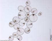
The Guide to the Marine Zooplankton of south eastern Australia, is an interactive tool providing a comprehensive, fully illustrated means of identification for the major zooplankton located in south eastern Australia. This new identification guide to local marine zooplankton is available online at: http://www.imas.utas.edu.au/zooplankton This is the result of collaboration between the Marine Research Laboratories and School of Zoology, University of Tasmania, and the Australian Antarctic Division. Please note that the full contents of the site will be available on (Free) CD-Rom
-

In the Derwent Estuary (south eastern Tasmania, Australia), the introduced northern Pacific seastar Asterias amurensis is highly abundant and fecund when associated with anthropogenic structures (wharves and marinas). Based on modelled predictions of fertilisation success, seastars at wharf 'hotspots', whilst representing <10% of the total population in the Derwent Estuary, and concentrated in <0.1% of the total area, contribute up to >80% of total larval production in the estuary. Reproductive potential of populations at wharf and control sites was quantified (in terms of individual capacity and spatial characteristics of the population. A large scale survey was undertaken in the Derwent estuary (to 27m) to determine spatial distribution of the species. Zygote production (i.e. number of fertilised eggs) was used as a measure of reproductive output and was simulated using empirical estimates of spatial and reproductive parameters of the adult seastars in a spatially explicit model of fertilization (developed by A. Morris and C. Johnson).
 IMAS Metadata Catalogue