 IMAS Metadata Catalogue
ENVIRONMENTAL ASSESSMENTS
Type of resources
Topics
Keywords
Contact for the resource
Provided by
Years
-

This record provides an overview of the NESP Marine and Coastal Hub Research Plan 2023 project "Guiding the sustainable development of offshore renewables and other emerging marine industries in Australia". For specific data outputs from this project, please see child records associated with this metadata. -------------------- Australia is entering a phase of rapid offshore renewable energy development, particularly offshore wind, with priority areas identified across the western, southern and eastern coasts. Regulatory assessment under the EPBC Act and Offshore Electricity Infrastructure Act requires accessible environmental, cultural and monitoring information to support socially and ecologically sustainable development. This project established inventories of existing environmental and cultural data, best-practice monitoring standards, and impact-related literature for continental shelf waters associated with Australia’s six priority offshore wind regions: Hunter and Illawarra, Gippsland, Southern Ocean, Bass Strait, and the Indian Ocean off Bunbury. The process was guided by an Offshore Renewable Energy Program Steering Committee with representatives from DCCEEW, NOPSEMA and Marine and Coastal Hub partners. The work ran in parallel with a related NESP Marine and Coastal Hub project (https://www.nespmarinecoastal.edu.au/project/3-21) focused on the confirmed area of declaration for ORE off the east Gippsland coast, Victoria. Together, both projects were guided by an Offshore Renewable Energy Program Steering Committee comprising representatives from DCCEEW, NOPSEMA and Marine and Coastal Hub partners. Focus areas of the data inventory were: • Seabed geomorphology, bathymetry, sedimentology, and habitat characterisation; • Oceanographic features and coastal processes; • Priority threatened, migratory, and marine species and habitats; • Potential impacts during installation, operation, and decommissioning; • Indigenous communities and cultural values affected by ORE development areas; • Monitoring needs and associated best practices. Project outputs included four database inventories with more than 500 publications across 16 impact types, seabed and oceanographic information, and tabulated summaries and mapped extents of priority species relevant to ORE assessment. The compiled data inventories identified major data and management gaps, including limited high-resolution bathymetry, geomorphology and biological survey data; inconsistent data acquisition standards; limited FAIR access to threatened species data; and the need for coordinated research investment and early Traditional Owner engagement. Outputs from the project will support environmental assessment, mitigation and monitoring of offshore wind impacts, standardisation of data collection methodologies, cumulative impact assessment, and regulatory decision-making under the EPBC and OEI Acts. Outputs • Inventory of existing information and associated sources for the following thematic areas: seabed geomorphology and habitat, oceanography, species and habitats, affected indigenous communities, ongoing monitoring needs and associated best practices, potential impacts of installation and operation [data inventories] • Final project report [written]
-
This record provides an overview of the NESP Marine and Coastal Hub Research Plan 2023 project "Identifying priority datasets of relevance to the Gippsland declaration area and pathways for their use in guiding decision-making". For specific data outputs from this project, please see child records associated with this metadata. -------------------- Offshore renewable energy is rapidly developing in Australian waters, creating an immediate need for efficient access to relevant environmental data for assessment and regulation. In the Gippsland declared area, Commonwealth agencies require information on threatened and migratory species to support evidence-based decisions, identify data gaps, and guide future research and monitoring. This project rapidly assessed the availability, accessibility, and utility of data and information for 15 priority species of seabirds, shorebirds, and marine mammals identified by DCCEEW and NOPSEMA in relation to the Gippsland offshore renewable energy area. The assessment considered species presence and occurrence, distribution and movement, habitat use, population dynamics, and behavioural information relevant to potential interactions during construction, operation, and decommissioning. Data and information were identified through a workshop with data holders and research users, a data holder/user survey, and literature and repository searches across the broader Bass Strait region. The project identified approximately 250 data records from 30 data holders, covering datasets such as tracking, banding, diet, presence records, population genetics, mark-recapture, species distribution models, and museum specimens. Records included information on dataset type, location, time period, owner, access pathway, associated publications, and links to source metadata or data repositories. The collation of this data inventory improved discoverability of priority species information. It also identified barriers to data use, including isolated databases, inconsistent metadata, inaccessible formats, and limited connections between data holders and assessment users. Recommendations focused on improving FAIR data practice, collaborative data-sharing arrangements, online aggregation of assessment-relevant information, and clearer definition of priority species, impacts, and data requirements. The outputs support offshore renewable energy assessment and regulatory processes for the Gippsland declared area, contributed key information to NESP Marine and Coastal Hub Project 3.3 (https://www.nespmarinecoastal.edu.au/project/3-3/), and provide a foundation for improving access to environmental data needed for future planning, monitoring, mitigation, and management. Outputs • Inventory of datasets relevant to the Gippsland OEI declaration area for priority species identified by DCCEEW and NOPSEMA [data inventory] • Final project report [written]
-
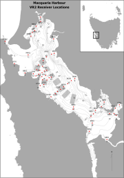
Fixed position oxygen and water temperature logger data from the Macquarie Harbour World Heritage Area (WHA). Two Hobo oxygen data loggers are positioned at approximately 15 m depth at different sites within the WHA, with the intent of monitoring representative mid-bottom water oxygen values in the WHA as these were identified in previous studies to be naturally low due to limited seawater exchange at the harbour entrance, and thus likely to be most susceptible to anthropogenic factors that may increase oxygen demand and alter WHA conservation values. These values include core habitat of the Maugean Skate, a listed threatened species. This work is funded by WHA advisory board via the Nature Conservation Branch of DPIPWE and is part of a larger study being conducted by IMAS undertaking a biological baseline study of the biodiversity of the Macquarie Harbour WHA. This data spans 08/11/14 to present (most recent update 02/02/17).