2002
Type of resources
Topics
Keywords
Contact for the resource
Provided by
Years
-
An environmental classification developed in conjunction with the NSW Marine Parks Authority Research Committee. For more information see: Breen D.A. and R.P. Avery. (2002). Broad-scale biodiversity assessment of the Manning Shelf marine bioregion. Draft final report for the NSW Marine Parks Authority. Copies of the report may be borrowed from the library: Environment Australia, GPO Box 787, Canberra ACT 2601 Australia. This coverage is intended for used in regional level marine conservation assessment. It was prepared using very low cost techniques (ie. unrectified API) and should not be relied upon for navigation purposes. This represents an historic dataset providing transparency on the 2002 marine park systematic planning process. This product is one of three related datasets used in the assessment process: "NSW Ocean Ecosystems 2002", "NSW Estuarine Ecosystems 2002" & "NSW Marine Habitats 2002" ----------------------------------- This record describes classes for each of the five major estuary ecosystems. The full study also describes the environmental classification of the four ocean ocean ecosystems classified by depth, and nine habitat surrogates.
-
An environmental classification developed in conjunction with the NSW Marine Parks Authority Research Committee. For more information see: Breen D.A. and R.P. Avery. (2002). Broad-scale biodiversity assessment of the Manning Shelf marine bioregion. Draft final report for the NSW Marine Parks Authority. Copies of the report may be borrowed from the library: Environment Australia, GPO Box 787, Canberra ACT 2601 Australia. This coverage is intended for used in regional level marine conservation assessment. It was prepared using very low cost techniques (ie. unrectified API) and should not be relied upon for navigation purposes. ----------------------------------- This record describes the environmental classification of the four ocean ocean ecosystems classified by depth. The full study also describes classes for each of the five major estuary ecosystems, and nine habitat surrogates.
-
An environmental classification developed in conjunction with the NSW Marine Parks Authority Research Committee. For more information see: Breen D.A. and R.P. Avery. (2002). Broad-scale biodiversity assessment of the Manning Shelf marine bioregion. Draft final report for the NSW Marine Parks Authority. Copies of the report may be borrowed from the library: Environment Australia, GPO Box 787, Canberra ACT 2601 Australia. This coverage is intended for use in regional level marine conservation assessment. It was prepared using very low cost techniques (ie. unrectified API) and should not be relied upon for navigation purposes. This represents an historic dataset providing transparency on the 2002 marine park systematic planning process. This product is one of three related datasets used in the assessment process: "NSW Ocean Ecosystems 2002", "NSW Estuarine Ecosystems 2002" & "NSW Marine Habitats 2002" ----------------------------------- This record describes the environmental classification of nine habitat surrogates (mangrove, seagrass, saltmarsh, subtidal sediment, beach, intertidal rocky shore, subtidal reef and island). The full study also describes classes for each of the five major estuary ecosystems, and the four ocean ecosystems classified by depth.
-

As a condition of licence for harvesting Macrocystis pyrifera (Linnaeus) C. Agardh 1820, Alginates (Australia) P/L lodged harvest returns to the Tasmanian Lands Department. The harvest returns consisted of what tonnage was harvested from where, when and the length of trip. While Alginates (Australia) P/L harvested from 1964-1973, harvest data for individual sites is only available for the years 1970-71. Here the data is summed for individual sites for the two years 1970-71.
-

A survey was conducted for Macrocystis pyrifera (Linnaeus) C. Agardh 1820 from Eddystone Point to South East Cape The survey was conducted from light aeroplane. Areas of Macrocystis pyrifera beds were marked on 1:100,000 topographical land tenure maps using landmarks as references. A Trimble GPS unit was used to track position in the aeroplane. As boundaries of the beds were flown over, these were marked on the GPS. When plotted up, these information assisted in determining Macrocystis bed boundaries where these were not close to the coast.
-

The results of this survey are based primarily on the first hand experience of Craig Sanderson who was doing his masters thesis at the time on aspects of the biology of Macrocystis pyrifera (Linnaeus) C. Agardh 1820. In need of significant beds of M. pyrifera for research much of the east coast was searched by boat. Significant stands (>1/2 acre) were found at Darlington, Southerly Bottom (East North Bay), Fortesque Bay and George III Rock, (near Actaeon Island). The status of the few areas not visited was determined from anecdotal reports.
-

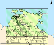
This spatial polygon dataset is derived from the 2001 mapping of mud crab (Scylla serrata) habitats along the NT and Queensland coastal wetlands. The polygons were derived from Landsat imagery and verified with field work and is suitable for use at scale 1:100,000. The information can be used in many ways to assist the management of these habitats. It provides a suitable baseline dataset for monitoring broad scale changes in area and composition of coastal wetland communities. Additionally, it provides information required by managers for choosing representative habitats for protection.
 IMAS Metadata Catalogue