 IMAS Metadata Catalogue
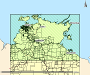
Mangroves of the Northern Territory, 1:100,000
This spatial polygon dataset is derived from the 2001 mapping of mud crab (Scylla serrata) habitats along the NT and Queensland coastal wetlands. The polygons were derived from Landsat imagery and verified with field work and is suitable for use at scale 1:100,000.
The information can be used in many ways to assist the management of these habitats. It provides a suitable baseline dataset for monitoring broad scale changes in area and composition of coastal wetland communities. Additionally, it provides information required by managers for choosing representative habitats for protection.
Simple
Identification info
- Date (Creation)
- 2002-08-02
- Date (Publication)
- 2017-04-27
- Date (Revision)
- 2022-09-01
- Credit
- Data supplied by Department of Environment and Natural Resources. © Copyright Northern Territory of Australia
- Status
- Completed
- Spatial representation type
- Vector
Spatial resolution
Equivalent scale
- Denominator
- 100000
- Topic category
-
- Biota
Extent
))
Temporal extent
- Time period
- 1996-06-30 1996-12-30
- Maintenance and update frequency
- Not planned
Resource format
- Title
- ESRI Shapefile
- Date
- Edition
- -
- Global Change Master Directory (GCMD) Earth Science Keywords Version 8.0
- Keywords (Theme)
-
- Benthic habitat
Resource specific usage
- Specific usage
- Data supplied for use by the Seamap Australia Project.
Resource constraints
- Classification
- Unclassified
Resource constraints
- Linkage
-
http://i.creativecommons.org/l/by/4.0/88x31.png
License Graphic
- Title
- Creative Commons Attribution 4.0 International License
- Website
-
http://creativecommons.org/licenses/by/4.0/
License Text
- Other constraints
- Cite data as: Department of Environment and Natural Resources, Northern Territory Government of Australia (2012). Mangroves of the Northern Territory, 1:100,000. Data accessed at http://metadata.imas.utas.edu.au/geonetwork/srv/en/metadata.show?uuid=39fbb324-b184-4ac5-8d3e-9a2994bbecb9 on (access date).
- Other constraints
- This dataset is hosted by the Institute for Marine and Antarctic Studies (IMAS), University of Tasmania, on behalf of the NT Government for the purposes of the Seamap Australia collaborative project (testing a national marine benthic habitat classification scheme).
- Language
- English
- Character encoding
- UTF8
- Supplemental Information
- de Vries, C., Danaher, K. and Dunning, M.C. (2002) Methods for monitoring the abundance and habitat of northern Australian mud crab, Scylla serrata. Milestone report. Objective 1: Habitat mapping. Report to the NT DBIRD and FRDC. Department of Primary Industries, Brisbane. Hay, T., Gribble, N., de Vries, C., Danaher, K., Dunning, M., Hearnden, M., Caley, P., Wright, C., Brown, I., Bailey, S. and Phelan, M. Methods for Monitoring the Abundance and Habitat of the Northern Australian Mud Crab Scylla serrata. Final Report FRDC Project 2000/142. ISBN 0 7245 4721 5, download link: http://www.nt.gov.au/d/Content/File/p/Fish_Rep/FR80.pdf
Content Information
- Content type
- Physical measurement
- Description
- Taxonomic identification of mangrove species and vegetation types
Identifier
- Name
- CLASS
- Description
- Appended to original data for styling purposes for the Seamap Australia Project.
- Name
- Benthic habitat
- Name
- SM_HAB_CLS
Distribution Information
- Distribution format
-
- ESRI Shapefile
- OnLine resource
-
SHAPE-ZIP
DATA ACCESS - This OGC WFS service returns the data (NT mangroves) in Shapefile format
- OnLine resource
-
seamap:SeamapAus_NT_mangroves_100
MAP - NT Mangroves
- OnLine resource
- Original metadata record [NT Government catalogue]
Data quality info
- Hierarchy level
- Dataset
Report
- Name of measure
- Positional Accuracy
- Measure description
- The resolution of the satellite imagery and the mapping process used results in a mapping product at a scale of 1: 100 000 with a high degree of accuracy (90%).
Report
- Name of measure
- Attribute Accuracy
- Measure description
- A reliability class was assigned to each polygon within the classification based on the amount of ground truth data available (i.e. aerial photography and field data). Refer to Data Dictionary in this record.
Report
- Measure description
- Complete.
Resource lineage
- Statement
- This dataset has been created to match the standards of (already existing) Queensland component, using remote sensing techniques and field validation. Landsat ETM+ imagery was processed using the standard technique of Danaher (1995a) to produce a digital dataset of the tidal coastal wetland habitats. This technique has been recognized by Environment Australia (Ward et al. 1998) as a suitable protocol for the assessment of tidal coastal wetland habitats at a regional scale. The computer-based coastal wetland community classification was validated with fieldwork conducted during June and August 2001. Approximately 170 sites were accessed by boat or helicopter. At each site, information on mangrove community floristics and structure was documented. The Queensland and Northern Territory datasets were then standardized to remove discrepancies in the classification of coastal wetland habitats. A number of classes in the Queensland dataset were amalgamated in order to provide consistency between the two mapping products. The foreshore_flats dataset from Geoscience Australia's 250k topo (1994 edition) has been used as reference in the preparation of this dataset. DATA DICTIONARY 01. SURVEY_NME Alias: Survey Name The name describing the survey 02. SURVEY_ID Alias: Survey Identifier The survey code used to identify the information in the department's database library 03. CLASS Mangroves were classified to the community level based on dominant genus present and canopy density of the whole community. The density of the community was determined by estimating the PFC. A canopy cover of greater than 50% was classified as closed, while less than 50% was identified as open. The standard Specht (1987) vegetation categories of forest and shrub, which are based on height, were not included in this classification. This is due to the fact that vegetation height cannot be determined from the Landsat ETM+ data. Only areas subject to tidal inundation were included in this mapping exercise. Excluded classes included permanent pools of water and elevated land containing terrestrial vegetation. Tidally exposed non-vegetated intertidal flats along with seagrass or algal beds were also excluded. 04. VEG_FORM Alias: Broad Veg Form Broad structural vegetation formation. Attribute added 5/07/2019 to improve data display in NR Maps using 5 groupings: Mangrove Closed Forest, Mangrove Open Forest, Samphire/Salt Flat or Non Mangrove. 05. RELIABILITY A reliability class was assigned to each polygon within the classification based on the amount of ground truth data available (i.e. aerial photography and field data). A Highest Reliability - Complete aerial photography coverage. Fieldwork conducted 28% B High Reliability - Complete aerial photography coverage. No fieldwork conducted 52% C Average Reliability - No aerial photography available. Fieldwork conducted. OR No aerial photography available. Local cloud cover on satellite imagery 1% D Reliability Unknown (Further Ground Truthing required) - No aerial photography available. No fieldwork conducted. OR No aerial photography available. Local cloud cover on satellite imagery 19% 06. SOURCE_DAT Alias: Source Data This field indicates the base imagery processed to produce mapping in that area (path/row_date_bands).
- Hierarchy level
- Dataset
- Hierarchy level
- Dataset
Platform
Identifier
- Code
- research aeroplane
Metadata
- Metadata identifier
- urn:uuid/39fbb324-b184-4ac5-8d3e-9a2994bbecb9
- Language
- English
- Character encoding
- UTF8
Point of contact
- Parent metadata
Type of resource
- Resource scope
- Dataset
- Metadata linkage
-
https://metadata.imas.utas.edu.au/geonetwork/srv/eng/catalog.search#/metadata/39fbb324-b184-4ac5-8d3e-9a2994bbecb9
Point of truth URL of this metadata record
- Date info (Creation)
- 2020-09-23T12:30:10
- Date info (Revision)
- 2025-08-14T21:29:14
Metadata standard
- Title
- ISO 19115-3:2018
Overviews

Spatial extent
Provided by
