 IMAS Metadata Catalogue
Threatened species
Type of resources
Topics
Keywords
Contact for the resource
Provided by
Years
-

This record provides an overview of the NESP Marine and Coastal Hub Research Plan 2023 project "Assessing changes in black rockcod abundance and size". For specific data outputs from this project, please see child records associated with this metadata. -------------------- The black rockcod (Epinephelus daemelii) is a long-lived, reef-dwelling species listed as Vulnerable under Commonwealth and NSW legislation. In Australia it occurs along the coast of New South Wales, including at Lord Howe Island. Although protected from fishing in NSW since 1983, the species is vulnerable to illegal take, incidental capture, barotrauma-related mortality, and degradation of nursery habitats. Long-term monitoring is a high priority for assessing whether recovery actions and spatial protections are improving population status. This project repeated the broadscale baseline survey of black rockcod across northern NSW and Lord Howe Island, extending a monitoring program that began in 2009–2011 and included smaller key-site surveys every four to five years. Divers surveyed reef sites, photographed and filmed individual fish, recorded habitat and depth, and estimated fish lengths, including with stereo-video where possible. Additional local field capability was built through Indigenous engagement and community-based monitoring activities. These survey outputs contributed to a 15-year time series (2009-2024) on abundance, occupancy, size structure, habitat associations, and spatial distribution of black rockcod. The results indicated continued low abundance across the species’ surveyed range, while also identifying larger mature individuals and higher abundances in some no-take sanctuary zones. The long-term dataset provided evidence for assessing recovery actions and sanctuary zone effectiveness, informs future monitoring priorities, and supports potential reassessment of the species’ threatened status. Outputs • Black rockcod underwater visual census (UVC) data [dataset] • Final project report [written]
-
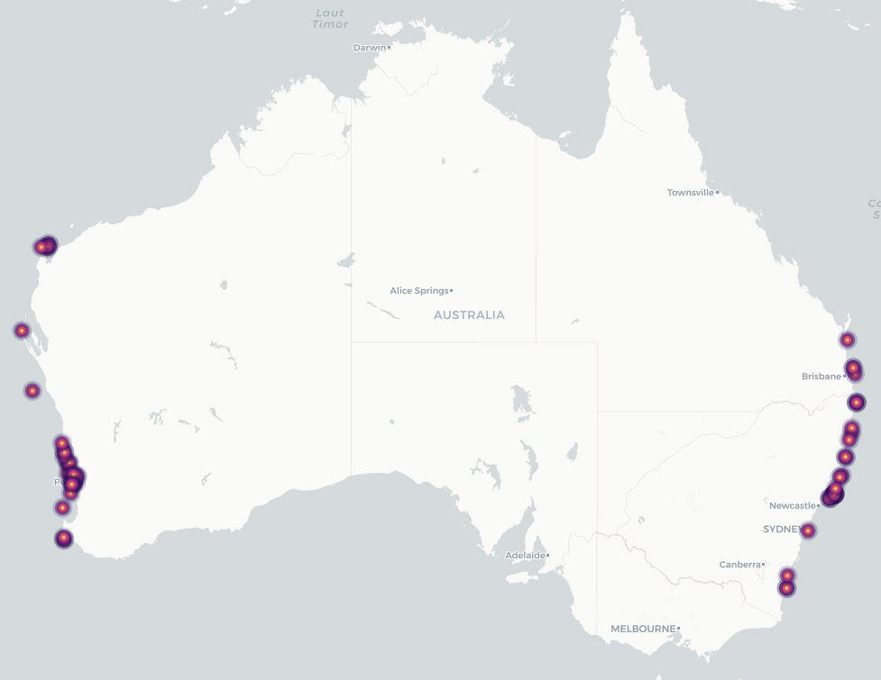
This dataset describes grey nurse shark (Carcharias taurus) listed, recognised and candidate aggregation sites in Australian waters, together with supporting individual acoustic-detection summaries from monitored aggregation sites. It consolidates previously documented site-level information on known, listed and candidate aggregation areas with time-series evidence of acoustically tagged shark detections. The project reviewed existing information on grey nurse shark aggregation sites and developed a revised definition for assessing aggregation status. Under this definition, an aggregation site is a discrete area where multiple grey nurse sharks are observed on a regular or predictable basis and where one or more behavioural functions may be inferred, including migration, resting, reproduction, feeding or undefined aggregation. The project also collected new survey and monitoring evidence from selected areas of potential grey nurse shark use, including Barwon Banks and the Hards in Queensland, Outer Gibber Reef in the Hunter Marine Park, and potential habitat in Gippsland, Victoria. These newly surveyed areas were not classified as confirmed aggregation sites as further monitoring is required to assess whether they support regular or predictable use by multiple grey nurse sharks. The data provided by this record include: • Aggregation-site data: a consolidated table of listed, recognised and potential grey nurse shark aggregation sites and associated information. • Individual detection data: collated acoustic telemetry detection summaries for tagged grey nurse sharks at monitored aggregation sites.