Time
Type of resources
Topics
Keywords
Contact for the resource
Provided by
Years
-

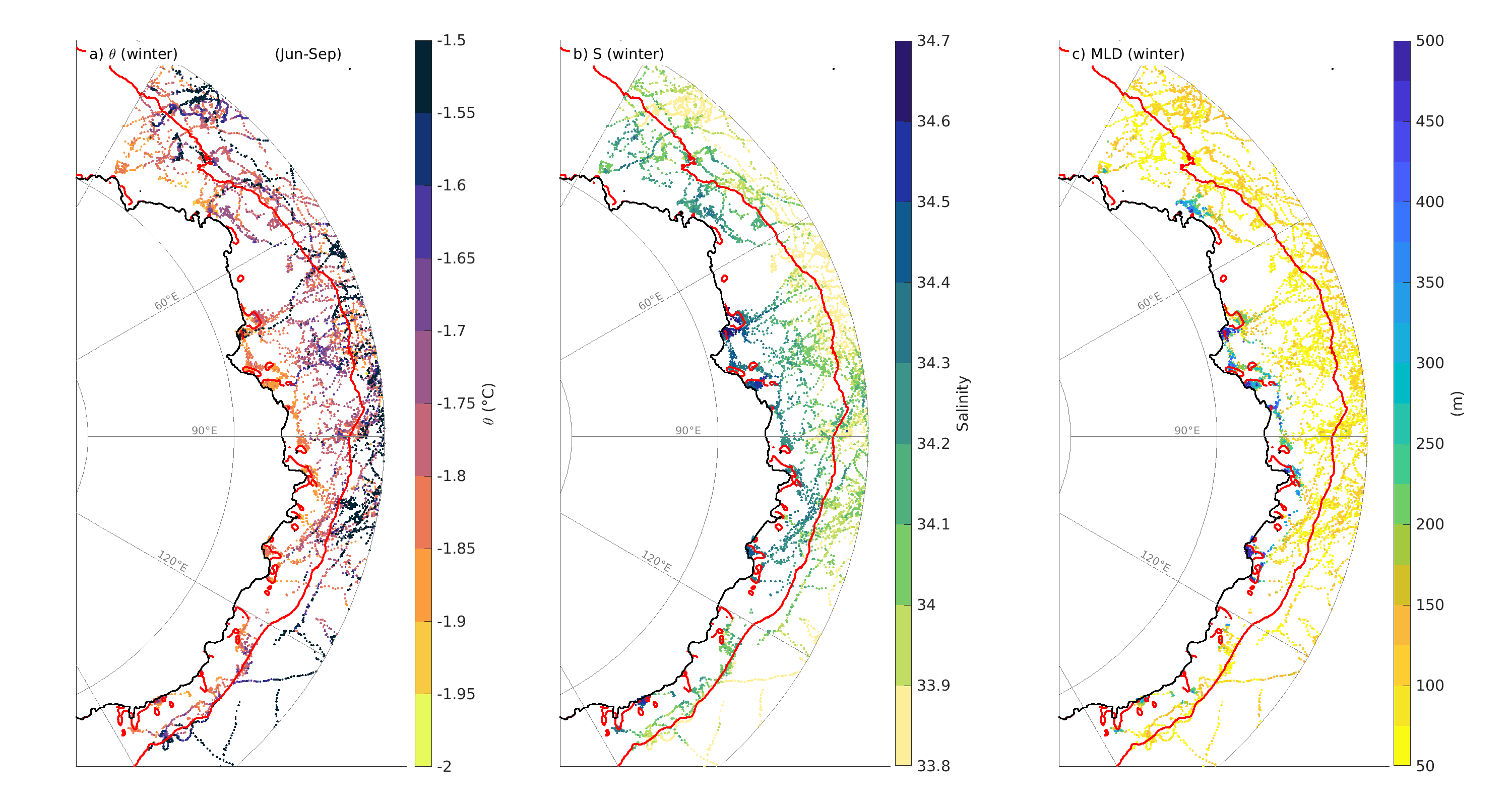
This is a collection of data in East Antarctica from Southern Elephant seal's between 2004 and 2009. The monthly data set has been further classified by polynya and year. Additionally, we provide a dataset of the polynyas contours defined following a criteria of 75% of sea-ice concentration for each individual month between 2004 and 2019. Data are provided in .mat format
-
The ETAS (Eastern TASmania) model is a high-resolution (~2 km in the horizontal) ocean model for eastern Tasmania, providing three-dimensional estimates of daily temperature, salinity, and circulation over the 1993-2014 period. This dataset consists of hourly temperature, salinity, sea level, eastward (u) and northward (v) currents (at depth and vertically-averaged) at selected locations.
-
The ETAS (Eastern TASmania) model is a high-resolution (~2 km in the horizontal) ocean model for eastern Tasmania, providing three-dimensional estimates of daily temperature, salinity, and circulation over the 1993-2014 period. This dataset consists of eastward (u) and northward (v) currents organised into yearly files.
-
The ETAS (Eastern TASmania) model is a high-resolution (~2 km in the horizontal) ocean model for eastern Tasmania, providing three-dimensional estimates of daily temperature, salinity, and circulation over the 1993-2014 period. This dataset consists of temperature, salinity, along- and cross-shore currents, density and sea level organised into yearly files.
-
The ETAS (Eastern TASmania) model is a high-resolution (~2 km in the horizontal) ocean model for eastern Tasmania, providing three-dimensional estimates of daily temperature, salinity, and circulation over the 1993-2014 period. This dataset consists of temperature, salinity, density, sea level, eastward (u) and northward (v) currents organised into timeseries files.
-
The ETAS (Eastern TASmania) model is a high-resolution (~2 km in the horizontal) ocean model for eastern Tasmania, providing three-dimensional estimates of monthly mean temperature, salinity, and circulation over the 1993-2016 period. This dataset consists of temperature, salinity, meridional (N-S), zonal (E-W), vertical, along- and cross-shore currents, density, sea level and net surface heat flux organised into yearly files. A MATLAB script to extract portions of the data is available here: https://github.com/ecjoliver/extractETAS
-
The ETAS (Eastern TASmania) model is a high-resolution (~2 km in the horizontal) ocean model for eastern Tasmania, providing three-dimensional estimates of daily temperature, salinity, and circulation over the 1993-2016 period. This dataset consists of temperature, salinity, meridional (N-S), zonal (E-W), vertical, along- and cross-shore currents, density, sea level and net surface heat flux organised into yearly files. A MATLAB script to extract portions of the data is available here: https://github.com/ecjoliver/extractETAS
 IMAS Metadata Catalogue