 IMAS Metadata Catalogue
SPECIES MIGRATION
Type of resources
Topics
Keywords
Contact for the resource
Provided by
Years
-

This record provides an overview of the NESP Marine and Coastal Hub Research Plan 2024 project "Potential impacts of offshore wind developments on eastern Indian Ocean pygmy blue whales". For specific data outputs from this project, please see child records associated with this metadata. -------------------- Pygmy blue whales (Balaenoptera musculus brevicauda) are listed as Endangered under the Environment Protection and Biodiversity Conservation Act (EPBC 1999). Their distribution and Biologically Important Areas (BIAs) overlap with regions proposed for offshore renewable energy development in western and south-eastern Australia, creating a need to assess potential impacts alongside existing pressures such as shipping, oil and gas activity, vessel strike, underwater noise and habitat disturbance. This project mapped the distribution and core foraging and migratory areas of eastern Indian Ocean pygmy blue whales by combining satellite tracking data with auxiliary information from aerial surveys, marine mammal observer records, and existing habitat suitability models. These spatial products were overlaid with proposed offshore renewable energy areas, BIAs, Australian Marine Park boundaries, and spatial pressures layers. A cumulative impact framework was used to identify areas of higher risk and potential lower-impact reference sites. The project outputs support regulators, proponents and government agencies in assessing and mitigating potential offshore renewable energy impacts on pygmy blue whales. The results contribute to cumulative risk assessment, blue whale recovery planning, future BIA review, monitoring design, and prioritisation of future research and data collection. Outputs • Spatial layers quantifying the relative distribution including migratory corridors and foraging areas across the known eastern Indian Ocean pygmy blue whale range [dataset] • Spatial layers of habitat suitability distribution [dataset] • Spatial layers for human activities identified as key pressures in this study [dataset] • Spatial layers of cumulative impact score across the species' range including potential threats from ORE and existing threats from other industries [dataset] • Final project report [written]
-

This dataset contains modelled monthly migration patterns across Bass Strait for three priority shorebird species: Curlew Sandpiper (Calidris ferruginea), Far Eastern Curlew (Numenius madagascariensis) and Red Knot (Calidris canutus). The species were selected from a suite of priority species identified by NOPSEMA and DCCEEW, building on species priorities investigated under NESP MaC Project 3.21. Modelling for Siberian Sand Plover was not progressed because insufficient records were available from Tasmania. Migration was modelled using BirdFlow, a population-level movement model that infers migration routes, timing and connectivity from weekly relative-abundance distributions. Available telemetry, banding and re-sighting data were used to evaluate and select candidate model configurations. The spatial outputs represent the rate (predicted number of crossings per 1 km grid cell) during each month of an average annual migration cycle. Separate raster products are provided for northward and southward movement, together with combined northward + southward transit surfaces. Values represent transit through a cell rather than occupancy or the number of birds present at a location. A single simulated bird may contribute to multiple cells as it moves across the landscape. The models were developed to support assessment of shorebird exposure to offshore renewable energy development in Bass Strait as part of NESP Hub Project 4.7. The products are intended for comparison of the spatial and seasonal intensity of migratory movement, including movement through and around offshore renewable energy areas. ***This data is under development. Access to the finalised spatial data will be provided once finalised, estimated early 2027.***
-
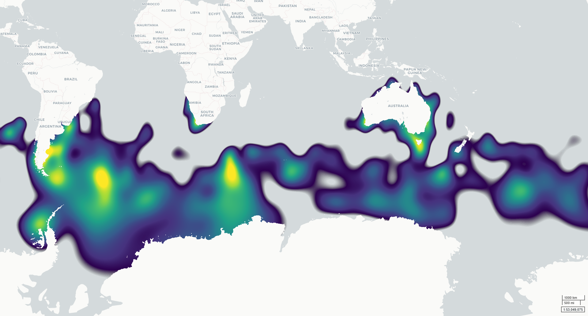
This dataset contains modelled monthly distributions of priority seabirds developed to support assessment of exposure to offshore renewable energy development as part of NESP MaC Project 4.7. Distributions are modelled for six species: Amsterdam Albatross, Gould’s Petrel, Gray-headed Albatross, Northern Royal Albatross, Shy Albatross and Southern Giant Petrel. The underlying project priority species were identified by NOPSEMA and DCCEEW, building on species priorities investigated under NESP MaC Project 3.21. Continuous integrated space-time species distribution models were fitted across the Southern Hemisphere using observations from multiple data types, including tracking, presence-absence, abundance and presence-only records. The outputs describe spatial and seasonal variation in seabird distribution on a 5 km equal-area EASE-Grid 2.0 grid. Two related raster products are provided for each modelled taxon: (1) a normalised population-distribution surface representing the relative proportion of the modelled population within each grid cell; and (2) an estimated population-density surface (individuals per km²) derived by scaling these proportions by the estimated total adult population size (Southern hemisphere). The models were developed to provide spatially and temporally explicit seabird distributions for cumulative risk assessment, including assessment of overlap with offshore renewable energy activities. Monthly outputs describe seasonal patterns across January–December. ***This data is under development. Access to the finalised spatial data will be provided once finalised, estimated early 2027.***