 IMAS Metadata Catalogue
ALBATROSSES/PETRELS AND ALLIES
Type of resources
Topics
Keywords
Contact for the resource
Provided by
Years
-
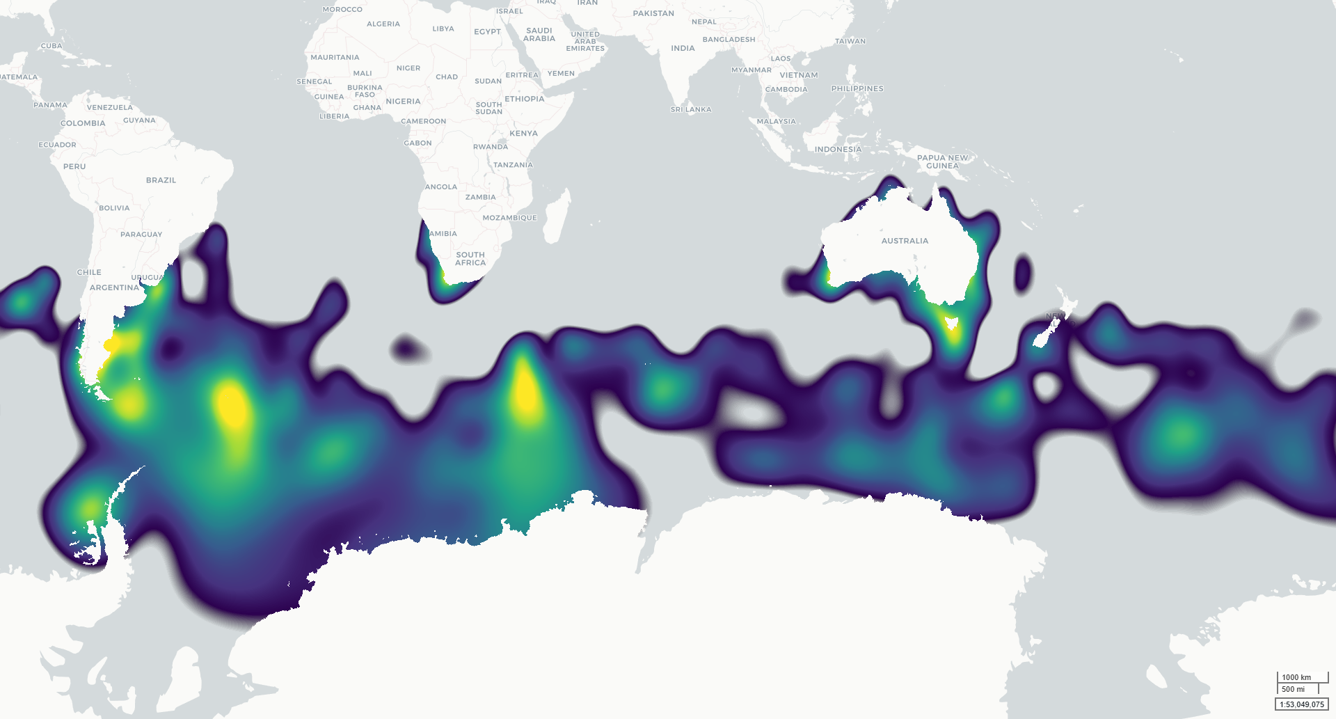
This dataset contains modelled monthly distributions of priority seabirds developed to support assessment of exposure to offshore renewable energy development as part of NESP MaC Project 4.7. Distributions are modelled for six species: Amsterdam Albatross, Gould’s Petrel, Gray-headed Albatross, Northern Royal Albatross, Shy Albatross and Southern Giant Petrel. The underlying project priority species were identified by NOPSEMA and DCCEEW, building on species priorities investigated under NESP MaC Project 3.21. Continuous integrated space-time species distribution models were fitted across the Southern Hemisphere using observations from multiple data types, including tracking, presence-absence, abundance and presence-only records. The outputs describe spatial and seasonal variation in seabird distribution on a 5 km equal-area EASE-Grid 2.0 grid. Two related raster products are provided for each modelled taxon: (1) a normalised population-distribution surface representing the relative proportion of the modelled population within each grid cell; and (2) an estimated population-density surface (individuals per km²) derived by scaling these proportions by the estimated total adult population size (Southern hemisphere). The models were developed to provide spatially and temporally explicit seabird distributions for cumulative risk assessment, including assessment of overlap with offshore renewable energy activities. Monthly outputs describe seasonal patterns across January–December. ***This data is under development. Access to the finalised spatial data will be provided once finalised, estimated early 2027.***
-
Ecosystem data was collected as part of an integrated study of the continental shelf over a 2 and a half year period between November 2015 and January 2018. Data were collected bi-monthly through the spring to autumn (November, January, March, May). Stations were situated perpendicular to shelf bathymetry, ranging in depth from ~50 m to 100 m near the edge of the shelf and were located between 5 km and 15 km from land; encompassing from south Storm Bay, past the southern tip of Bruny Island and into the Southern Ocean (south-east Tasmania, Australia). Data collected focused on each trophic level, characterizing the zooplankton community, fish schools and marine predators. The overarching aim of the study was to investigate the effects of long term warming, and a marine heatwave event on zooplankton dynamics in terms of community response variables and the flow-on effects of changing lower-trophic level dynamics for top predators.