 IMAS Metadata Catalogue
Creation year
2009
Type of resources
Topics
Keywords
Contact for the resource
Provided by
Years
From
1
-
2
/
2
-
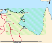
This is a collection of polygons outlining signficant seagrass meadows around Arnhem Land, Kakadu and Gulf of Carpentaria coastal waters for the Northern Australia Marine Biodiversity Survey (NAMBS) project between 2003 and 2005. Data was collected from imagery and ground truthed by observers from helicopter and insitu sample grabs.
-
This dataset has been superseded by https://metadata.imas.utas.edu.au/geonetwork/srv/eng/catalog.search#/metadata/5d62676f-63d6-4282-9b23-ba1aedfc4fdd (NSW Estuarine Macrophytes). Distribution and abundance of seagrass, mangrove and saltmarsh in NSW estuaries