 IMAS Metadata Catalogue
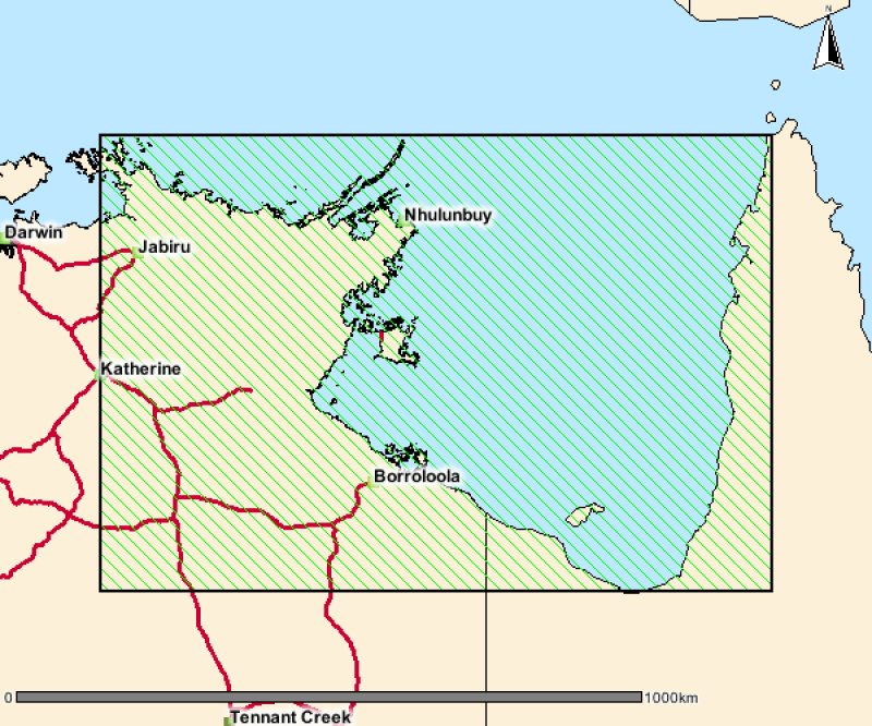
Seagrass meadows of Arnhem Land, Kakadu and Gulf of Carpentaria
This is a collection of polygons outlining signficant seagrass meadows around Arnhem Land, Kakadu and Gulf of Carpentaria coastal waters for the Northern Australia Marine Biodiversity Survey (NAMBS) project between 2003 and 2005. Data was collected from imagery and ground truthed by observers from helicopter and insitu sample grabs.
Simple
Identification info
- Date (Creation)
- 2009-07-10T00:00:00
- Date (Publication)
- 2017-05-01
Resource provider
Department of Environment and Natural Resources (DENR), Northern Territory Government - Marine Biodiversity Group
Northern Territory Department of Environment and Natural Resources
Level 1, Goyder Centre
25 Chung Wah Terrace
Palmerston
Northern Territory
0830
Australia
- Credit
- Data supplied by Department of Environment and Natural Resources. © Copyright Northern Territory of Australia
- Status
- Completed
Point of contact
Department of Environment and Natural Resources (DENR), Northern Territory Government - Marine Biodiversity Group
Northern Territory Department of Environment and Natural Resources
Level 1, Goyder Centre
25 Chung Wah Terrace
Palmerston
Northern Territory
0830
Australia
- Spatial representation type
- Vector
- Topic category
-
- Biota
- Environment
- Oceans
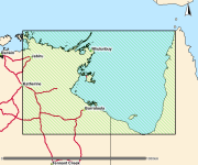
Extent
N
S
E
W
))
Temporal extent
- Time period
- 2003-12-09 2005-02-25
- Maintenance and update frequency
- Not planned
Resource format
- Title
- ESRI Shapefile
- Date
- Edition
- -
- Global Change Master Directory (GCMD) Earth Science Keywords Version 8.0
- Keywords (Theme)
-
- Benthic habitat
Resource specific usage
- Specific usage
- Data supplied for use by the Seamap Australia Project.
- ()
Resource constraints
- Classification
- Unclassified
Resource constraints
- Linkage
-
http://i.creativecommons.org/l/by/4.0/88x31.png
License Graphic
- Title
- Creative Commons Attribution 4.0 International License
- Website
-
http://creativecommons.org/licenses/by/4.0/
License Text
- Other constraints
- Cite data as: Department of Environment and Natural Resources, Northern Territory Government (2005). Seagrass meadows of Arnhem Land, Kakadu and Gulf of Carpentaria. Data accessed at http://metadata.imas.utas.edu.au/geonetwork/srv/en/metadata.show?uuid=b110ebcb-7584-413f-bf12-71651d9b3b18 on (access date).
- Other constraints
- This dataset is hosted by the Institute for Marine and Antarctic Studies (IMAS), University of Tasmania, on behalf of the NT Government for the purposes of the Seamap Australia collaborative project (testing a national marine benthic habitat classification scheme).
- Language
- English
- Character encoding
- UTF8
Content Information
- Content type
- Physical measurement
- Description
- Taxonomic identification of seagrass species
Identifier
- Name
- SPECIES
- Description
- Appended to original data for styling purposes for the Seamap Australia Project.
- Name
- Benthic habitat
- Name
- SM_HAB_CLS
Distribution Information
- Distribution format
-
- ESRI Shapefile
- OnLine resource
-
SHAPE-ZIP
DATA ACCESS - This OGC WFS service returns the data (NT seagrass meadows) in Shapefile forma
- OnLine resource
-
seamap:SeamapAus_NT_seagrass_ArnhemKakaduGoC_2005
MAP - NT seagrass meadows
- OnLine resource
- Original metadata record [NT Government catalogue]
- Hierarchy level
- Dataset
Platform
Identifier
- Code
- research aeroplane
Metadata
- Metadata identifier
- b110ebcb-7584-413f-bf12-71651d9b3b18
- Language
- English
- Character encoding
- UTF8
Point of contact
- Parent metadata
Type of resource
- Resource scope
- Dataset
- Metadata linkage
-
https://metadata.imas.utas.edu.au/geonetwork/srv/eng/catalog.search#/metadata/b110ebcb-7584-413f-bf12-71651d9b3b18
Point of truth URL of this metadata record
- Date info (Creation)
- 2020-09-23T12:36:29
- Date info (Revision)
- 2020-09-23T12:36:29
Metadata standard
- Title
- ISO 19115-3:2018
Overviews
thumbnail
large_thumbnail
Spatial extent
N
S
E
W
Provided by

Associated resources
Not available