 IMAS Metadata Catalogue
Global / Oceans | Global / Oceans | World
Type of resources
Topics
Keywords
Contact for the resource
Provided by
-
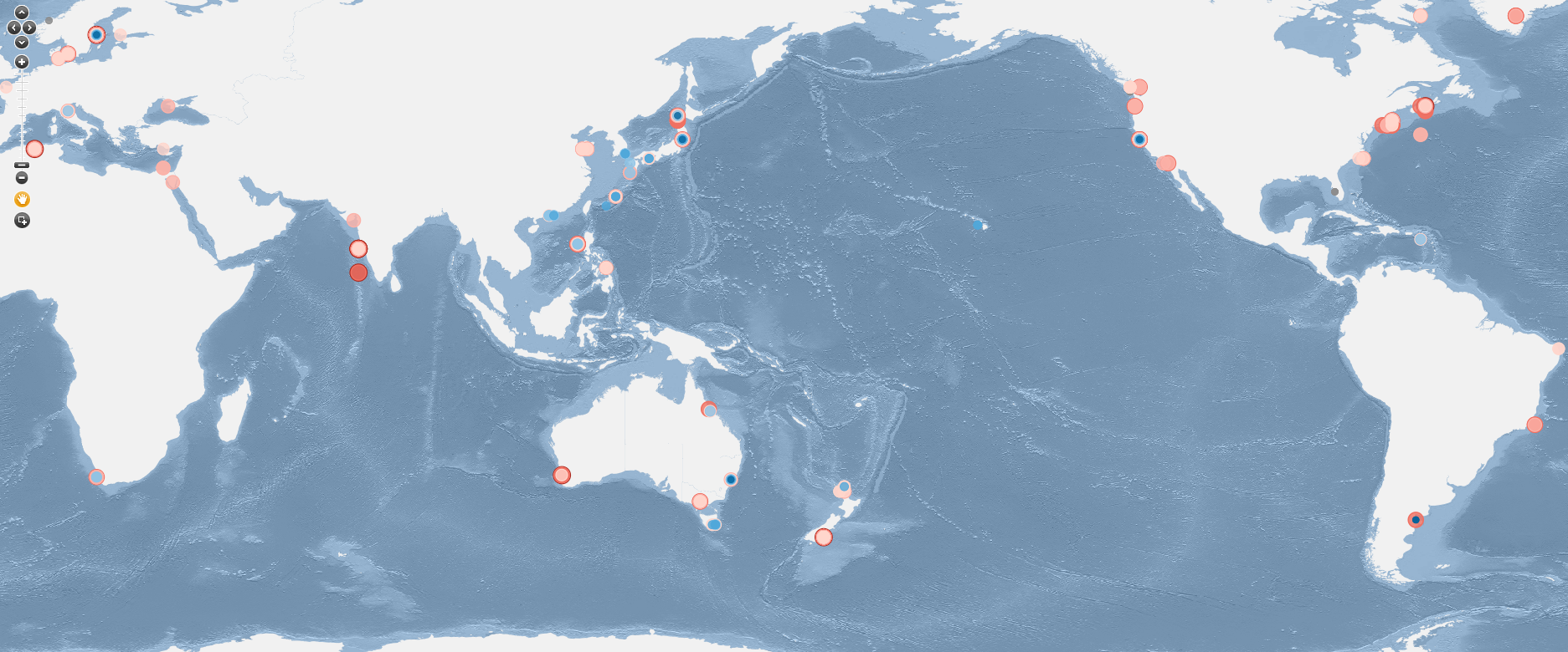
This dataset is presented as an Excel spreadsheet containing data that were collected and analysed for the project "𝗞𝗶𝗻𝗲𝘁𝗶𝗰𝘀 𝗼𝗳 𝗻𝗶𝘁𝗿𝗮𝘁𝗲 𝗮𝗻𝗱 𝗮𝗺𝗺𝗼𝗻𝗶𝘂𝗺 𝘂𝗽𝘁𝗮𝗸𝗲 𝗯𝘆 𝘀𝗲𝗮𝘄𝗲𝗲𝗱𝘀: 𝗮 𝗴𝗹𝗼𝗯𝗮𝗹 𝗮𝗻𝗮𝗹𝘆𝘀𝗶𝘀” published in 𝘉𝘰𝘵𝘢𝘯𝘪𝘤𝘢 𝘔𝘢𝘳𝘪𝘯𝘢 by Hurd, CL, Lush H, Gannon T and Britton (2027). Data were collected between May 2025 and July 2025 from published studies on the uptake kinetics of nitrate (NO₃⁻) and ammonium (NH₄⁺) by marine macroalgae from the phyla Chlorophyta, Heterokontophyta and Rhodophyta. Articles were identified through searches on Google Scholar and ISI Web of Science. Each study contained data obtained from laboratory experiments on the rate of Dissolved Inorganic Nitrogen (DIN) uptake rate at a range of DIN concentrations. A total of 82 published studies were located, with 532 distinct data entries. Values of the Michaelis-Menten kinetic constants maximum uptake rate (Vmax) and the half saturation constant (Ks) were extracted from studies that reported saturating uptake, and cases where the pattern of uptake with concentration was linear or biphasic were also recorded. For each study, metadata was extracted and recorded that included: taxonomic information (phylum, order, genus and species), functional group using Steneck and Dethier (1994), the experimental subject (species and algal tissue used e.g. apical, basal), habitat of origin (subtidal, intertidal, or cultured), season of collection, and geographic coordinates of the study location (latitude and longitude). Each of the 82 studies in this dataset includes the full reference (author and year) and a functional DOI where available (as of November 2025).
-
This dataset provides observation-informed latitudinal estimates of apparent grazing parameters used to constrain community-integrated zooplankton grazing dynamics. The products were developed to represent large-scale variation in zooplankton grazing using three independent approaches that draw on observational datasets, empirical grazing relationships and inverse modelling. The first estimate combines latitudinal patterns in zooplankton community composition with empirically derived grazing characteristics. Zooplankton biomass distributions were informed by the MAREDAT database and the statistically interpolated biomass distribution model of Clerc et al. (2024), while grazing parameters were derived from laboratory dilution experiments. Micro- and mesozooplankton contributions were combined according to their relative abundance and empirical grazing characteristics, with temperature-dependent adjustment of grazing parameters. Two additional estimates were derived from inverse-modelling experiments using the WOMBAT biogeochemical model (Rohr et al., 2024). Grazing dynamics were optimised to reproduce satellite-observed phytoplankton phenology while physical transport and bottom-up environmental controls were constrained. Independent optimisations were undertaken using satellite-derived phytoplankton carbon biomass from MODIS backscatter and chlorophyll concentration from VIIRS ocean colour, producing separate carbon-based and chlorophyll-based estimates of community-integrated grazing dynamics. Together, the three products provide alternative observation-informed estimates of the latitudinal structure of apparent zooplankton grazing parameters.
-
This atlas uses all of the available full water column profiles of oxygen, salinity and temperature available as part of the World Ocean Atlas released in 2018. Instead of optimal interpolation we use the Data Interpolating Variational Analysis (DIVA) approach to map the available profiles onto 108 depth levels between the surface and 6800 m, covering more than 99% of ocean volume. This 1/2° x 1/2° degree atlas covers the period 1955 to 2018 in 1 year intervals. The DIVA method has significant benefits over traditional optimal interpolation. It allows the explicit inclusion of advection and boundary constraints thus offering improvements in the representations of oxygen, salinity and temperature in regions of strong flow and near coastal boundaries. We demonstrate these benefits of this mapping approach with some examples from this atlas. We can explore the regional and temporal variations of oxygen in the global oceans. Preliminary analyses confirm earlier analyses that the oxygen minimum zone in the eastern Pacific Ocean has expanded and intensified. Oxygen inventory changes between 1970 and 2010 are assessed and compared against prior studies. We find that the full ocean oxygen inventory decreased by 0.84% ± 0.42%. For this period temperature driven solubility changes explain about 21% of the oxygen decline over the full water column, in the upper 100 m solubility changes can explain all of the oxygen decrease, for the 100-600 m depth range it can explain only 29%, 19% between 600 m and 1000 m, and just 11% in the deep ocean.