 IMAS Metadata Catalogue
Department of Planning, Industry and Environment (DPIE), New South Wales Government
Type of resources
Topics
Keywords
Contact for the resource
Provided by
-
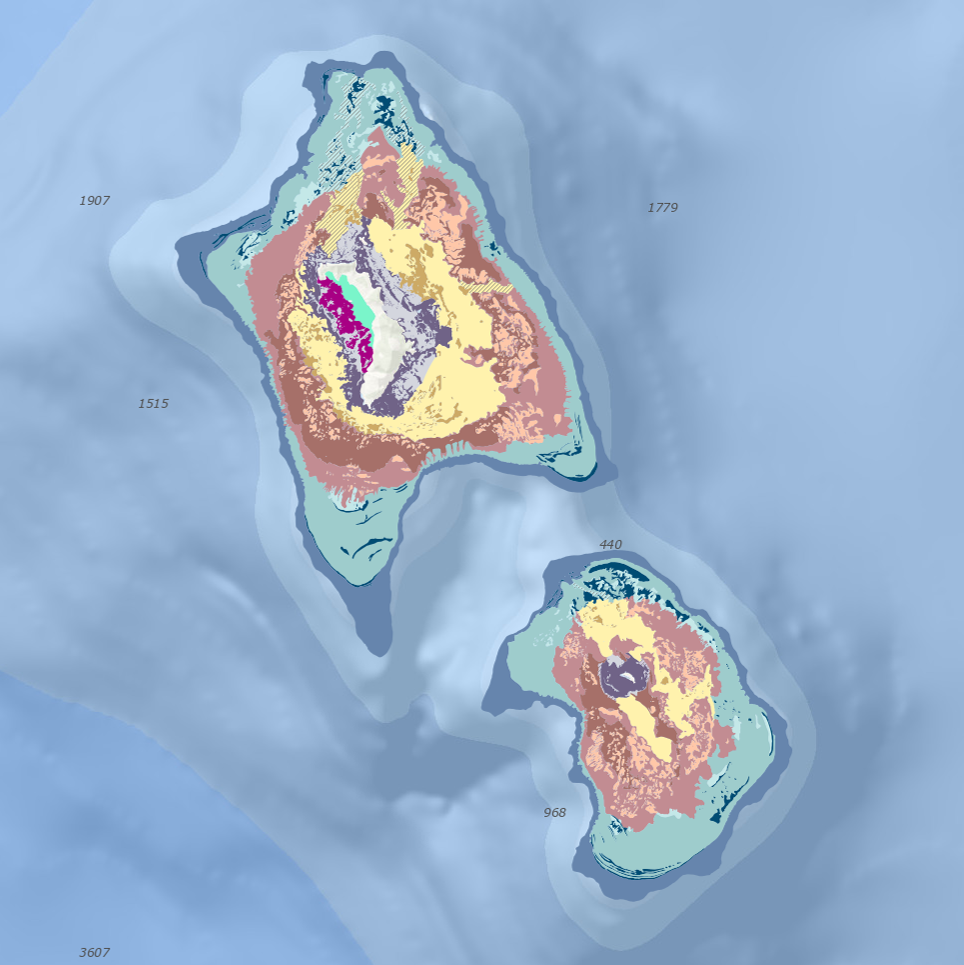
This dataset is a geomorphic classification of the shelf features surrounding Lord Howe Island and Balls Pyramid. This dataset provides information on the size, extent and type of features which occur around the shelves, which can be used for a broad range of marine planning and research purposes. Shelves were classified into shelf region (inner, mid, outer) and geomorphic features. Features include an extensive submerged fossil reefs, ridges and patch reefs, sandy basins, paleochannels, modern fringing reef, shallow lagoon, shelf edge terraces and shelf break. Broad seafloor features were visually interpreted through digitisation in ArcGIS v10.1 using terminology consistent with international nomenclature and national standards. The classification of geomorphic features extends upon the interpretation of Balls Pyramid shelf undertaken by Linklater et al. (2015). Full description of methods is outlined in the following open-access publication, accessible by the following link: https://doi.org/10.3390/geosciences8010011 Version 1 of the data available from https://doi.org/10.17632/8vrtxts669.1