 IMAS Metadata Catalogue
Blue carbon stocks of temperate subtidal seagrass beds in Tayaritja Sea Country (Furneaux Group of Islands), Lutruwita (Tasmania) (NESP MaC 3.6)
Seagrass beds are a dominant marine ecosystem of Tayaritja (the Furneaux Group of Islands) in the north-eastern waters off Tasmania. Historical coarse mapping has indicated extensive beds of Posidonia, Amphibolis, Heterozostera, and Zostera species, potentially comprising some of the largest and deepest seagrass extents found in temperate Australian waters. However, limited data on the distribution and ecological value of these seagrass habitats represents a significant knowledge gap in understanding Australia's wetland natural assets.
This project mapped the extent, ecological composition, population structure, and blue carbon value of seagrass beds around Tayaritja, in partnership with the Tasmanian Aboriginal Centre. This record specifically describes the seagrass-associated blue carbon component of the project, supporting improved understanding of sedimentary carbon storage in the region.
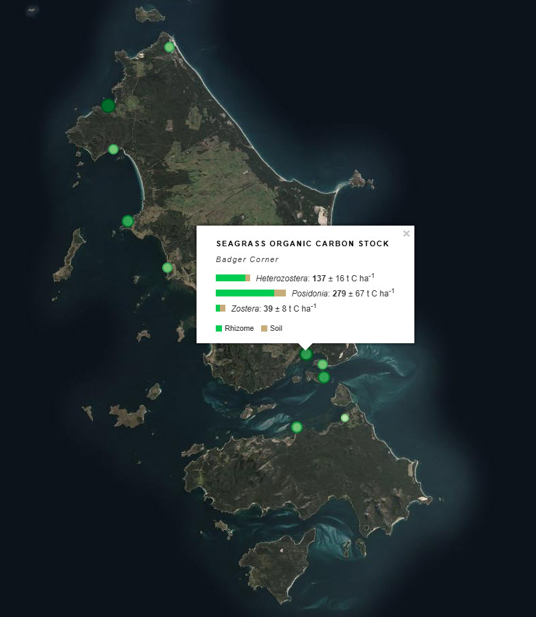
Sediment cores were collected from ten seagrass habitat sites around Flinders Island to assess spatial variability in carbon stocks and differences among seagrass species. Cores were collected to a maximum depth of 50 cm, or to the boundary between sediment and underlying rock, and were processed to estimate organic carbon stocks in below-ground sediment and plant material. The dataset includes sampling site locations, carbon stock estimates for the upper 50 cm of sediment, and measurements reported by depth interval within the core. At selected sites, samples were sieved to separate roots/rhizomes from the soil fraction, allowing carbon components to be reported separately where available.
See the "Lineage" section of this record for full methodology.
***EMBARGO NOTE*** Data is currently embargoed until 31/12/2026. Please contact the NESP Data Wrangler (Southern node) to discuss access options: Emma.Flukes@utas.edu.au Emma.Flukes@utas.edu ***EMBARGO NOTE*** Data is currently embargoed until 31/12/2026. Please contact the NESP Data Wrangler (Southern node) to discuss access options: Emma.Flukes@utas.edu.au
Simple
Identification info
- Date (Creation)
- 2026-06-26
Identifier
- Title
- Information and documentation - Digital object identifier system
- Citation identifier
- ISO 26324:2012
- Code
- 10.25959/W80S-JH16
- Codespace
- doi.org
- Description
- Digital Object Identifier (DOI)
Principal investigator
Collaborator
Collaborator
- Credit
- The data collections described in this record are funded by the Australian Government Department of Climate Change, Energy, the Environment and Water (DCCEEW) through the NESP Marine and Coastal Hub. In addition to NESP (DCCEEW) funding, this project is matched by an equivalent amount of in-kind support and co-investment from project partners and collaborators.
- Status
- Completed
Point of contact
Point of contact
- Topic category
-
- Biota
Extent

Temporal extent
- Time period
- 2024-02-05 2024-02-19
- Maintenance and update frequency
- Not planned
Resource format
- Date
- Keywords (Project)
-
- National Environmental Science Program (NESP) Marine and Coastal Hub
- GCMD Earth science Keywords
- Keywords (Taxon)
-
- Posidonia australis
- Heterozostera nigricaulis
- Zostera muelleri
Resource constraints
- Classification
- Unclassified
Resource constraints
- Other constraints
- This dataset is hosted by the Institute for Marine and Antarctic Studies (IMAS), University of Tasmania, on behalf of NESP Marine and Coastal Hub Project 3.6.
Resource constraints
- Linkage
-
http://i.creativecommons.org/l/by/4.0/88x31.png
License Graphic
- Title
- Creative Commons Attribution 4.0 International License
- Website
-
http://creativecommons.org/licenses/by/4.0/
License Text
- Other constraints
- Cite data as: Carnell, P., Lucieer, V., Fractal, K. & Yusuf, A. (2026). Blue carbon stocks of temperate subtidal seagrass beds in Tayaritja Sea Country (Furneaux Group of Islands), Lutruwita (Tasmania) [Dataset]. Institute for Marine and Antarctic Studies. https://doi.org/10.25959/W80S-JH16
Associated resource
- Title
- Related dataset: Imagery from BOSS and uBRUVs deployed for mapping temperate subtidal seagrass of Tayaritja Sea Country (Furneaux Group of Islands), Lutruwita (Tasmania)
Identifier
- Code
- 10.25959/wrxk-kv06
- Codespace
- doi.org
- Association Type
- Cross reference
Associated resource
- Title
- NESP MaC Project 3.6 - Exploring the distribution and ecological value of seagrass at the Furneaux Islands, Tasmania, 2023-2025 (IMAS, Deakin Uni)
Identifier
- Association Type
- Dependency
- Initiative Type
- Project
- Language
- English
- Character encoding
- UTF8
Distribution Information
- Distribution format
-
- .xlsx
OnLine resource
- Protocol
- https://data.imas.utas.edu.au/attachments/ecace70f-7545-4551-a84a-b3e774351ca2
- Name of the resource
- DATA ACCESS - raw carbon & derived organic carbon data
- OnLine resource
-
MaC_3-6_Furneaux_seagrass_C_stocks
MAP - Seagrass sediment carbon stock
- OnLine resource
- View & explore data in Seamap Australia
Resource lineage
- Statement
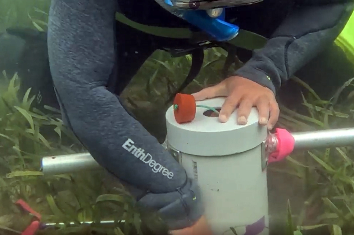
- Seagrass below-ground carbon stock data were collected from ten field sampling sites around Flinders Island, Tasmania. Sampling was designed to assess spatial variability in carbon stocks within Posidonia australis beds and to compare below-ground carbon stocks among seagrass species present at selected locations, including Posidonia australis, Heterozostera nigricaulis and, where present, Zostera muelleri. At each species/site combination, four sediment cores were collected using a 5 cm diameter PVC pipe. Cores were collected to 50 cm depth, or to the boundary between sediment and underlying rock where this occurred shallower than 50 cm. Sample compaction during collection was measured and accounted for when calculating sample volumes. Cores were subsampled in the field to characterise down-core variation in below-ground carbon. Subsamples were taken from five depth intervals: 0–5 cm, 5–10 cm, 10–20 cm, 24–26 cm (representative sample for 20–30 cm), and 39–41 cm (representative sample for 30–50 cm). Samples were then dried at 60°C until a consistent weight was achieved. Dry bulk density was calculated as dry weight divided by the original compaction-corrected sample volume. At sites sampled for comparison of carbon stocks among seagrass species, samples were sieved using a 500 µm sieve to separate roots/rhizomes from the soil fraction. Material retained above 500 µm was treated as root/rhizome material, while material passing through the sieve was treated as soil. Each dried sample was homogenised using an agate mortar and pestle. Total carbon content was determined from a 0.5–1 g subsample using a LECO TruMac CN analyser. For non-calcareous soils, organic carbon content was equated to total carbon content. For samples containing inorganic carbon, 4% hydrochloric acid was applied to remove inorganic carbon prior to analysis of organic carbon. Organic carbon stock values were derived from the processed sample data and associated with sampling site, seagrass species, depth interval and, where applicable, soil/rhizome sample fraction. Further methodological detail is provided in the associated project report.
- Hierarchy level
- Dataset
Metadata
- Metadata identifier
- urn:uuid/ecace70f-7545-4551-a84a-b3e774351ca2
- Language
- English
- Character encoding
- UTF8
Point of contact
Type of resource
- Resource scope
- Dataset
- Metadata linkage
-
https://metadata.imas.utas.edu.au/geonetwork/srv/eng/catalog.search#/metadata/ecace70f-7545-4551-a84a-b3e774351ca2
Point of truth URL of this metadata record
- Date info (Creation)
- 2015-05-06T11:44:25
- Date info (Revision)
- 2026-07-15T13:29:10
Metadata standard
- Title
- ISO 19115-3:2018
Overviews
Spatial extent

Provided by