 IMAS Metadata Catalogue
Benthic annotations of stereo-BRUV and drop camera imagery from the South-west Corner Marine Park (NESP MaC 1.4)
Benthic habitat annotations of stereo Baited Remote Underwater Video (Stereo-BRUV) and panoramic drop camera imagery, were completed as part of a report funded by the NESP Marine & Coastal Hub. This report focussed on an IUCN II zone in the South-west Corner Marine Park off the 'Capes region' near Margaret River. These data were analysed in TransectMeasure using a modified version of the CATAMI scheme.
Simple
Identification info
- Date (Creation)
- 2022-07-01
Identifier
- Title
- Information and documentation - Digital object identifier system
- Citation identifier
- ISO 26324:2012
- Code
- 10.25959/6G5A-3G03
- Codespace
- doi.org
- Description
- Digital Object Identifier (DOI)
Principal investigator
Collaborator
Collaborator
- Credit
- The data collections described in this record are funded by the Australian Government Department of Climate Change, Energy, the Environment and Water (DCCEEW) through the NESP Marine and Coastal Hub. In addition to NESP (DCCEEW) funding, this project is matched by an equivalent amount of in-kind support and co-investment from project partners and collaborators.
- Status
- Completed
Point of contact
- Topic category
-
- Biota
Extent

Temporal extent
- Time period
- 2020-03-01 2021-03-31
Vertical element
- Minimum value
- 35
- Maximum value
- 255
- Identifier
- EPSG::5715
- Name
- MSL depth
- Maintenance and update frequency
- Not planned
Resource format
- Date
- Keywords (Project)
-
- National Environmental Science Program (NESP) Marine and Coastal Hub
- Keywords (Theme)
-
- seafloor habitat
- underwater imagery
- GCMD Earth science Keywords
Resource constraints
- Classification
- Unclassified
Resource constraints
- Other constraints
- This dataset is hosted by the Institute for Marine and Antarctic Studies (IMAS), University of Tasmania, on behalf of The University of Western Australia and NESP Marine and Coastal Hub Project 1.4.
Resource constraints
- Linkage
-
http://i.creativecommons.org/l/by/4.0/88x31.png
License Graphic
- Title
- Creative Commons Attribution 4.0 International License
- Website
-
http://creativecommons.org/licenses/by/4.0/
License Text
- Other constraints
- Cite data as: Langlois, T., Spencer, C., & Gibbons, B. (2022). Benthic annotations of stereo-BRUV and drop camera imagery from the South-west Corner Marine Park [Data set]. Institute for Marine and Antarctic Studies. https://doi.org/10.25959/6G5A-3G03
Associated resource
- Title
- NESP MaC Project 1.4 - Characterising natural values and identifying indicators and metrics in South-west Corner Marine Park, 2021-2022 (UWA)
Identifier
- Association Type
- Dependency
- Initiative Type
- Project
- Language
- English
- Character encoding
- UTF8
Distribution Information
- Distribution format
-
- CSV
- OnLine resource
- DATA ACCESS - raw TransectMeasure files
Resource lineage
- Statement
- Stereo Baited Remote Underwater Video and panoramic drop camera imagery was annotated in TransectMeasure using 20 random points over the lower 50% of each image, using a modified version of the CATAMI scheme.
- Hierarchy level
- Dataset
Metadata
- Metadata identifier
- urn:uuid/eaa856a1-88ea-4399-8311-2c706e75e962
- Language
- English
- Character encoding
- UTF8
Point of contact
- Parent metadata
Type of resource
- Resource scope
- Dataset
- Metadata linkage
-
https://metadata.imas.utas.edu.au/geonetwork/srv/eng/catalog.search#/metadata/eaa856a1-88ea-4399-8311-2c706e75e962
Point of truth URL of this metadata record
- Date info (Creation)
- 2015-05-06T11:44:25
- Date info (Revision)
- 2026-06-27T10:43:38
Metadata standard
- Title
- ISO 19115-3:2018
Overviews
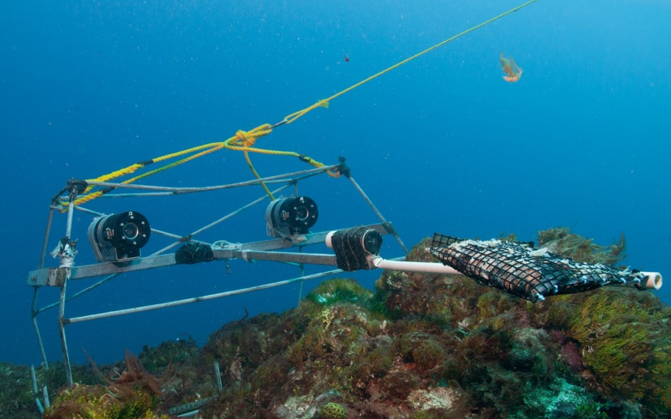
Stereo-BRUV equipment
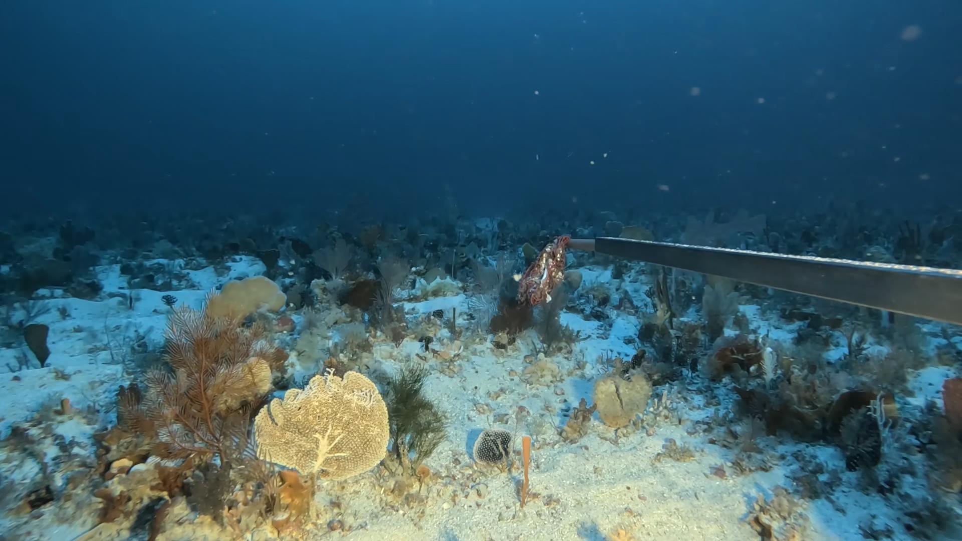
Stereo-BRUV imagery
Spatial extent

Provided by

Associated resources
Not available