 IMAS Metadata Catalogue
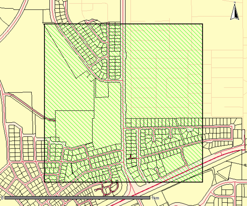
Ludmilla Creek Vegetation Survey
This is a high resolution survey (1:5,000 scale dataset) describing mapped vegetation communities for the Ludmilla Creek catchment area (within the City of Darwin, Northern Territory).
(Vegetation Unit - A reasonably homogeneous part of the land surface, distinct from surrounding terrain with constant properties in landform and vegetation)
This vegetation survey was undertaken in 1996. This dataset represents the vegetation on the ground at the time of the survey and reflects the data and methods used to create the mapped polygons. The dataset has been revised in 2015 to include community descriptions but has not been updated to reflect the vegetation on the ground. The Darwin Remnant Vegetation Survey is considered a more up-to-date representation of vegetation for this area.
Simple
Identification info
- Date (Creation)
- 2000-01-14T00:00:00
- Date (Revision)
- 2015-07-23T00:00:00
- Date (Publication)
- 2017-04-27
Owner
- Credit
- Data supplied by Department of Environment and Natural Resources. © Copyright Northern Territory of Australia
- Status
- Completed
Point of contact
- Spatial representation type
- Vector
Spatial resolution
Equivalent scale
- Denominator
- 100000
- Topic category
-
- Biota
Extent
))
Temporal extent
- Time period
- 1996-06-30 1996-12-30
- Maintenance and update frequency
- Not planned
Resource format
- Title
- ESRI Shapefile
- Date
- Edition
- -
- Global Change Master Directory (GCMD) Earth Science Keywords Version 8.0
- Keywords (Theme)
-
- Benthic habitat
Resource specific usage
- Specific usage
- Data supplied for use by the Seamap Australia Project.
Resource constraints
- Classification
- Unclassified
Resource constraints
- Linkage
-
http://i.creativecommons.org/l/by/4.0/88x31.png
License Graphic
- Title
- Creative Commons Attribution 4.0 International License
- Website
-
http://creativecommons.org/licenses/by/4.0/
License Text
- Other constraints
- Cite data as: Department of Environment and Natural Resources, Northern Territory Government of Australia (2015). Ludmilla Creek Vegetation Survey. Data accessed at http://metadata.imas.utas.edu.au/geonetwork/srv/en/meta data.show?uuid=9b241ea6-f73a-4236-a0da-47be25b6c28b on (access date).
- Other constraints
- This dataset is hosted by the Institute for Marine and Antarctic Studies (IMAS), University of Tasmania, on behalf of the NT Government for the purposes of the Seamap Australia collaborative project (testing a national marine benthic habitat classification scheme).
- Language
- English
- Character encoding
- UTF8
Content Information
- Content type
- Physical measurement
- Description
- Taxonomic identification of mangrove species and vegetation types
Identifier
- Name
- COM_GROUP
- Description
- Appended to original data for styling purposes for the Seamap Australia Project.
- Name
- Benthic habitat
- Name
- SM_HAB_CLS
Distribution Information
- Distribution format
-
- ESRI Shapefile
OnLine resource
- Protocol
- OGC:WFS-1.0.0-http-get-feature--shapefile
- Name of the resource
- SHAPE-ZIP
- Description
- DATA ACCESS - This OGC WFS service returns the data (Ludmilla Creek mangroves) in Shapefile format
- OnLine resource
-
seamap:SeamapAus_NT_mangroves_LudmillaCreek
MAP - Ludmilla Creek vegetation
- OnLine resource
- Original metadata record [NT Government catalogue]
Data quality info
- Hierarchy level
- Dataset
Report
- Measure description
- Polygon Data (1985 - 1998): Map unit boundaries transferred from aerial photographs to topographic maps, using the best available topographic mapping at the time (generally 1:100 000) via a mapograph. Level of accuracy depends on the number of control points on individual aerial photographs. Control points include creek lines, cadastre and other topographic features. Depending on the nature of the landscape (the number of control points), positional accuracy may vary. Positional accuracy generally considered moderate to high. Point Data (1990 - 1997): Site point coordinates collected from a geographic positioning system with general accuracy of within 100m. Selective availability during this time prevented increased accuracy.
Report
- Measure description
- Attributes assigned according to the dominant feature. Descriptive attributes for each vegetation community have been added to all polygons.
Report
- Name of measure
- Logical consistency
- Measure description
- GIS editing tools were used to rectify all overshoots and undershoots in line work. Polygon topology rules applied are; must not overlap, must not have gaps and each polygon has only one label.
Report
- Measure description
- Complete.
Resource lineage
- Statement
- Original map unit boundaries delineated from aerial photographs and stereoscope interpretation. Map units transferred to topographic map sheets via a mapograph. Original maps were hardcopy only. With the advent of geographic information systems polygons were digitised by rectifying the original hard copy maps. Map unit boundaries derived using aerial photography and digital satellite imagery, geological and topographic data. Field data (site information) described and classified according to national standards at the time of capture. Map unit polygons collected via geographic information system (ArcGIS/MapInfo). Attributes attached to map units are unique to individual surveys.
- Hierarchy level
- Dataset
- Hierarchy level
- Dataset
Platform
Identifier
- Code
- research aeroplane
Metadata
- Metadata identifier
- urn:uuid/9b241ea6-f73a-4236-a0da-47be25b6c28b
- Language
- English
- Character encoding
- UTF8
Point of contact
- Parent metadata
Type of resource
- Resource scope
- Dataset
- Metadata linkage
-
https://metadata.imas.utas.edu.au/geonetwork/srv/eng/catalog.search#/metadata/9b241ea6-f73a-4236-a0da-47be25b6c28b
Point of truth URL of this metadata record
- Date info (Creation)
- 2020-10-12T15:52:47
- Date info (Revision)
- 2025-08-14T21:30:00
Metadata standard
- Title
- ISO 19115-3:2018
Overviews
Spatial extent
Provided by
