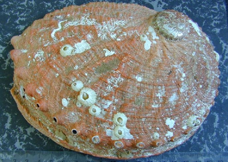
Electronic Fishery Dependent data of the Tasmanian Abalone Fishery
This project uses positional information from GPS loggers on abalone divers' boats and depth information from depth loggers attached to the divers for fine-scale spatial reporting of abalone fishing.
Simple
Identification info
- Date (Creation)
- 2007-07-03T00:00:00
Principal investigator
- Purpose
- These data are collected to provide fine scale spatial information about the fishing activities of abalone divers.
- Credit
- Fisheries Research and Development Corporation (FRDC) 2006/029
- Credit
- Fisheries Research and Development Corporation (FRDC) 2011/201
- Status
- On going
Principal investigator
- Spatial representation type
- Text, table
- Topic category
-
- Economy
Extent
N
S
E
W
))
Temporal extent
- Time position
- 2005-01-01T00:00:00
Vertical element
- Minimum value
- 0
- Maximum value
- 25
- Identifier
- EPSG::5715
- Name
- MSL depth
- Maintenance and update frequency
- Not planned
Resource format
- Title
- SQL Server
- Date
- Edition
- 2008 R2
- Global Change Master Directory Earth Science Keywords v5.3.8
-
- Agriculture | Agricultural Aquatic Sciences | Fisheries
- Oceans | Marine Biology | Marine Invertebrates
- CAAB - Codes for Australian Aquatic Biota v2.
-
- 24 038006
- Haliotis rubra rubra
- 24 038004
- Haliotis laevigata
- Keywords (Theme)
-
- GPS position
- Depth
- Water Temperature
Resource constraints
- Classification
- Restricted
Resource constraints
- Use limitation
- The data described in this record are the intellectual property of the University of Tasmania through the Institute for Marine and Antarctic Studies.
Resource constraints
- Linkage
-
http://i.creativecommons.org/l/by/2.5/au/88x31.png
License Graphic
- Title
- Creative Commons Attribution 2.5 Australia License
- Website
-
http://creativecommons.org/licenses/by/2.5/au/
License Text
- Other constraints
- The citation in a list of references is: citation author name/s (year metadata published), metadata title. Citation author organisation/s. File identifier and Data accessed at (add http link).
- Other constraints
- Some aspects of this data have either, Commercial in confidence, or privacy issues. Please contact the POC for access to the data.
- Language
- English
- Character encoding
- UTF8
- Environment description
- SQL Server
- Supplemental Information
- Mundy C. 2006/029 FRDC - Final Report. Using GPS Technology to Improve Fishery Dependent Data Collection in Abalone Fisheries.
Content Information
- Content type
- Physical measurement
- Name
- GPS position
- Name
- Depth
- Name
- metres
- Name
- Water Temperature
- Name
- Degrees celcius
Distribution Information
- Distribution format
-
- SQL Server
Distributor
Principal investigator
Resource lineage
- Statement
- Data currently stored include date, time, GPS position, depth, temperature and can be used to create dive profiles. The two tables are linked via date/time stamp.
- Hierarchy level
- Dataset
Metadata
- Metadata identifier
- urn:uuid/961922e0-44a3-11dc-8cd0-00188b4c0af8
- Language
- English
- Character encoding
- UTF8
Point of contact
Type of resource
- Resource scope
- Dataset
- Metadata linkage
-
https://metadata.imas.utas.edu.au/geonetwork/srv/eng/catalog.search#/metadata/961922e0-44a3-11dc-8cd0-00188b4c0af8
Point of truth URL of this metadata record
- Date info (Creation)
- 2021-03-30T00:32:57
- Date info (Revision)
- 2025-08-14T11:08:15
Metadata standard
- Title
- ISO 19115-3:2018
Overviews

large_thumbnail
Spatial extent
N
S
E
W
))
Provided by

Associated resources
Not available
 IMAS Metadata Catalogue