 IMAS Metadata Catalogue
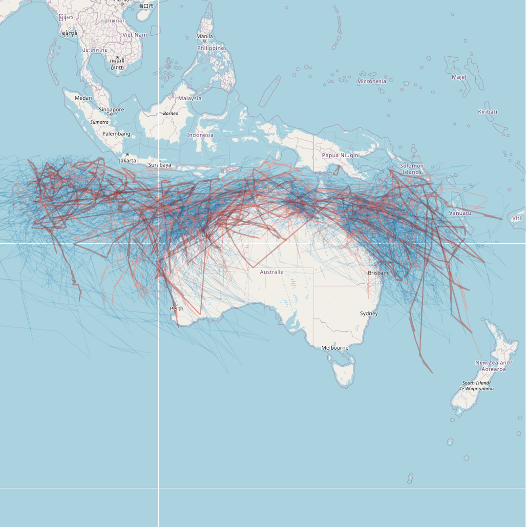
Tropical cyclone tracks: 1907 to present
This dataset details all tropical cyclones that are known to have occurred in the region south of the equator between 90E and 160E. The data has been sourced from the Tropical Cyclone Database, maintained by the Bureau of Meteorology (BOM). This record represents a snapshot of the data taken on 23/03/2023 for the purposes of generating a mapping visualisation of recent cyclone activity. The most current database can be downloaded from the BOM website: http://www.bom.gov.au/cyclone/tropical-cyclone-knowledge-centre/databases/
Point data from the BOM has been converted into cyclone tracks for visualisation. The data and mapping layer will be refreshed annually following cyclone season (May-June each year).
Last updated 21st November 2023.
Simple
Identification info
- Date (Creation)
- 2023-03-23
- Date (Revision)
- 2023-11-21
Owner
Processor
- Status
- On going
Distributor
- Topic category
-
- Climatology, meteorology, atmosphere
Extent
))
Temporal extent
- Time period
- 1907-01-17 2023-03-23
- Maintenance and update frequency
- As needed
- Keywords (Theme)
-
- climate change
- impact
- NASA/GCMD Keywords, Version 8.5
Resource constraints
- Classification
- Unclassified
Resource constraints
- Linkage
-
http://i.creativecommons.org/l/by/4.0/88x31.png
License Graphic
- Title
- Creative Commons Attribution 4.0 International License
- Website
-
http://creativecommons.org/licenses/by/4.0/
License Text
- Language
- English
- Character encoding
- UTF8
Distribution Information
- OnLine resource
-
SHAPE-ZIP
DATA ACCESS - Tropical cyclones tracks [extract of BOM database] - Shapefile download
- OnLine resource
-
imas:BOM_cyclone_tracks
MAP - Tropical cyclone tracks (styled for use in desktop GIS or similar)
Resource lineage
- Statement
- Data was downloaded from the Bureau of Meteorology's Tropical Cyclone Database http://www.bom.gov.au/cyclone/tropical-cyclone-knowledge-centre/databases/ (endpoint http://www.bom.gov.au/clim_data/IDCKMSTM0S.csv). Points were converted to tracks using the QGIS "Points to Path" function, ordered by timestamp and grouped by Disturbance ID (unique cyclone ID). The tracks map is styled to empasise primarily cyclones from 2020 to present; and secondarily 2010 to 2020; with a zoom-based styling where the name and start year of the cyclone event is displayed at 1:2M or finer. Tracks of cyclones prior to 2010 are shown as faint lines. This data was last refreshed from BOM on 23/03/2023.
- Hierarchy level
- Dataset
Metadata
- Metadata identifier
- urn:uuid/6f74128b-a41f-4219-9a46-f606819170e5
- Language
- English
- Character encoding
- UTF8
Point of contact
Type of resource
- Resource scope
- Dataset
- Metadata linkage
-
https://metadata.imas.utas.edu.au/geonetwork/srv/eng/catalog.search#/metadata/6f74128b-a41f-4219-9a46-f606819170e5
Point of truth URL of this metadata record
- Date info (Revision)
- 2023-12-05T11:58:19
- Date info (Creation)
- 2023-03-23T11:44:25
Metadata standard
- Title
- ISO 19115-3:2018
Overviews
Spatial extent
Provided by
