The effect of anthropogenic structures on reproductive output of the northern Pacific seastar (Asterias amurensis) in the Derwent River estuary, SE Tasmania
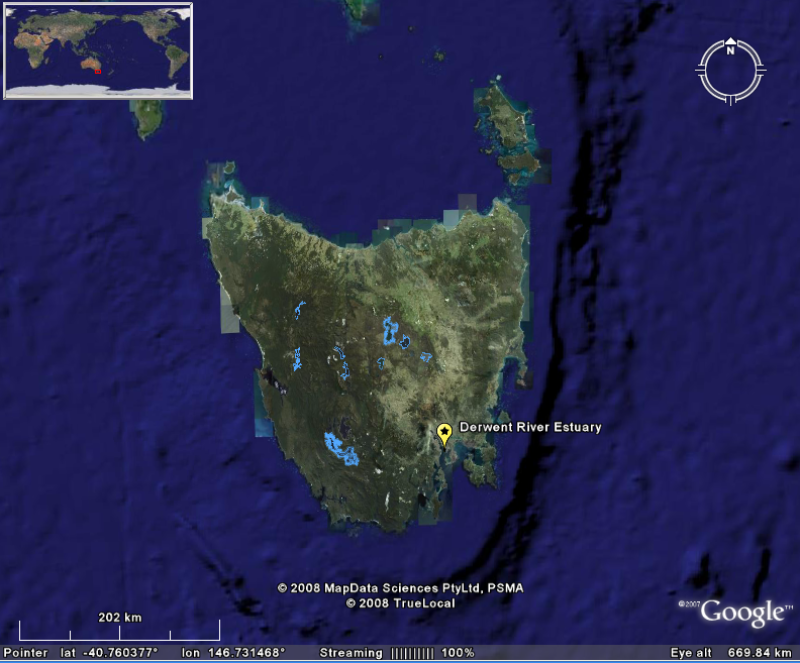
In the Derwent Estuary (south eastern Tasmania, Australia), the introduced northern Pacific seastar Asterias amurensis is highly abundant and fecund when associated with anthropogenic structures (wharves and marinas). Based on modelled predictions of fertilisation success, seastars at wharf 'hotspots', whilst representing <10% of the total population in the Derwent Estuary, and concentrated in <0.1% of the total area, contribute up to >80% of total larval production in the estuary.
Reproductive potential of populations at wharf and control sites was quantified (in terms of individual capacity and spatial characteristics of the population. A large scale survey was undertaken in the Derwent estuary (to 27m) to determine spatial distribution of the species. Zygote production (i.e. number of fertilised eggs) was used as a measure of reproductive output and was simulated using empirical estimates of spatial and reproductive parameters of the adult seastars in a spatially explicit model of fertilization (developed by A. Morris and C. Johnson).
Simple
Identification info
- Date (Creation)
- 2008-09-09T11:36:00
Principal investigator
Principal investigator
- Purpose
- To investigate whether fertility hotspots exist across the seastars stronghold in the Derwent Estuary and if such populations can be targets for pest management strategies.
- Credit
- Ross, Jeff, Dr
- Credit
- Mundy, Craig, Dr
- Credit
- Morris, Alice
- Status
- Completed
Principal investigator
- Spatial representation type
- Text, table
- Topic category
-
- Biota
Extent
))
Temporal extent
- Time period
- 1999-07-01T00:00:00 2000-10-31T00:00:00
Vertical element
- Minimum value
- 3
- Maximum value
- 27
- Identifier
- EPSG::5715
- Name
- MSL depth
- Maintenance and update frequency
- Not planned
Resource format
- Title
- Excel
- Date
- Edition
- 2003
- Global Change Master Directory Earth Science keywords v.5.3.8
-
- Biosphere | Zoology | Echinoderms
- Biosphere | Aquatic Habitat | Reef Habitat
- CAAB - Codes for Australian Aquatic Biota v2
-
- 25 154001
- Asterias amurensis
- Australian and New Zealand Standard Research Classification (ANZSRC): Fields of Research
- Keywords (Theme)
-
- Seastar mass
- Gonad mass
- Gonad Index
- Seastar density
- Mussel density
Resource constraints
- Classification
- Restricted
Resource constraints
- Use limitation
- The data described in this record are the intellectual property of S. Ling.
Resource constraints
- Linkage
-
http://i.creativecommons.org/l/by-sa/2.5/au/88x31.png
License Graphic
- Title
- Creative Commons Attribution-Share Alike 2.5 Australia License
- Website
-
http://creativecommons.org/licenses/by-sa/2.5/au/
License Text
- Other constraints
- The citation in a list of references is: citation author name/s (year metadata published), metadata title. Citation author organisation/s. File identifier and Data accessed at (add http link).
- Other constraints
- Contact the researcher for access to data. Data will not be made available until published.
- Language
- English
- Character encoding
- UTF8
- Supplemental Information
- S.D. Ling (2000). The effect of anthropogenic structures on reproductive output of the northern Pacific seastar (Asterias amurensis) in the Derwent estuary. Honours thesis, University of Tasmania. Paper submitted for publication 2011: Ling, S.D., Johnson, C.R., Mundy C.N., Morris, A., & Ross, D.J. Harboring fecundity of an exotic pest: wharves facilitate invasion by an introduced seastar.
Content Information
- Content type
- Physical measurement
- Name
- Seastar mass
- Name
- Grams
- Name
- Gonad mass
- Name
- Grams
- Name
- Gonad Index
- Name
- GI
- Name
- dimensionless
- Name
- Seastar density
- Name
- Individuals per m2
- Name
- Mussel density
- Name
- Individuals per m2
Distribution Information
Distributor
Principal investigator
- Title
- Microsoft Excel (xls)
- Date
- Edition
- 2003
Resource lineage
- Statement
- 1. Reproductive potential of Asterias amurensis in SE Tasmania Sites Derwent River estuary: 3 adjacent to anthropogenic structures (Derwent Sailing Squadron marina: 4m, Princess wharf:8-14m, Bellerieve Yacht Club marina:6m); and 3 control sites (Trywork Point:6-10m, 2nd Bluff: 6-10m, Sandy Bay:6m). Reproductive capacity Thirty adult A.amurensis (ray length >55mm) were collected from each site every 2 weeks prior to spawning until after the peak spawning period (July-Oct, 1999). Water temperature was recorded (at seafloor) at each site for each sampling occasion. In the laboratory, seastars were dissected and gonads and total body weight (wet) were measured. Individuals were sexed and ray length measured. Small scale spatial distribution Belt transects (2x10m at wharf sites, 2x30m at control sites) were used to estimate the density and dispersion of individuals concurrent with time at which reproductive capacity was estimated. A 60m baseline was established parallel to wharf or shore, 6 belt transects were set perpendicular to the this at random positions within each 10m interval (with interception point also random). Seastar abundance was recorded every 2m. Availability of mussels as a food source Mussels (Mytilus edulis planulatus) are a preferred food source of A.amurensis, and their availability was therefore quantified at wharf sites (and were absent at control sites). The abundance of seastars, abundance of live mussels, and abundance of seastars feeding on mussels was assessed in 1x1m quadrats. At each wharf site, 10m transects perpendicular to the wharf were laid at 5m intervals with quadrats at 0, 3, 5, 7 and 10m's along the line. 2. Large scale spatial distribution of A. amurensis in the Derwent River estuary, SE Tasmania A remote underwater video camera mounted on a sled and towed behind a vessel was used to survey A. amurensis in the Derwent River estuary. Three paired video transects were deployed perpendicular to the shore in the 4 designated zones (northern, Ralphs Bay, southeastern and southwestern zones) in Sept/Oct 1999. Transects were divided into ranges (3-5, 6-10, 11-15, 16-20 and 20+ metres). Tow duration was 20 minutes, with depth recorded every minute. Field of view was 1x1m. Tow speed was calculated from the footage using a stop watch, and the distance covered estimated from the average speed over the benthos. Benthic video footage currently on VHS tapes, with plans to digitise in the future - see Scott Ling.
- Hierarchy level
- Dataset
Metadata
- Metadata identifier
- 4634fa40-7e0b-11dd-a21f-00188b4c0af8
- Language
- English
- Character encoding
- UTF8
Point of contact
Type of resource
- Resource scope
- Dataset
- Metadata linkage
-
https://metadata.imas.utas.edu.au/geonetwork/srv/eng/catalog.search#/metadata/4634fa40-7e0b-11dd-a21f-00188b4c0af8
Point of truth URL of this metadata record
- Date info (Creation)
- 2019-03-07T08:24:13
- Date info (Revision)
- 2019-03-07T08:24:13
Metadata standard
- Title
- ISO 19115-3:2018
Overviews


Spatial extent
))
Provided by

 IMAS Metadata Catalogue