 IMAS Metadata Catalogue
Multi-decadal coverage of giant kelp (Macrocystis pyrifera) in Tasmania derived from satellite imagery
Giant kelp (Macrocystis pyrifera) forests are a foundational habitat that dominates many nearshore rocky coastlines in temperate and cold-water regions worldwide. Macrocystis forests can extend as much as 40 m to the surface and form closed canopies that alter the light, current, and sedimentation environment beneath them. They play an ecosystem-structuring function and provide habitat for a diverse range of fish and invertebrate species.
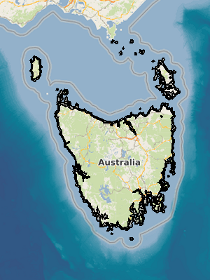
The coastal waters of Tasmania represent the most extensive giant kelp habitat in Australia. Dense forests have historically covered large areas of the nearshore reef habitat, but significant declines have been recorded in eastern Tasmania in recent decades. These losses are thought to be linked to environmental stressors such as extended periods of high water movement, warming sea temperatures, and nutrient depletion. Eastern Tasmania has experienced some of the most pronounced declines, leading to the 2012 listing of the giant kelp community as an ‘endangered marine community type’ under Australia’s Federal Environment Protection and Biodiversity Conservation Act.
This dataset uses Landsat satellite imagery to quantifiy the spatial extent and temporal variability of giant kelp surface canopies along the Tasmanian coastline to address gaps in long-term monitoring. The data collection is divided into two components:
1) A statewide analysis that maps the extent of Macrocystis pyrifera canopies across the whole Tasmanian coastline, grouped into nine three-year bins spanning 1987–2015. This long-term dataset is intended for assessing long-term (decadal) changes at a broad spatial scale.
2) A higher temporal-resolution analysis of 24 specific sites along the Tasmanian coastline. This dataset includes canopy coverage from all cloud-free Landsat imagery captured over the period 1986-2015 to enable detailed analysis of seasonal and interannual fluctuations in kelp canopy extent and understand localised population dynamics.
Simple
Identification info
- Date (Publication)
- 2024-12-12T00:00:00
Identifier
- Title
- Information and documentation - Digital object identifier system
- Citation identifier
- ISO 26324:2012
- Code
- 10.25959/SX8Y-AK04
- Codespace
- doi.org
- Description
- Digital Object Identifier (DOI)
Principal investigator
Collaborator
Collaborator
Collaborator
- Status
- Completed
Point of contact
- Topic category
-
- Biota
Extent

Temporal extent
- Time period
- 1987-07-01 2015-12-31
Vertical element
- Minimum value
- 0
- Maximum value
- 30
- Identifier
- EPSG::5715
- Name
- MSL depth
- Maintenance and update frequency
- Not planned
- Keywords (Theme)
-
- Climate change
- Range contraction
- Population dynamics
- Remote sensing
- Landsat
- Keywords (Taxon)
-
- Macrocystis pyrifera
- Global Change Master Directory Earth Science Keywords, Version 8.5
Resource constraints
- Use limitation
- Data, products and services from IMAS are provided "as is" without any warranty as to fitness for a particular purpose.
Resource constraints
- Other constraints
- This dataset is the intellectual property of the University of Tasmania (UTAS) through the Institute for Marine and Antarctic Studies (IMAS).
Resource constraints
- Linkage
-
https://licensebuttons.net/l/by/4.0/88x31.png
License Graphic
- Title
- Creative Commons Attribution 4.0 International License
- Alternate title
- CC-BY
- Edition
- 4.0
- Website
-
https://creativecommons.org/licenses/by/4.0/
License Text
- Other constraints
- Cite data as: Butler, C. L., Lucieer, V., Johnson, C., & Wotherspoon, S. (2025). Multi-decadal coverage of giant kelp (Macrocystis pyrifera) in Tasmania derived from satellite imagery [Data set]. Institute for Marine and Antarctic Studies. https://doi.org/10.25959/SX8Y-AK04
- Language
- English
- Character encoding
- UTF8
- Supplemental Information
- Butler CL, Lucieer VL, Wotherspoon SJ, Johnson CR (2020) Multi-decadal decline in cover of giant kelp Macrocystis pyrifera at the southern limit of its Australian range. Marine Ecology Progress Series 653:1-18. https://doi.org/10.3354/meps13510
Distribution Information
- Distribution format
-
- Shapefile
- OnLine resource
-
Tas_statewide_Macrocystis_canopy_timeseries_SMview
MAP - statewide timeseries of giant kelp extent 1987-2015
- OnLine resource
-
Tas_finescale_Macrocystis_canopy_timeseries_SMview
MAP - fine-scale timeseries of 24 giant kelp sites 1986-2015
- OnLine resource
- SUPPLEMENTARY - Landsat statewide image mosaics used in analysis
- OnLine resource
- SUPPLEMENTARY - Full scene timeseries (1986-2015) metadata for fine-scale site analysis (includes absences)
- OnLine resource
- SUPPLEMENTARY - Tas statewide coastal mask for study area
Resource lineage
- Statement
- Giant kelp forms large and dense floating canopies at the sea surface. These photosynthetic canopies have spectral properties very similar to terrestrial vegetation, and can be detected in multispectral satellite imagery based on relative reflectance and absorption of different wavelengths of light. Specifically, vegetation has a low reflectance in the visible range and high reflection in the near infrared (NIR) range, while water absorbs almost all incoming NIR wavelengths. This contrast enables identification of surface macroalgal canopies in multispectral satellite imagery. Landsat TM, ETM+ and OLI Surface imagery with a 30 m spatial resolution was collated from between 1986-2015 for the Tasmanian coastline. Landsat satellites have been in almost continuous operation since 1984 and have a 16 day repeat cycle across the globe. Images were classified based on the Normalised Difference Vegetation Index (NDVI), a technique commonly used to detect terrestrial vegetation. A threshold NDVI value was used such that when it was exceeded in a given pixel, that pixel was classified as containing 100% floating surface canopy of giant kelp. The statewide analysis collated 90 Landsat scenes from 1987-2015 acquired from July to December — the period of maximum canopy development for M. pyrifera. These were 'binned' into 3-year periods to ensure each time period had complete cloud-free cover across the entire Tasmanian coastline. The site-based analysis built a fine-scale (2-week to 12-month interval) timeseries of canopy coverage for 24 spatially defined sites around Tasmania. All available cloud-free images from July-December 1986-2015 were retained. For both analyses, the image zone that was examined for M. pyrifera canopies was between 30 and 1,000 m from the shoreline. The inshore limit of 30 m was chosen to exclude other algal species that form canopies in the intertidal and shallow subtidal zone. The offshore limit of 1,000 m defines the outer extent of probable giant kelp habitat, beyond which water depths are typically >30 m and surface light penetration is inadequate for growth. See http://dx.doi.org/10.3354/meps13510 for full methodology. -----DATA DICTIONARY----- • bioregion: IMCRA v4.0 (2016) meso-scale bioregion [site dataset] • site: name of spatially-explicit site used for regional analysis [site dataset] • period: time period #1-9 representing 3y time bins 1987-2015 [statewide dataset] • years: years spanned by time period bin [statewide dataset] • LSSceneID: Landsat Scene identifier • LSProdID: Landsat Product identifier • ImDate_GMT: date of Landsat image acquisition (GMT) • ImTime_GMT: time of Landsat image acquisition (GMT) • ImDate_loc: date of Landsat image acquisition (local time - AEDT) • ImTime_loc: time of Landsat image acquisition (local time - AEDT) • kelp_ha: area of canopy coverage (hectares) for each distinct Landsat scene within a 3y time period [statewide dataset] • period_ha: area of canopy coverage (hectares) for each 3y time period [statewide dataset]
- Hierarchy level
- Dataset
- Hierarchy level
- Dataset
Metadata
- Metadata identifier
- urn:uuid/029a5df5-04da-4c64-a73d-d15f1201965d
- Language
- English
- Character encoding
- UTF8
Type of resource
- Resource scope
- Dataset
- Name
- IMAS Dataset level record
- Metadata linkage
-
https://metadata.imas.utas.edu.au/geonetwork/srv/eng/catalog.search#/metadata/029a5df5-04da-4c64-a73d-d15f1201965d
Point of truth URL of this metadata record
- Date info (Creation)
- 2024-12-12T00:00:00
- Date info (Revision)
- 2026-04-27T16:51:24
Metadata standard
- Title
- ISO 19115-3:2018
Overviews
Spatial extent
Provided by
