Biodiversity and degradation of estuaries in North-Western Tasmania: Detention River
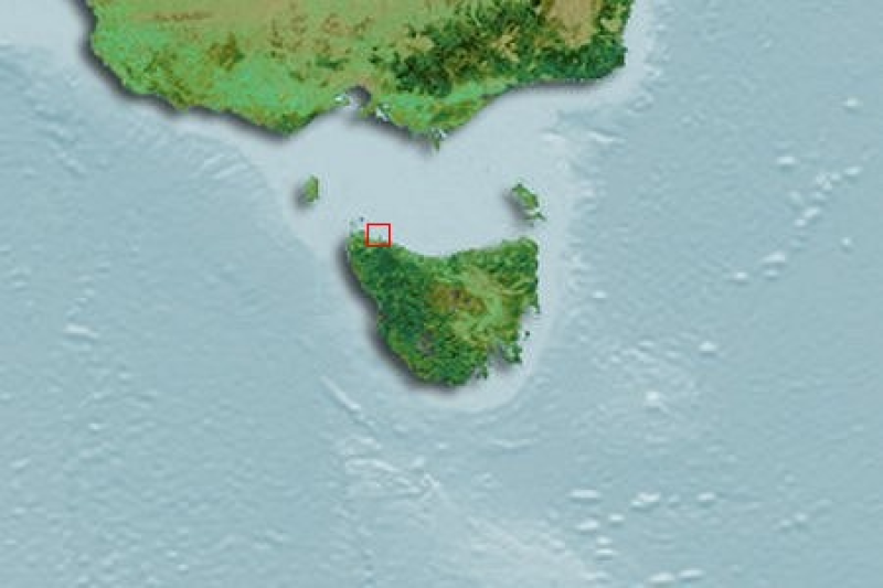
Water quality and biological data was collected from four tide-dominated river estuaries indicative of catchments with varying levels of human impacts to: 1) assess draft indicator levels for water quality, and 2) investigate biological indicators of estuarine health in NW Tasmania. The data represented by this record was collected in the Detention River.
Simple
Identification info
- Date (Creation)
- 2011-11-16T10:33:00
Principal investigator
Tasmanian Aquaculture and Fisheries Institute (TAFI) - Crawford, Christine, Dr
Private Bag 49
Hobart
TAS
7001
Australia
Collaborator
Tasmanian Aquaculture and Fisheries Institute (TAFI) - Hirst, Alastair, Dr
Private Bag 49
Hobart
TAS
7001
Australia
Collaborator
Tasmanian Aquaculture and Fisheries Institute (TAFI) - Kilpatrick, Robert
Private Bag 49
Hobart
TAS
7001
Australia
Collaborator
Tasmanian Aquaculture and Fisheries Institute (TAFI) - Mount, Richard, Dr
Private Bag 49
Hobart
TAS
7001
Australia
Collaborator
Tasmanian Aquaculture and Fisheries Institute (TAFI) - Guest, Michaela, Dr
Private Bag 49
Hobart
TAS
7001
Australia
- Purpose
- The design utilise, broadly contrasts estuaries within catchments relatively free of human impacts (Black and Detention Rivers) with estuaries situated within more degraded catchments (Duck and Montagu Rivers).
- Credit
- Natural Heritage Trust (NHT) and National Action Plan (NAP) Project No. 46927
- Status
- Completed
Principal investigator
Institute for Marine and Antarctic Studies (IMAS), University of Tasmania (UTAS) - Crawford, Christine, Dr
IMAS - Taroona
Private Bag 49
Hobart
TAS
7001
Australia
Point of contact
Institute for Marine and Antarctic Studies (IMAS), University of Tasmania (UTAS) - Ross, Jeff, Dr
IMAS - Taroona
Private Bag 49
Hobart
TAS
7001
Australia
- Topic category
-
- Oceans
Extent
N
S
E
W
))
- Geographic identifier
-
3414:205:3
- Title
- c-squares
- Date (Creation)
- 2001-12-13T00:00:00
Owner
CSIRO Marine and Atmospheric Research
Temporal extent
- Time period
- 2004-11-15T00:00:00 2005-04-15T00:00:00
Vertical element
- Minimum value
- 0
- Maximum value
- 1
- Identifier
- EPSG::5715
- Name
- MSL depth
- Maintenance and update frequency
- Not planned
Resource format
- Title
- Microsoft Excel (xls)
- Date
- Edition
- 2003
- Keywords (Theme)
-
- Human impact
- Degradation
- Benthic macroinvertebrates
- Global Change Master Directory (GCMD) Earth Science Keywords Version 8.0
- Keywords (Discipline)
-
- Temperate Reef
- Australian and New Zealand Standard Research Classification (ANZSRC): Fields of Research
- Keywords (Theme)
-
- Salinity
- Dissolved oxygen
- Turbidity
- Ammonia
- Nitrates and Nitrites
- Nitrate
- Nitrite
- Reactive phosphorus
- Sediment particle size
- Sediment organic carbon
- Number of species - macroinvertebrates
- Abundance - macroinvertebrates
- Number of individuals caught - fish
Resource constraints
- Classification
- Unclassified
Resource constraints
- Use limitation
- The data described in this record are the intellectual property of the University of Tasmania through the Tasmanian Aquaculture and Fisheries Institute.
Resource constraints
- Linkage
-
http://i.creativecommons.org/l/by/2.5/au/88x31.png
License Graphic
- Title
- Creative Commons Attribution 2.5 Australia License
- Website
-
http://creativecommons.org/licenses/by/2.5/au/
License Text
- Other constraints
- The citation in a list of references is: citation author name/s (year metadata published), metadata title. Citation author organisation/s. File identifier and Data accessed at (add http link).
Associated resource
- Title
- Tasmanian Estuaries Monitoring
- Date (Creation)
- 2011-11-16T00:00:00
- Character encoding
- UTF8
- Supplemental Information
- Hirst, AJ and Kilpatrick, R and Mount, RE and Guest, MA and Crawford, C, Biodiversity and Degradation of Estuaries in North-western Tasmania, Cradle Coast NRM Region, NHT/NAP 46927 (2005). NHT/NAP Final Report.
Content Information
- Content type
- Physical measurement
- Name
- Salinity
- Name
- ppt
- Name
- Dissolved oxygen
- Name
- DO
- Name
- percentage DO
- Name
- Turbidity
- Name
- NTU
- Name
- Ammonia
- Name
- NH3
- Name
- ug/L
- Name
- Nitrates and Nitrites
- Name
- NOx - N
- Name
- uG/L
- Name
- Nitrate
- Name
- uG/L
- Name
- Nitrite
- Name
- uG/L
- Name
- Reactive phosphorus
- Name
- Dissolved P
- Name
- ug/L
- Name
- Sediment particle size
- Name
- mm
- Name
- Sediment organic carbon
- Name
- percentage of sediment
- Name
- Number of species - macroinvertebrates
- Name
- Abundance - macroinvertebrates
- Name
- Number of individuals caught - fish
Distribution Information
- Distribution format
-
- Microsoft Excel (xls)
Distributor
- OnLine resource
- DATA ACCESS - Detention River data [direct download]
- OnLine resource
- REPORT - Final project report [direct download]
Resource lineage
- Statement
- Each estuary was visited twice during the course of this study to measure a range of water quality parameters (nutrients, turbidity etc.) and sample estuarine biological assemblages (benthic invertebrates and fish). Estuaries were visited initially in late November/early December 2004, and then approximately four months later in early April 2005. Each estuary was sampled from its mouth (sea-estuary interface) to the uppermost reach of tidal influence that could be easily accessed from the shore or via a small boat. In practice, each eastuar was split into four regions (marine, lover, mid and upper) on the basis of salinity, habitat (particularly the appearance of the benthos) and distance from the mouth. Within each estuary three sites were randomly assigned to each regions, each separated by a distance of a few hundred metres. Water quality within each of the four estuaries was measured at the first and third site within each regions - a subset of 8 out of a total of 12 designated sites per estuary. During each visit water quality parameters were measured at high and low tide, within the same 24 hour period, to examine the extent to which these parameters varied between tides. The water quality parameters measured in this study were: salinity (ppt), dissolved oxygen concentrations (%DO), turbidity (NTU), and dissolved nutrients including ammonia, nitrate, nitrite and reactive phosphorus (ug/L). Water quality measurements were made mid-channel (i.e. equidistant from either bank) within surface waters <30cm. Salinity, DO, and turbidity were measured in the field using meters. Nutrient levles were determined later in the lab from water samples collected in the field. Dissolved nutrients were collected and analysed using standard protocols by Analytical Services Tasmania. Benthic macroinvertebrates The diversity and composition of the soft sediment invertebrate fauna in each estuary was determined using replicated sediment cores collected at each site. All sampling was undertaken at low tide using methods comparable ot those utilised by Edgar et al. (1999). At each site five sediment cores (diameter = 150mm, depth = 100mm) were collected from subtidal sediments using a rough transect (spanning from the low tide mark to a depth of 0.7m where applicable) as a guide. Cores were collected at 0.0, 0.1, 0.2, 0.3, and 0.7m depths. Cores were seived through a 1.0mm sieve in the field and the portion retained was fixed in 10% buffered formalin. Invertebrate taxa were identified to species, where possible, and counted. Salinity, dissolved oxygen and turbidity were recorded for the bottom waters overlying the area of benthos sampled (probes were generally placed on the sediment). Sediments from each site were collected using five 30cm diameter cores (corresponding with the 5 biological sediment samples collected), and the sediments amalgamated. In the lab, sediment particle-size distribution was determined by wet sieving samples through a nested series of sieves (0.63, 0.125, 0.25, 0.5, 1, 2 and 4mm mesh size). The sediments retained by different sieves were weighed after drying at 50oC. The proportion of fine particulates <0.63mm that passed through the final sieve was calculated by subtracting the total weight of sediments retained on the nested sieves from the initial dried weight of the sediment sample. Sieve fractions were expressed as a % fo the total sediment sample. Organic carbon content of the sediments was calculated by loss of organic carbon on ignition at 500oC. Sediments were first treated with 1M hydrocholoric acid to remove inorganic carbon in the form of carbonates prior to combustion. Fish biodiversity Limited fish sampling was conducted in spring, and only in the the lower reaches of the estuaries. Demersal fish assemblages were sampled using a standard 3 x 35mm beach seine, with 13mm mesh size. This precluded sampling in the mid and upper regions of the estuaries due to the size of the net and the retricted nature of the benthic habitats among the sites. Captured fish were identified, counted and then released.
- Hierarchy level
- Dataset
Metadata
- Metadata identifier
- edc26a78-3123-4303-8be1-2c1b939ccd54
- Language
- English
- Character encoding
- UTF8
Point of contact
- Parent metadata
Type of resource
- Resource scope
- Dataset
- Metadata linkage
-
https://metadata.imas.utas.edu.au/geonetwork/srv/eng/catalog.search#/metadata/edc26a78-3123-4303-8be1-2c1b939ccd54
Point of truth URL of this metadata record
- Date info (Creation)
- 2018-12-17T13:12:45
- Date info (Revision)
- 2018-12-17T13:12:45
Metadata standard
- Title
- ISO 19115-3:2018
Overviews

thumbnail

large_thumbnail
Spatial extent
N
S
E
W
))
Provided by

Associated resources
Not available
 IMAS Metadata Catalogue