 IMAS Metadata Catalogue
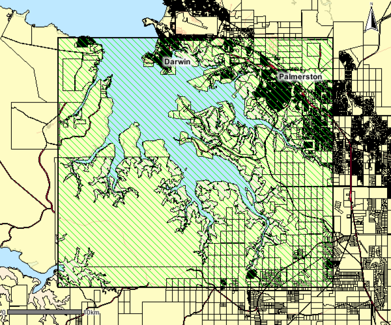
Mangrove mapping of Darwin Harbour, 1996
This polygon spatial dataset describes the mangrove communities for Darwin Harbour and its environs and was surveyed at a mapping scale of 1:25 000. The associated report notes an area of approximately 20,400 hectares of mangroves in Darwin Harbour and describes ten main mangrove associations or communities.
The data provides a basis for identifying the extent and distribution of mangrove communities for Darwin Harbour and its environs.
Simple
Identification info
- Date (Creation)
- 2000-01-14T00:00:00
- Date (Publication)
- 2017-04-27
Owner
Department of Environment and Natural Resources (DENR), Northern Territory Government
Northern Territory Department of Environment and Natural Resources
Level 1, Goyder Centre
25 Chung Wah Terrace
Palmerston
Northern Territory
0830
Australia
- Credit
- Data supplied by Department of Environment and Natural Resources. © Copyright Northern Territory of Australia
- Status
- Completed
Point of contact
Department of Environment and Natural Resources (DENR), Northern Territory Government - SDM Information Officer (SDM Information Officer)
Northern Territory Department of Environment and Natural Resources
Level 1, Goyder Centre
25 Chung Wah Terrace
Palmerston
Northern Territory
0830
Australia
- Spatial representation type
- Vector
Spatial resolution
Equivalent scale
- Denominator
- 25000
- Topic category
-
- Biota
- Oceans
Extent
N
S
E
W
))
Temporal extent
- Time period
- 1995-01-07 1996-01-06
- Maintenance and update frequency
- Not planned
Resource format
- Title
- ESRI Shapefile
- Date
- Edition
- -
- Global Change Master Directory (GCMD) Earth Science Keywords Version 8.0
- Keywords (Theme)
-
- Benthic habitat
Resource specific usage
- Specific usage
- Data supplied for use by the Seamap Australia Project.
- ()
Resource constraints
- Classification
- Unclassified
Resource constraints
- Linkage
-
http://i.creativecommons.org/l/by-sa/4.0/88x31.png
License Graphic
- Title
- Creative Commons Attribution-ShareAlike 4.0 International License
- Website
-
http://creativecommons.org/licenses/by-sa/4.0/
License Text
- Other constraints
- Cite data as: Department of Environment and Natural Resources, Northern Territory Government of Australia (2000). Mangrove mapping of Darwin Harbour, 1996. Data accessed at http://metadata.imas.utas.edu.au/geonetwork/srv/en/metadata.show?uuid=8ebd1996-c77d-4012-b409-002f4422a915 on (access date).
- Other constraints
- This dataset is hosted by the Institute for Marine and Antarctic Studies (IMAS), University of Tasmania, on behalf of the NT Government for the purposes of the Seamap Australia collaborative project (testing a national marine benthic habitat classification scheme).
- Language
- English
- Character encoding
- UTF8
- Supplemental Information
- Department Survey Code (Vegetation Survey): MANGD_25 Bibliographic Reference: Brocklehurst, P. and Edmeades, B. (1996) THE MANGROVE COMMUNITIES OF DARWIN HARBOUR; Department of Infrastructure, Planning and Environment, Darwin, NT. Supplementary Post - Brocklehurst, P.S. (2013) THE MANGROVE COMMUNITIES OF DARWIN HARBOUR ﾿ BIOMASS UPDATE. The technical reports are available for download (PDF) via the Northern Territory Library, http://hdl.handle.net/10070/213495 RELATED SURVEYS Mangrove Mapping Bynoe Harbour Mangrove Mapping Darwin to Cape Hotham
Content Information
- Content type
- Physical measurement
- Description
- Taxonomic identification of mangrove species and vegetation types
Identifier
- Name
- VEG_DESC
- Description
- Appended to original data for styling purposes for the Seamap Australia Project.
- Name
- Benthic habitat
- Name
- SM_HAB_CLS
Distribution Information
- Distribution format
-
- ESRI Shapefile
OnLine resource
- Protocol
- OGC:WFS-1.0.0-http-get-feature--shapefile
- Name of the resource
- SHAPE-ZIP
- Description
- DATA ACCESS - This OGC WFS service returns the data (Darwin Harbour mangroves) in Shapefile format
- OnLine resource
-
seamap:SeamapAus_NT_DarwinHarbour_mangrove
MAP - Mangrove mapping Darwin Harbour
- OnLine resource
- Original metadata record [NT Government catalogue]
Data quality info
- Hierarchy level
- Dataset
Report
- Measure description
- POLYGON DATA - Map unit boundaries transferred from aerial photographs to topographic maps, using the best available topographic mapping at the time (generally 1:100 000) via a mapograph. Level of accuracy depends on the number of control points on individual aerial photographs. Control points include creek lines, cadastre and other topographic features. Depending on the nature of the landscape (the number of control points), positional accuracy may vary. Positional accuracy generally considered moderate to high. POINT DATA - Site point coordinates collected from a geographic positioning system with general accuracy of within 100m. Selective availability during this time prevented increased accuracy.
Report
- Measure description
- The attribute information conforms to the 'Australian Soil and Land Survey Field Handbook' at time of capture. In November 2013 additional attribute values, as described in the Data Dictionary below, have been added to each polygon in the spatial dataset.
Report
- Name of measure
- Logical consistency
- Measure description
- GIS editing tools were used to rectify all overshoots and undershoots in line work. Polygon topology rules applied are; must not overlap, must not have gaps and each polygon has only one label.
Report
- Measure description
- complete
Resource lineage
- Statement
- Original map unit boundaries delineated from aerial photographs and stereoscope interpretation. Map units transferred to topographic map sheets via a mapograph. Original maps were hardcopy only. With the advent of geographic information systems polygons were digitised by rectifying the original hard copy maps. Map unit boundaries derived using aerial photography and digital satellite imagery, geological and topographic data. Field data (site information) described and classified according to national standards at the time of capture. Map unit polygons collected via geographic information system. (ESRI ArcInfo) Vegetation attributes attached to map units may be unique to individual surveys.
- Hierarchy level
- Dataset
Resource lineage
- Statement
- Data Dictionary GEOMORPH Alias: Geomorphic Unit A summary notation to describe the geomorphological unit for the veg map unit. SURVEY_ID Alias: Survey Identifier A department code that usually refers to the first five characters from the original survey site sheet. SURVEY_NME Alias: Survey Name The name of the survey / report that the mapping refers to. TIDALLEVEL Alias: Tidal Level A summary notation to describe the Tidal Level for the veg map unit. VEG_DESC Alias: Vegetation Description The vegetation description applicable only at the mapping scale 1:25 000. VEG_TYPE Alias: Vegetation Broad Type A broad classification used to group the veg map unit communities; Mangrove Closed Forests, Mangrove Open Forests, Mangrove Woodlands/Open Woodlands, Samphire/Salt Flat, Beach, Not Recorded. VEG_UNIT Alias: Veg Map Unit The vegetation mapping unit used to describe the vegetation community and label the polygon in the spatial dataset.
- Hierarchy level
- Attribute
- Hierarchy level
- Dataset
Platform
Identifier
- Code
- research aeroplane
Metadata
- Metadata identifier
- urn:uuid/8ebd1996-c77d-4012-b409-002f4422a915
- Language
- English
- Character encoding
- UTF8
Point of contact
- Parent metadata
Type of resource
- Resource scope
- Dataset
- Metadata linkage
-
https://metadata.imas.utas.edu.au/geonetwork/srv/eng/catalog.search#/metadata/8ebd1996-c77d-4012-b409-002f4422a915
Point of truth URL of this metadata record
- Date info (Creation)
- 2020-10-12T15:51:34
- Date info (Revision)
- 2025-09-14T14:05:22
Metadata standard
- Title
- ISO 19115-3:2018
Overviews
large_thumbnail
Spatial extent
N
S
E
W
Provided by

Associated resources
Not available